Karmactive Staff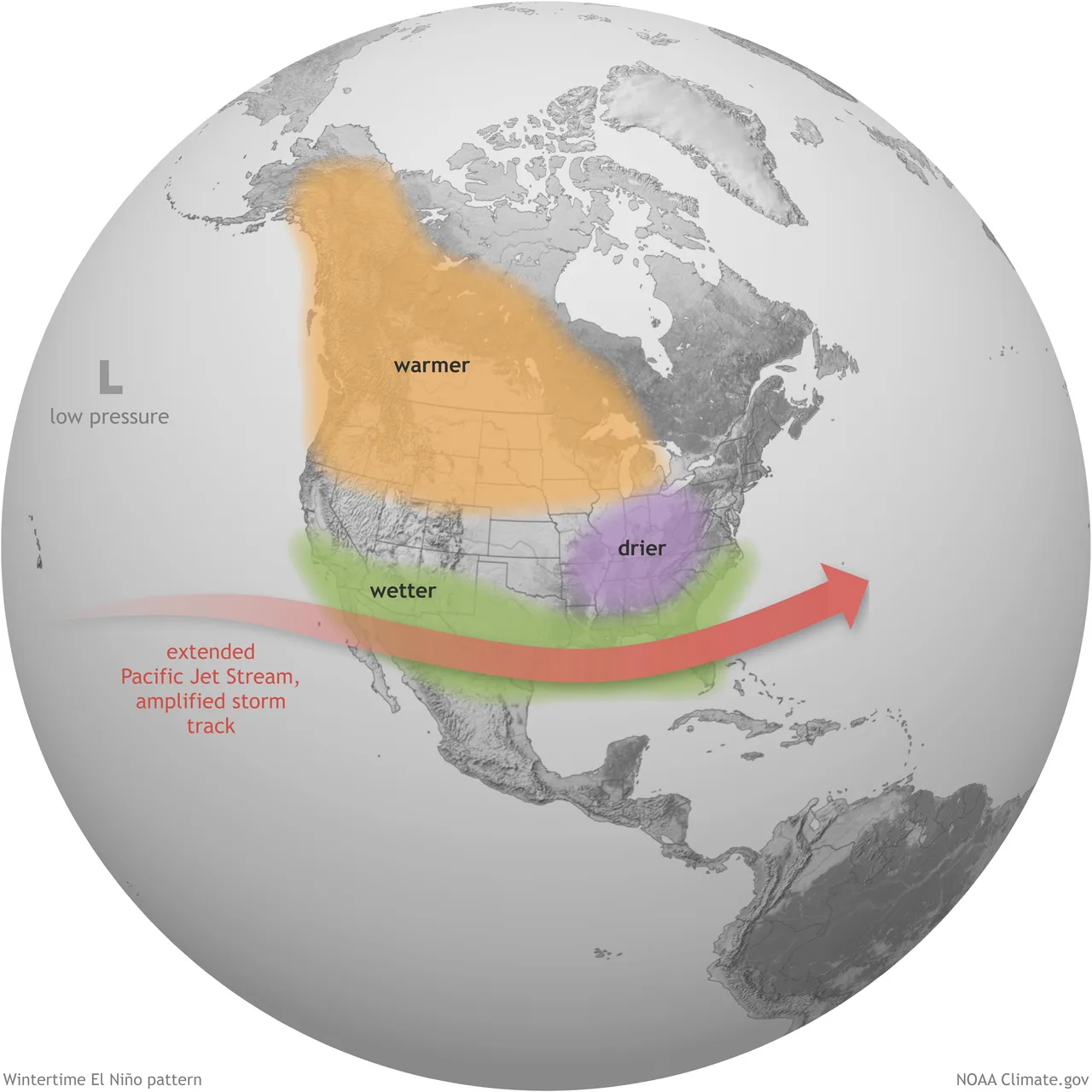
Estimated reading time: 3 minutes
Climate forecasters are releasing early predictions for winter 2026-2027, and one pattern dominates the outlook: a developing strong El Niño. This climate condition may reshape winter weather across North America in significant ways.
El Niño means warming ocean water in the Pacific. When this happens, it changes weather patterns globally. For North America, El Niño typically can bring specific outcomes: warmer west, wetter south, active storm systems.
NOAA’s Climate Prediction Center has El Niño under an active advisory and says it strengthened over the past month, with the weekly Niño-3.4 index at +1.2C and the eastern Niño-1+2 index at +2.7C. The North American Multi-Model Ensemble forecasts further intensification through the rest of 2026, and NOAA, JAMSTEC, Canadian and European models broadly agree on the large-scale signal.
However, these forecasters do not all agree on identical detailed regional winter precipitation patterns. Regional snowfall outcomes involve additional complexity and uncertainty.
Here’s what the forecast shows for different regions. The West Coast, particularly Washington and Oregon, may experience relatively mild temperatures and possibly drier conditions. This could affect ski resorts and water supplies. Reduced snowpack could mean lower snow accumulation at some elevations, affecting water storage for summer.
California presents a mixed situation. Higher elevations in the Sierra Nevada may see active storm systems and potentially heavy snow. Lower elevations and coastal areas could experience atmospheric rivers bringing rain instead of snow. Lower-elevation resorts might struggle, while higher-elevation areas may perform better.
The Southwest, including Arizona and New Mexico, may face wetter than average conditions. Storm systems could repeatedly track through this region. At higher elevations in Colorado, Utah, and New Mexico, this moisture could mean potential snowfall. At lower elevations, it could mean rain or marginal snow conditions.
The real story is the South and East. Multiple forecasters highlight an active southern storm track pattern. This suggests frequent low-pressure systems moving across the southern United States, then strengthening along the Atlantic Coast. When cold air is present, these systems could produce significant snowfall across the Ohio Valley, Mid-Atlantic, Northeast, and Great Lakes.
But here’s the complication: warmer conditions overall may mean higher snow levels. Snow might not reach as far down mountains or into valleys as it normally does. Timing matters enormously. Early-season snow might be marginal. Mid-winter storms could produce better results.
For skiers, the forecast creates both opportunity and challenge. High-elevation resorts in California, the Southwest, and southern Colorado may benefit from active storm tracks. Resorts at lower elevations or in northern regions may struggle with warmer temperatures and higher snow levels.
The Climate Prediction Center’s July diagnostic discussion is blunt about the headline number: El Niño “continues and will strengthen through the end of the year, with a 97% chance it will persist through early spring 2027.” Forecasters have separately put the odds of the event reaching very strong intensity late in 2026 at around 81 percent. That is an unusually confident call this far out — but no two El Niño winters deliver identical regional impacts, and the CPC says so itself.
Forecasters caution that seasonal predictions are broad guides, not precise forecasts. Exact snowfall amounts and timing remain uncertain. Conditions could shift if other climate patterns change. The Quasi-Biennial Oscillation, Atlantic ocean patterns, and solar activity could all influence results. These seasonal outlooks provide probabilistic guidance rather than definitive predictions.
For residents and businesses depending on winter weather—ski resorts, water managers, emergency planners—the message is: Prepare for conditions that may differ from recent winters. Higher elevations and southern regions may see increased precipitation. Northern and western regions should prepare for potentially warmer temperatures and variable snow conditions.
Winter 2026-2027 is expected to differ from last winter, when the West experienced warmer and drier than average conditions.