 Rahul Somvanshi
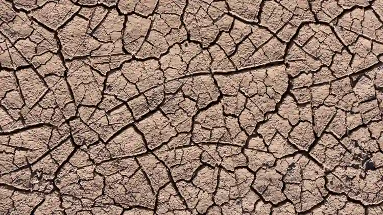
Crop shortfalls that could affect food prices, concerns about rural well water levels, and flash-flood risks on roads that had been cracked by drought just weeks earlier — October 2026 brought all three as potential pressures to millions of households across Kansas, Oklahoma, and Texas. The primary data come from the NOAA / NIDIS Southern Plains Drought Status Update published October 22, 2026, authored by researchers from CIRES/University of Colorado Boulder, Texas A&M University, the Oklahoma Climatological Survey, Kansas State University, and the National Weather Service.
How Did Record September 2026 Heat Set the Stage for the Drought?
The Southern Plains recorded temperatures in September 2026 that had no precedent in 132 years of instrumental weather records. According to the October 22, 2026 NOAA / NIDIS Southern Plains Drought Assessment, September 2026 was the warmest September across the region in that 132-year record, averaging +8.8°F above normal for the Southern Plains as a whole.
State-by-State September 2026 Temperature Records
| State | September 2026 Anomaly | Context |
|---|---|---|
| Oklahoma | +9.7°F | 3.1°F higher than any prior September on record |
| Kansas | +8.7°F | 13th consecutive warmer-than-normal month |
| Texas | +8.2°F | All-time September heat records in 225 counties |
For Kansas, September 2026 marked the end of more than a year of unbroken above-normal monthly temperatures. For Oklahoma, the margin over the previous record — 3.1°F — was itself exceptional; breaking a longstanding record by more than one degree is rare in temperature climatology.
What Does the NOAA/NIDIS Drought Map Show for the Southern Plains?
Record heat and below-normal rainfall contributed to worsening soil-moisture deficits and expanding drought across the region. By late September 2026, 84 percent of the Southern Plains DEWS (Drought Early Warning System) region — an area encompassing an estimated 26.7 million residents — had entered moderate-to-exceptional drought (D1 through D4) as classified by the US Drought Monitor. That represented the largest drought extent in the Southern Plains DEWS region since 2022.
Dallas recorded 67 consecutive rainless days from July 16 to September 20, 2026, tying the city’s second-longest dry streak on record. Oklahoma winter wheat growers, who typically begin seeding in September and early October, faced delayed planting due to the sustained precipitation deficit.
What Happened When Hurricane Polo Remnants Hit the Drought Zone?
The sequence that followed Dallas’s dry streak illustrates what is sometimes described as “drought whiplash”: an abrupt shift from prolonged deficit to extreme rainfall, with the soil too hardened to absorb either event effectively.
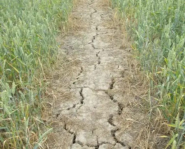
Remnants of Hurricane Polo stalled over the Southern Plains from September 28 to October 3, 2026. Dallas-Fort Worth Airport recorded its 9th wettest single day on record on October 1 — while Dallas County was simultaneously classified as Exceptional Drought (D4) by the US Drought Monitor. In the Texas Panhandle, farmers reported that early October moisture pooled on the surface rather than seeping to deeper soil levels, limiting root-depth recharge despite the rainfall totals.
The coexistence of a record-wet single day and exceptional drought on the same calendar date in the same county reflects the pace at which extreme rainfall can accumulate without reversing a multi-month moisture deficit in compacted soils.
Historical Context: Why Back-to-Back Extremes Are More Damaging Than Either Alone
The Southern Plains is no stranger to drought. The 2011–2012 drought was among the most severe on record in the region, and the 2022 drought produced drought extents comparable to what NOAA/NIDIS documented in 2026. What sets the 2026 sequence apart is the combination of a record-shattering temperature anomaly (+8.8°F regional average in a single month), the speed of the transition from 67-day dry streak to one of the wettest single days on record, and the fact that the rainfall arrived while the region was simultaneously in exceptional drought.
For agriculture, a slow and sustained soil recharge over weeks is far more beneficial than an equivalent volume of rainfall concentrated in hours. Surface runoff can limit deep-soil recharge in the subsoil layers where winter wheat roots develop, meaning even a rainfall record does not automatically translate into recovered planting conditions.
Practical Guidance for Households and Growers in the Affected Region
Monitoring soil moisture and planting windows. Oklahoma winter wheat growers and smallholder farms across the affected counties can monitor NOAA / NIDIS’s Drought Early Warning System regional updates at drought.gov for current drought-monitor classifications and soil moisture recovery projections. The October 22 assessment noted that the 2026–2027 El Niño pattern is projected to bring above-normal precipitation to the Southern Plains from November 2026 through January 2027, offering the potential for multi-month soil moisture recovery before spring planting.
Water conservation during whiplash sequences. Households on private wells and municipal systems in drought-affected counties should not assume that a heavy rainfall event has restored groundwater levels. Aquifer recharge from surface precipitation takes weeks to months depending on soil type and depth to the water table. Continuing conservation measures through at least the first quarter of 2027 is consistent with the NIDIS seasonal outlook.
Flood preparedness after prolonged drought. The same hardened soil conditions that limited infiltration during the Hurricane Polo rainfall event increase the risk of flash flooding during future heavy rain events. Households in low-lying areas of Oklahoma, Kansas, and Texas should check FEMA flood-risk maps and maintain readiness for rapid water-level rises, particularly during the projected wetter winter months.
Long-Term Effects: Winter Wheat, Water Supply, and Climate Outlook
The 60-to-90-day precipitation deficit across the Southern Plains carries implications beyond the current planting season. Oklahoma winter wheat seeding was delayed by the sustained drought despite the short-term Hurricane Polo rainfall, and the pace at which drought-stressed subsoil recovers will determine whether germination and early-growth conditions are adequate before winter hardening.
NOAA and NIDIS project that the 2026–2027 El Niño should bring above-normal winter precipitation to the Southern Plains from November 2026 through January 2027. However, the pace and geographic distribution of that precipitation will determine whether multi-month soil moisture deficits are reversed before spring — particularly for deep-rooted crops and depleted groundwater systems.
The 132-year temperature record broken in September 2026 places the event within the context of a multi-decadal warming trend across the Southern Plains. The CIRES/University of Colorado Boulder, Texas A&M University, Oklahoma Climatological Survey, Kansas State University, and National Weather Service researchers who authored the NIDIS assessment noted that the September anomaly was consistent with the region’s observed long-term warming trajectory.
Pre-Conclusion Summary
The data reviewed in this article covered the NOAA / NIDIS Southern Plains Drought Status Update of October 22, 2026. In that report, September 2026 was documented as the warmest September in the 132-year instrumental record across the Southern Plains, with a regional anomaly of +8.8°F; Oklahoma at +9.7°F (3.1°F above the prior record), Kansas at +8.7°F (its 13th consecutive warmer-than-normal month), and Texas at +8.2°F (setting all-time September heat records in 225 counties). By late September, 84 percent of the Southern Plains DEWS region — encompassing 26.7 million residents — was in moderate-to-exceptional drought (D1–D4), the largest extent since 2022. Dallas recorded 67 consecutive rainless days from July 16 to September 20, Hurricane Polo remnants gave Dallas-Fort Worth Airport its 9th wettest single day on record on October 1 while Dallas County was in Exceptional Drought (D4), and Texas Panhandle farmers reported early October moisture pooling on the surface rather than seeping to deeper soil levels. Oklahoma winter wheat seeding delays and an El Niño-driven wetter-than-normal November 2026–January 2027 outlook were also documented.
Conclusion
In summary, the October 22, 2026 NOAA / NIDIS data documented a record-warm September (+8.8°F regional anomaly) across the Southern Plains, the largest drought extent in the region since 2022 (84 percent of the DEWS region in D1–D4, 26.7 million residents), a 67-consecutive-day rainless streak in Dallas, extreme rainfall whiplash from Hurricane Polo remnants, and delayed Oklahoma winter wheat seeding. An above-normal winter precipitation outlook associated with the 2026–2027 El Niño was projected for November 2026 through January 2027.