 Sunita Somvanshi
The stratospheric polar vortex—the spinning column of cold air that sits 10 to 50 kilometers above the Arctic and governs much of North America’s winter severity—is tracking weeks ahead of schedule in its seasonal weakening. But that weakening is not the “polar vortex collapse” some forecasts have suggested. NASA data shows the vortex is slowing down sharply, not reversing, and the distinction matters for what comes next.
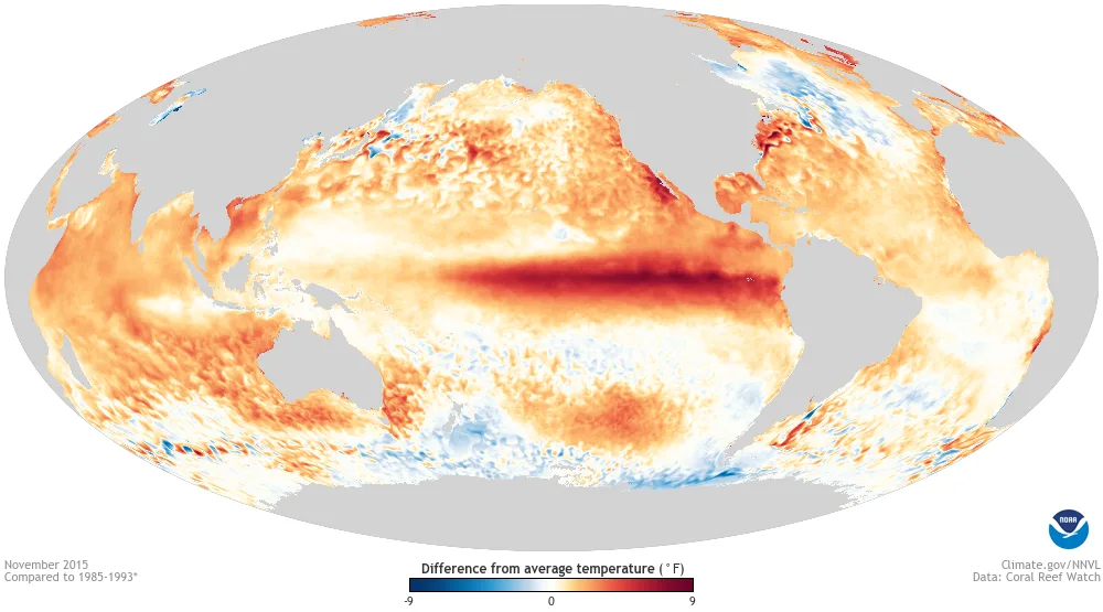
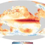
The polar vortex normally strengthens through late October and early November as the Arctic cools. NASA’s 60°N, 10-hPa stratospheric wind climatology shows average winds rising from 21.53 meters per second (48.2 mph) on October 25 to 25.97 m/s (58.1 mph) by November 3. This year’s forecast shows winds at that altitude dropping sharply against that seasonal trend—yet remaining above zero through November 3 in the central forecast, though some modeling runs show the potential for a complete wind reversal. A true Sudden Stratospheric Warming (SSW) event requires those winds to fully reverse direction. What has happened is an unusually early weakening of the seasonal wind ramp-up, driven by upward atmospheric wave activity from the troposphere wobbling the vortex like a spinning top being nudged off its axis. This event is occurring alongside a strong 2026–27 El Niño; NOAA notes that when El Niño combines with a westerly Quasi-Biennial Oscillation, the vortex typically strengthens—but other upward wave-forcing factors are driving the current disruption despite that tendency.
For homeowners across the northern US and Canada, an early-November wobble in the polar vortex does not mean January-style deep freezes will hit next week, because the Arctic has not yet built up its mid-winter reservoir of sub-zero air. Instead, a weakened vortex occurring alongside a strong El Niño increases jet stream volatility—raising the risk of sudden late-winter cold snaps in January and February even across regions forecast for a milder overall winter.
What This Actually Means by Region and Month
The timing matters as much as the event itself. In November, the Arctic’s cold-air reservoir is still accumulating—it has not yet reached the depth it holds in January or February. Even if the vortex weakens further, there is less stored cold air available to spill southward compared to a mid-winter disruption. The more dangerous scenario is a vortex that weakens now, partially recovers, and then collapses hard in January—which is when Arctic air masses are at their deepest and most mobile.
Environment and Climate Change Canada’s 2026 climate assessment adds a counterintuitive finding: when stratospheric disruptions push the North Atlantic Oscillation (NAO) negative—a frequent outcome of vortex weakening—eastern Canada often ends up warmer than normal, while Europe and Asia bear the brunt of the displaced Arctic air. The same pattern that produces a brutal cold snap in the UK or Central Europe can simultaneously keep temperatures above average in Ontario and Quebec.
Meteorologist Tyler Hamilton of The Weather Network has described upward tropospheric wave transfer as the key mechanism driving the current early weakening. In practical terms, that means surface weather systems—large winter storms—are sending energy vertically into the stratosphere at a time of year when that kind of feedback rarely occurs. For the full seasonal picture alongside this vortex data, see NOAA’s 2026–27 El Niño winter outlook by region and home winterization checklist for early winter volatility.
Is a Sudden Stratospheric Warming (SSW) event happening in November 2026?
While atmospheric models show the polar vortex weakening weeks earlier than normal, NASA’s 10-hPa stratospheric wind forecast at 60°N remains above zero through November 3 in the central forecast. Because a true Sudden Stratospheric Warming event requires westerly winds to completely reverse direction, meteorologists classify the early-November anomaly as a sharp weakening rather than a confirmed SSW—though some models show a full reversal remains possible.
What happens when the polar vortex weakens early in fall?
An early fall weakening reduces the vortex’s capacity to contain Arctic air in the stratosphere, increasing the probability of jet stream displacement and sudden cold outbreaks during late winter—particularly January and February—rather than immediately. The Arctic cold reservoir is still building through November, so the most severe surface effects typically arrive several weeks to months after a stratospheric disruption.
How does El Niño interact with the polar vortex in 2026?
A strong El Niño shifts the subtropical jet stream southward and injects additional energy into the Northern Hemisphere atmospheric system. When that combines with a weakening polar vortex, the result is heightened jet stream instability across the US, Canada, and Europe—increasing both the frequency and severity of winter storm events while also creating pockets of above-normal warmth in regions like eastern Canada.
The next key dates are mid-November stratospheric wind updates and the official winter forecast releases due around November 25. If the vortex does not recover in the next two to three weeks, the January–February period across the northern US and Europe carries significantly elevated risk for sudden cold outbreaks.