 Rahul Somvanshi

Winter weather headlines have been running hard on warnings of a "polar vortex snow bomb" bearing down on the UK and northern United States. The agencies actually responsible for those forecasts say something quite different.
The underlying driver is real and significant. The El Niño climate pattern — caused by warmer-than-average sea surface temperatures in the central and eastern Pacific Ocean — is building toward potentially record strength. Sea surface temperature anomalies averaged plus 1.7 degrees Celsius above normal between July and September 2026. The World Meteorological Organization projects Pacific sea surface temperatures could reach up to 3.8 degrees Celsius above average between November 2026 and January 2027, a level WMO Secretary-General Celeste Saulo says has never appeared in the agency's records — the strongest historical El Niños have reached around 3 degrees Celsius above average. NOAA's October 8 Climate Prediction Center update puts an 83 percent probability on this becoming an exceptionally strong El Niño event.
That is genuinely alarming at a global humanitarian level. What it does not mean is that a severe freeze is coming for the northern United States or Britain.
Both NOAA's 2026–27 US Winter Outlook and the UK Met Office's seasonal forecast project the opposite pattern in the northern tier. NOAA is calling for warmer-than-average temperatures across the Pacific Northwest, Northern Rockies, and Great Lakes region, with drier conditions there as well. At the same time, the US Southwest, Gulf Coast, and East Coast are forecast to see wetter-than-average conditions — helpful for regions still carrying drought deficits. The NWS also cautions that seasonal outlooks express probabilities over several months and cannot reliably predict individual snowstorms, cold spells, or seasonal snowfall totals months in advance.
The UK Met Office is projecting milder and wetter conditions overall for Britain this winter. The "polar vortex" collapse scenario being promoted in parts of the UK press has no support in official seasonal forecasts.
What is genuinely serious about this El Niño is the effect outside North America and Europe. WMO Secretary-General Celeste Saulo and UN OCHA chief Tom Fletcher have both issued warnings about cascading humanitarian consequences. The African Development Bank estimates this El Niño event could cost African economies between $10 billion and $20 billion — roughly 1 to 2 percent of GDP — and may push approximately 50 million people toward food insecurity as rainfall patterns shift across the continent.
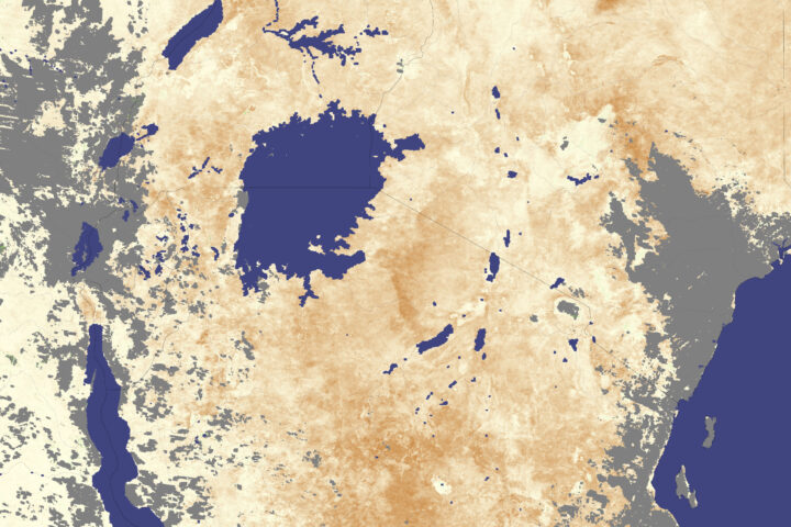
The mechanism is agricultural. El Niño events alter global precipitation distribution. In East Africa, the WMO expects wetter conditions and a heightened flooding risk. In Southern Africa, reduced rainfall cuts maize and sorghum harvests. In South Asia, disruption to the monsoon pattern affects rice and wheat production at scale.
Those disruptions eventually reach food prices. When multiple major agricultural regions face severe growing-season damage simultaneously, global commodity markets for grains, coffee, cocoa, and sugar can see price increases that work their way into retail shelves months later. That is a lagged effect, not an immediate one, but it is the channel through which a Pacific Ocean temperature anomaly eventually becomes visible in grocery shopping in the US and UK.
The bottom line for the coming months: if you are in the northern United States, the official forecast is a milder, drier winter, not a historic freeze. If you are in the US Southwest, Gulf Coast, or East Coast, expect above-average rainfall. If you are in the UK, expect a mild, wet winter. The dangerous version of this El Niño is happening in Sub-Saharan Africa and South Asia, where the consequences are already materialising in food and agricultural markets.
NOAA and the WMO are scheduled to release updated seasonal outlooks in mid-November. Those will be the last major forecasting checkpoints before northern hemisphere winter conditions fully set in.