Karmactive Staff
A High Wind Warning is in effect for parts of Maui on September 27, with the National Weather Service also reporting high-surf and high-wind hazards across Hawaii County on the Big Island. Residents and visitors planning outdoor or coastal activities face specific active hazards today.
What warnings are in effect
The National Weather Service forecast office in Honolulu has issued a High Wind Warning valid through 6pm HST on September 27, with gusts up to 75 mph expected in warned portions of Maui, the Big Island, Molokai, and Lanai. A separate point forecast for Lahaina showed temperatures around 87°F — lower wind speeds in that specific zone reflect local terrain, while warned areas can experience far stronger gusts.
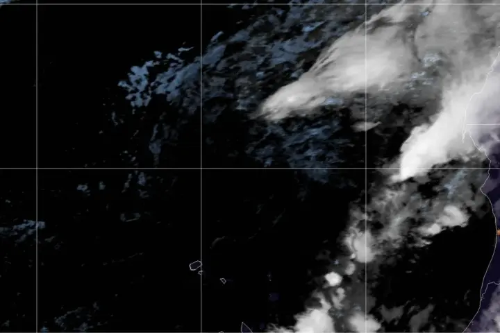
The conditions are linked to Tropical Storm Nolo moving westward through the region. The NWS confirmed the threat of flooding rain had ended across Big Island and Maui County as Nolo moved away.
For Hawaii County on the Big Island, the NWS is showing high-surf and high-wind hazards alongside a risk of isolated showers across portions of the island. The specific warning type for your area should be checked directly at the National Weather Service website, as conditions vary across the Hawaiian Islands.
What this means if you are on Maui or the Big Island today
High Wind Warnings mean the National Weather Service expects winds strong enough to make driving high-profile vehicles difficult, knock down tree branches, and create hazardous conditions for unsecured outdoor objects. Gusts up to 75 mph in warned areas represent a significantly more dangerous condition than routine trade-wind weather.
High surf conditions on the Big Island carry a different risk profile — primarily for anyone in or near the water. Elevated wave heights, strong shorebreak, and rip currents are the specific hazards. Follow the specific NWS advisory language and local lifeguard guidance before entering the water.
For visitors, check current NWS advisories before heading out. Conditions in Hawaii can shift quickly, particularly when a wind event is in progress.
How long the warnings last
The High Wind Warning was set to expire at 6pm HST on September 27. NWS advisories can be extended, reduced, or replaced as conditions change. Checking live conditions at the National Weather Service directly is the appropriate step before making decisions.
If you are following Hawaii weather conditions and marine forecasts, the NWS Honolulu office is the authoritative source for updates.