 Govind Tekale
A powerful 7.7 magnitude earthquake struck Indonesia’s East Nusa Tenggara region on August 15, 2026, triggering tsunami warnings and leaving at least 51 people dead in its aftermath. According to BMKG earthquake and tsunami monitoring, the earthquake occurred at 4:58 AM local time, centered approximately 68 kilometers northwest of Ende with a shallow depth of 15 kilometers. The U.S. Geological Survey earthquake catalog confirmed the magnitude and location of the seismic event, which shook the area during the early morning hours.
The shallow depth of the earthquake made it particularly dangerous, as such quakes typically cause more damage than deeper events. BMKG immediately issued tsunami warnings for East Nusa Tenggara, South Sulawesi, and West Nusa Tenggara following the initial tremor. The agency warned residents in coastal areas to move to higher ground as waves were predicted to reach the shore within minutes. According to tsunami detection systems in the Indian Ocean, waves ranging from 20 to 30 centimeters were detected across affected areas, and authorities lifted all tsunami warnings after approximately three hours, once it became clear that the waves posed no further immediate threat.
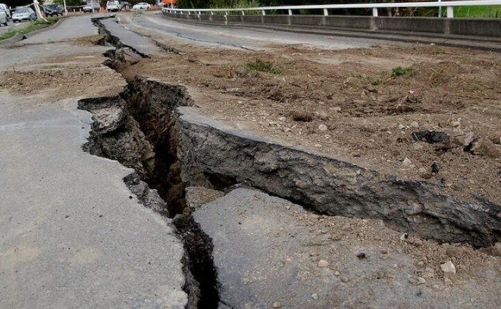
The earthquake’s impact on communities was severe despite the relatively modest tsunami heights. The BNPB disaster response reported that the initial death toll had reached at least 51 people, with rescue operations still ongoing across the region. Beyond the fatalities, the disaster caused extensive damage to infrastructure and homes. According to BNPB assessments, 157 homes were either destroyed or damaged by the earthquake’s force. The impact on education was also significant, with 87 schools damaged across the affected areas, potentially disrupting schooling for thousands of students. Health facilities were not spared either, with 18 health clinics and medical centers damaged, complicating emergency medical response efforts when they were most needed.
Local authorities worked to evacuate residents from the most dangerous areas as the disaster unfolded. In Nagekeo, a district in East Nusa Tenggara, approximately 2,000 residents were evacuated to temporary shelters as a precaution, both during the tsunami warning period and afterward as aftershock risks remained elevated. The region has faced other natural dangers; incidents like 16-foot python swallows missing woman in Indonesia remind residents of East Nusa Tenggara’s multiple environmental hazards. Many evacuees remained displaced as rescue workers assessed damage in more remote locations that were difficult to access.
The earthquake generated three significant aftershocks in the hours following the main event, according to BMKG. The first aftershock measured magnitude 5.9, followed by a 5.6 magnitude tremor, and then a stronger 6.1 magnitude aftershock. These successive shocks increased fear among residents and posed ongoing risks of additional building collapses in structures already weakened by the initial earthquake.
Communication and transportation remained major challenges as rescue and relief efforts expanded. Reuters coverage of the Indonesia earthquake reported that many roads in the affected areas had been cut off, isolating some communities and making it difficult for rescue teams to reach damaged villages. Communication infrastructure was also disrupted, preventing some residents from contacting family members and hampering coordination between disaster response agencies.
Indonesia’s location on the Pacific Ring of Fire makes it one of the world’s most seismically active regions. According to earthquake monitoring in the Pacific Ring of Fire, approximately 90 percent of the world’s earthquakes occur along the Ring of Fire. This 2026 event recalled several major seismic disasters: the 1992 Flores earthquake (magnitude 7.7), the 2018 Palu earthquake (magnitude 7.5, about 4,300 deaths), and the 2004 Indian Ocean earthquake (magnitude 9.1, about 230,000 deaths).