 Rahul Somvanshi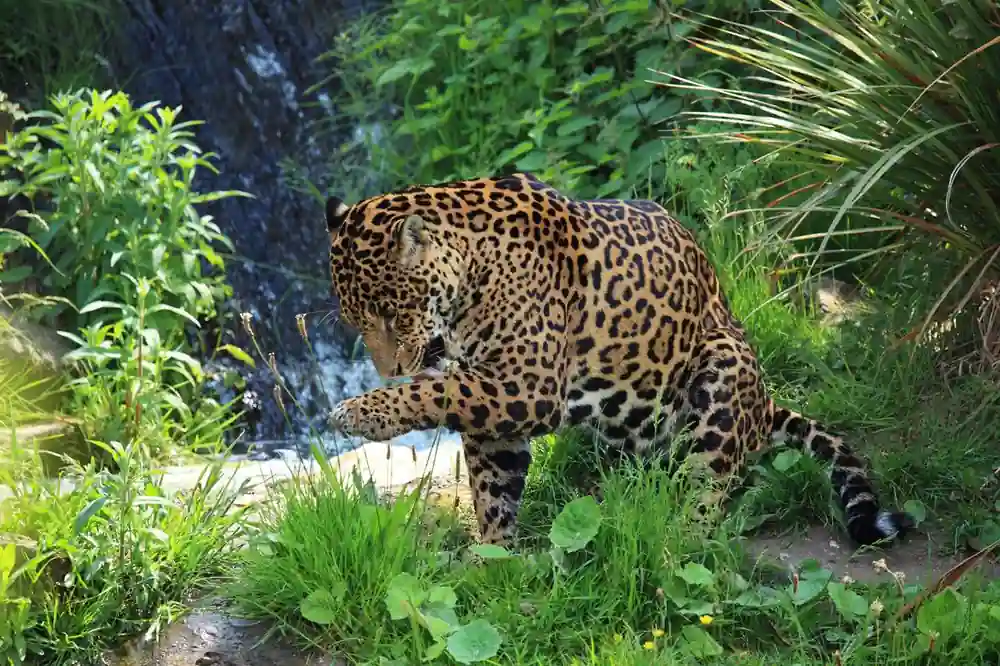
A camera trap operating in eastern Guatemala captured something researchers described as a once-in-a-decade event. A single adult male jaguar moved through a stretch of forest linking protected areas in Guatemala to the Honduran border. The photograph, released by the Wildlife Conservation Society and Defensores de la Naturaleza, provides direct documentation that the Guatemala-Honduras biological corridor remains in use.
The camera station was installed in the Sierra Caral mountain range by a joint conservation team. The photographed animal is an adult male. Its movement through the forest connecting the two national border territories documents what biological corridor modeling has long predicted but rarely been able to show directly: that jaguars can navigate human-altered landscapes when tree canopy remains intact. The corridor runs through the Sierra Caral and Merendón mountain ranges on the Guatemala-Honduras border — an area under pressure from cattle ranching expansion and agricultural activity. The single crossing documents a biological connection between jaguar populations across the two countries. Without that corridor, the populations risk becoming genetically isolated over time, reducing long-term viability. The area through which the jaguar traveled is partially protected but contains buffer zones with varying levels of formal legal land protection.
This photographic evidence validates predictions from international biological corridor models, showing that at least one jaguar did navigate a human-altered landscape when minimal tree canopy remained intact. For conservation donors and environmental policymakers, the sighting emphasizes the importance of protecting the narrow buffer tracts in eastern Guatemala before expanding agricultural activity reduces the remaining connections between regional jaguar populations.
What the Photograph Actually Proves — and What It Doesn’t
Conservation organizations are right to call this a significant confirmation, but it is easy to misread what the camera trap data shows. Panthera representatives described camera-trap shots of jaguars as a “luxury treat” that occurs only once every decade — a characterization of how rare such documentation is, not a claim that this specific corridor has been formally assessed as nearly severed. The jaguar photographed was not resident in the area. The motion-activated record shows a transit: the cat moved through the available forest and continued. For genetic connectivity between Guatemala and Honduras jaguar populations, any documented crossing matters. But a single documented crossing is evidence the corridor is being used — it does not by itself establish the frequency of jaguar movement or the overall health of the connection.
Panthera, the wild cat conservation organization with active Guatemala-Honduras corridor programs, describes the binational landscape as one of the key remaining jaguar movement zones in Central America. Panthera’s corridor field data from the region shows that habitat fragmentation from agricultural expansion is the primary driver of jaguar range contraction in this area. The camera trap image circulating in conservation media shows a jaguar in forest. It does not show the aerial view: the strip of trees the jaguar used is surrounded on both sides by cleared agricultural land, and parts of that strip sit on private smallholder farmland with varying conservation protections. Conservation teams working in the Sierra Caral area are engaged in ongoing work to formalize land protections in the buffer zones through which jaguars transit. The jaguar corridor connects fragmented habitats from Mexico through Central America into South America, allowing jaguars to travel between territories for hunting and breeding. Conservation Biology research on Central American corridor fragmentation shows that narrow pinch-points in the corridor are at risk of functional severance under current land-use pressure.
Formal boundary decisions on the proposed Sierra Caral protected area expansion are expected in the coming months. Conservation partners have indicated that land tenure negotiations with local landholders are ongoing. The outcome of those negotiations will determine whether the corridor documented in this photograph remains usable.