 Rahul Somvanshi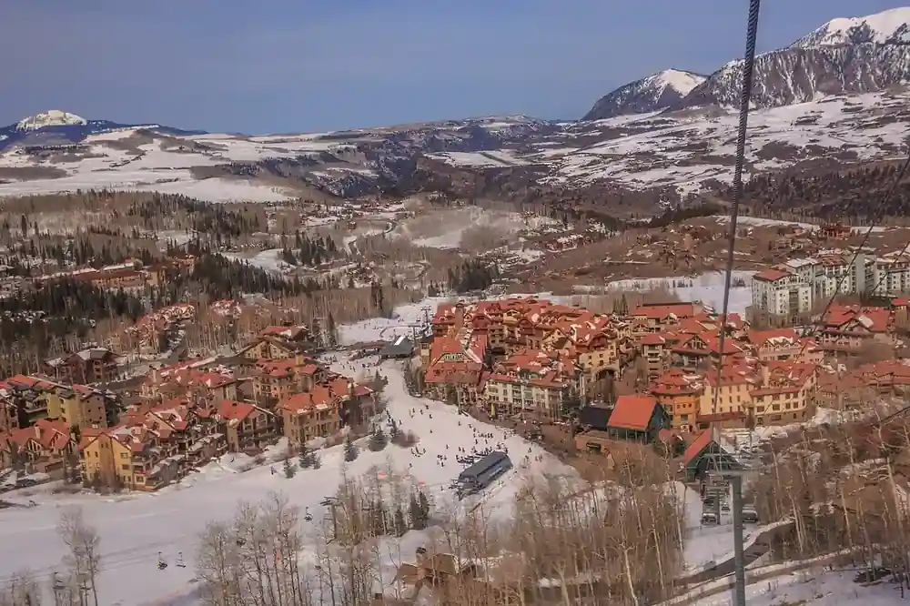
NOAA has placed the probability of a very strong El Niño this winter at above 90%, with a 75% chance of it ranking among the strongest on record for October through December. For ski resort operators, seasonal workers, and anyone booking a winter trip, that forecast shifts the regional risk picture — but it does not guarantee a specific outcome at any individual mountain.
NOAA’s Climate Prediction Center ENSO Diagnostic Discussion confirms El Niño conditions are in place for Northern Hemisphere fall and winter 2026-27. A strong El Niño shifts the Pacific jet stream southward, funneling storm systems into the southern tier of the country. That pattern typically produces above-average snowfall across the southern Rocky Mountains, Southwest, and California’s Sierra Nevada while the Pacific Northwest and parts of the northern tier receive below-average precipitation and above-average temperatures. The Pacific Northwest is the region most consistently projected to underperform in strong El Niño winters.
If you’re planning a ski trip to the Pacific Northwest, expect a higher risk of delayed resort openings, restricted terrain, and rain events on lower-elevation runs. Resorts in the Pacific Northwest face a compressed snowmaking window when overnight temperatures rise above the effective threshold for producing durable base snow — snowmaking efficiency depends heavily on wet-bulb temperature, with warmer and more humid conditions making production increasingly difficult. New England forecasts are more mixed, with one regional outlook describing conditions there as “fairly neutral.” Protect non-refundable bookings with weather-specific cancellation coverage and verify pass deferral deadlines before December 1.
Which Ski Regions Win and Which Face Pressure
The southern Rocky Mountain corridor and California’s Sierra Nevada are the consistent beneficiaries of strong El Niño winters. Taos Ski Valley, Ski Santa Fe, and Arizona Snowbowl benefit when the southern Pacific storm track strengthens. Wolf Creek, Telluride, and Purgatory in southern Colorado are similarly well-positioned. Mammoth Mountain and Palisades Tahoe in California’s Sierra Nevada stand to gain, with forecasters projecting 20 to 30% more winter snowfall for the Sierra Nevada region in a strong El Niño year. Utah and central Colorado are forecast as broadly neutral, meaning neither strong gains nor significant losses are expected for most resorts in those areas. Karmactive’s previous 2026-27 El Niño winter outlook explains the wider seasonal signal.
Multi-resort pass holders on packages like Epic or Ikon carry destinations in both winning and losing regions. If a northern resort opens late or operates with restricted terrain, a pass that includes southern Colorado or New Mexico options has practical flexibility built in — that flexibility has real value in an El Niño winter and should factor into trip-planning decisions made now. Past reporting on Mammoth Mountain’s extreme snowfall also shows how dramatically individual seasons can vary.
For independent operators in the Pacific Northwest and other at-risk regions, the pressure is operational. When overnight temperatures rise above effective snowmaking thresholds, resorts must balance the cost of less-efficient snow production against the need to open terrain. Resorts at lower elevations face the greatest exposure, while higher-elevation destinations have more buffer against warmer overnight temperatures. Resorts that cannot sustain snowmaking through a compressed window typically respond by reducing open terrain, adjusting ticket prices, or operating at a loss during the early season. Each of those outcomes affects the ski instructors, lift operators, and lodging workers who depend on full-season hours.
The broader picture from NOAA is that “strong El Niño” is a climate probability, not a local operating forecast. The same regional pattern that benefits Taos can shift storm tracks away from the Pacific Northwest. Elevation, base temperature, individual storm timing, snowmaking capacity, and local water availability all determine what actually happens at a given resort, independent of the national El Niño signal. Winter-dependent businesses that treat NOAA’s regional outlook as a snowfall guarantee rather than a planning input are misreading the forecast. Readers comparing mountain options can also consult individual resort opening-date trackers and NSAA industry data for seasonal benchmarking context.
Does El Niño mean more snow at every ski resort?
No. El Niño shifts seasonal probability by region — it does not guarantee snow depth or quality at any specific resort. A mountain at 11,000 feet in southern Colorado and one at 2,500 feet in the Pacific Northwest face completely different operational realities from the same national climate signal. Use NOAA’s regional seasonal outlook alongside individual resort reports to make specific plans, not national El Niño headlines alone.
NOAA updates its ENSO discussion monthly; subsequent outlooks will provide updated seasonal probabilities as winter approaches. Individual resort opening dates and terrain reports begin publishing through November. Watch those updates before finalizing any winter travel or business plans.