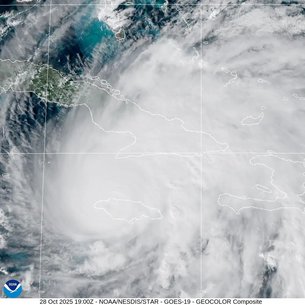
National Hurricane Center key messages and forecast path graphic for Hurricane Melissa on October 28, 2025, as the storm approached Jamaica as a Category 5 system. (Source: NOAA / NHC)
Hurricane Melissa: 190 MPH Record and 252 MPH Gust Over Jamaica
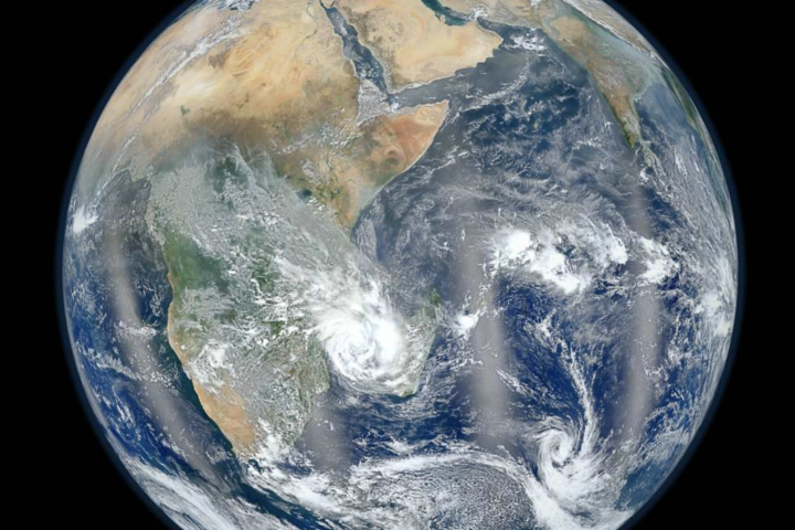
The National Hurricane Center’s Tropical Cyclone Report for Hurricane Melissa confirms 190 mph peak winds, a 252 mph dropsonde gust, and US$8.8 billion in damage to Jamaica with 95 deaths across the Caribbean.
Hurricane Melissa 190 MPH Record: What the NHC Found
A simple walk‑through of the official numbers for Hurricane Melissa from NHC, NCAR, World Bank, PAHO, ODPEM, and other first‑hand sources.
The National Hurricane Center’s Tropical Cyclone Report for Hurricane Melissa states that the storm reached peak 1‑minute sustained winds of 190 mph, with a minimum central pressure of 892 mb. This ties Melissa with Hurricane Allen (1980) for the strongest sustained winds ever recorded in an Atlantic hurricane.
At landfall in Jamaica on October 28, 2025, Melissa’s sustained winds were estimated at 185 mph with a landfall pressure of 897 mb. This landfall wind speed ties the 1935 Labor Day Hurricane and Hurricane Dorian (2019) for the highest landfall winds on record in the Atlantic basin. The NHC Tropical Cyclone Reports archive lists these reference storms alongside Melissa.
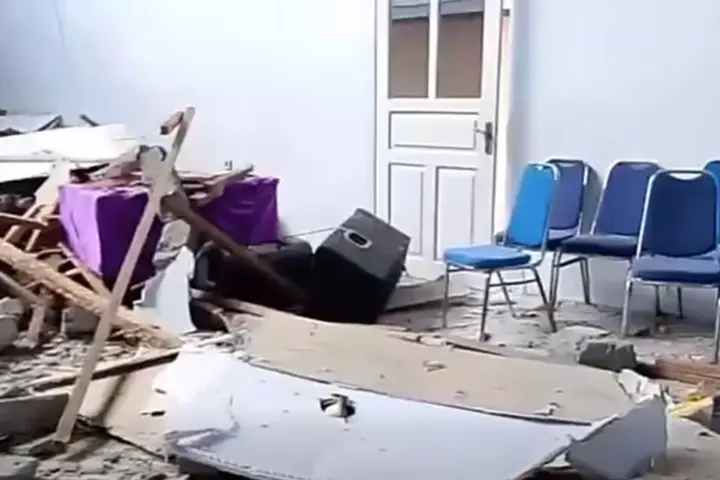
The post‑storm review notes that Melissa dropped up to 35 inches of rain in Jamaica and generated an estimated storm surge of 7–11 feet above normally dry ground east of landfall at Crawford and the Black River. The report describes the overall destruction in Jamaica as “among the worst ever recorded for Jamaica,” referring to collapsed homes, damaged hospitals, blocked roads, flooding, and extended power outages.
Melissa’s rapid intensification over very warm Caribbean waters attracted close attention from researchers at the University of Miami Rosenstiel School, who analysed the storm’s eyewall structure and the surrounding ocean heat content. For broader context on unusually high ocean temperatures, see KarmActive’s coverage of historic sea surface temperatures.
Hurricane Melissa Records Compared with Other Atlantic Hurricanes
Use the quick view below to see how Melissa’s winds and pressures sit next to other major Atlantic hurricanes.
Hurricane Melissa Timeline: From Formation to Final Report
Key dates collected from NHC advisories, NCAR’s dropsonde verification, World Bank and IMF releases, and Caribbean situation reports.
Hurricane Melissa Damage, Fatalities, and Humanitarian Toll
Figures summarised from NHC, ODPEM, PAHO, IOM, World Bank / IDB GRADE reports, and related Caribbean situation reports.
Based on regional situation reports, 95 deaths were linked to Hurricane Melissa across the Caribbean: 45 in Jamaica, 43 in Haiti, 4 in the Dominican Republic, and 1 in Cuba. Two additional deaths near Coral Springs, Florida, were classified as indirectly related when a relief flight crashed while delivering supplies for Jamaica.
The World Bank / IDB GRADE assessment estimated total physical damage at US$8.8 billion in mid‑November 2025, including damage to homes, public buildings, health facilities, transport networks, and agriculture. This value corresponds to about 41% of Jamaica’s 2024 GDP.
The NHC report lists point rainfall totals up to 35 inches in parts of Jamaica and notes storm surge of 7–11 feet above normally dry ground east of landfall near Crawford and the Black River. Flooding affected multiple parishes, including Westmoreland and St Elizabeth.
Health‑sector sitreps from PAHO describe damaged hospitals, disrupted water supply, and temporary closure of several facilities in areas such as Kingston, St James, and St Elizabeth. ODPEM reports detail blocked roads, collapsed dwellings, and extended power outages in coastal and inland communities.
Hurricane Melissa 252 MPH Dropsonde Gust: How It Was Measured
A simple explanation of the dropsonde, the NOAA Hurricane Hunter mission, and NCAR’s verification work.
Dropsondes used in hurricane reconnaissance were developed at the National Center for Atmospheric Research (NCAR), with funding from the U.S. National Science Foundation. The instruments transmit high‑frequency measurements of the atmosphere as they fall, allowing precise profiles of wind and pressure to be reconstructed.
In Melissa’s case, the 252 mph reading refers to a very short‑duration gust. The NHC’s 190 mph peak intensity figure uses a one‑minute average that combines data from satellite, flight‑level instruments, and dropsondes. The Tropical Cyclone Report notes that reconnaissance sampling does not always capture every maximum wind in the eyewall, so the true peak gusts near the surface may have been higher than the one instrument profile.
“The blend of data (dropsondes, flight‑level data, satellites, etc) suggested that this was as strong a storm as you will ever see in the Atlantic basin, and unfortunately this happened right before landfall. Thankfully, the forecast was accurate and timely thanks to the hard work of forecasters, modelers, and other scientists who have helped us learn to better understand and predict rapid intensification.”
— Andrew Hazelton, hurricane scientist at the University of Miami, describing Melissa’s analysis
NOAA’s hurricane reconnaissance work is coordinated by the Aircraft Operations Center, which manages flights of WP‑3D and other aircraft into tropical cyclones. Additional information on hurricane research flights and observing systems is available from NOAA’s Atlantic Oceanographic and Meteorological Laboratory and related technical summaries.
Jamaica Hurricane Recovery: Cat‑Bond Payout and IMF / World Bank Packages
How the parametric cat‑bond, emergency IMF funds, and wider multilateral support helped cover part of the US$8.8 billion damage.
The World Bank reported that Hurricane Melissa triggered a 100% payout of Jamaica’s US$150 million cat‑bond. This bond is parametric, paying out when predefined wind and pressure thresholds are met, rather than depending on ground‑based loss assessments.
In January 2026, the IMF approved about US$415 million in emergency financing for Jamaica through a Rapid Financing Instrument. This was designed to address the immediate balance‑of‑payments needs that followed Melissa.
According to IMF communications, Jamaica’s broader recovery and reconstruction package totals about US$6.7 billion over three years from the IMF, World Bank, IDB, and other partners. This support is intended to fund rebuilding of housing, infrastructure, and key services.
The joint World Bank / IDB GRADE report placed total physical damage at US$8.8 billion. This means that even when cat‑bond funds and multilateral financing are combined, not all losses are fully covered, and additional domestic and private resources are still required.
The World Bank’s GRADE methodology uses satellite imagery, exposure data, and sector‑specific models to estimate damage rapidly after disasters. For Hurricane Melissa, the methodology was applied to buildings, infrastructure, and agriculture, and the US$8.8 billion estimate was adopted as the reference figure for Jamaica’s recovery planning.
For additional context on how climate‑related disasters stress public finances and infrastructure, readers can examine the World Bank’s Jamaica country reports and KarmActive’s coverage of extreme flooding risks and the UN Secretary‑General’s warnings on the climate crisis.
Jamaica Agriculture Damage: Coffee Crop, Livestock, and Food Security
Agricultural losses are summarised in the NHC report and the GRADE Jamaica assessment, with direct consequences for farmers and food systems.
The NHC report and the GRADE Jamaica document record that farmers reported losing about 45% of their coffee crop. This loss affects both export revenues and local livelihoods, as coffee is one of Jamaica’s higher‑value agricultural products.
The same sources estimate that about 1.25 million animals died during the storm, including poultry and cattle. These livestock losses reduce household income in rural communities and can have knock‑on effects on local food availability, particularly in parishes such as St Elizabeth and Westmoreland where agriculture plays a major role.
For a broader view of how extreme weather is affecting farming in multiple regions, KarmActive’s analysis of global farming and extreme weather provides additional context.
Hurricane Preparedness Checklist: Based on NHC and NOAA Guidance
Key points adapted from official preparedness information. The 2026 Atlantic hurricane season begins on June 1.
Local emergency management offices publish evacuation and storm surge zone maps. Residents are asked to confirm their zone before the season begins.
NHC and NOAA guidance suggests at least seven days of water and non‑perishable food, essential medicines, a battery‑powered radio, flashlights, and first‑aid items.
Residents are asked to follow official advisories from the NHC and national meteorological or disaster agencies, and to avoid unverified social media rumours.
Recommended steps include clearing gutters, reinforcing doors and windows, trimming trees, and securing loose outdoor items before a storm is close.
Storm surge is identified by NHC as a leading cause of hurricane‑related deaths in coastal zones. Melissa’s 7–11 foot surge in Jamaica is one example of this hazard.
Families are encouraged to choose a meeting point and an out‑of‑area contact and to make sure all members know where to go if they are separated.
Official, detailed hurricane preparedness advice is available from the National Hurricane Center’s preparedness pages. For additional context on flood‑risk reduction, see KarmActive’s guide “7 Solutions to Avoid Floods.”
NHC Preparedness GuideHurricane Melissa Summary
The official post‑season documents report that Hurricane Melissa reached peak 1‑minute sustained winds of 190 mph with a minimum central pressure of 892 mb, that the storm made landfall in Jamaica with sustained winds of 185 mph and a landfall pressure of 897 mb, and that a dropsonde in the eyewall measured a 252 mph gust.
These same documents report that rainfall totals in Jamaica reached up to 35 inches, that storm surge heights of about 7–11 feet occurred east of landfall at Crawford and the Black River, and that total physical damage in Jamaica was estimated at US$8.8 billion, corresponding to about 41% of Jamaica’s 2024 GDP.
They also record that at least 95 deaths in the Caribbean were linked to the storm, that about 1.25 million animals were lost, that roughly 45% of the coffee crop in Jamaica was reported damaged, and that a combination of cat‑bond, IMF, World Bank, IDB, and other support was arranged to help address the losses over a multi‑year period.
Official Documents and Related KarmActive Coverage
External links below go only to first‑hand sources such as NHC, NCAR, World Bank, IMF, PAHO, ODPEM, GFDRR, and CDEMA.