Karmactive Staff
Planning around the first snowfall in New York State this season means understanding two different things: what historical averages show about timing, and what the current seasonal forecasts actually say. The averages are reliable baselines. The forecasts — from the Farmers' Almanac to long-range models — come with accuracy limits that matter when you’re planning around a specific date or event.
National Weather Service historical data places the average date of the first measurable snowfall at Central Park on December 7. Upstate arrives significantly earlier: Saranac Lake averages October 23 for its first measurable snow. Binghamton averages November 1. Syracuse averages November 5. Buffalo averages November 8. Albany averages November 16. Poughkeepsie averages November 30. Long Island’s Islip averages December 14, generally after the city.
These are averages across many decades — meaning half of years see the first snow earlier, half later. They are not forecasts for this specific winter.
For 2026–27, the Farmers’ Almanac is predicting what it calls a “tricky mix of snow, sleet, and surprises” for the Northeast. That characterization is worth keeping in context: the Almanac itself describes its first-snowfall map as “a climatological guide, not a forecast for specific storms.” It is a pattern indicator, not a date-specific prediction. Using it as a precise planning tool for when to put on your snow tires will likely disappoint you in either direction.
What “First Snow” Actually Means
The phrase “first snow” covers three meaningfully different events that can arrive weeks apart. Meteorologists distinguish between the first snowflakes observed (which often melt on contact and leave no accumulation), the first measurable snowfall (defined as at least 0.1 inches of accumulation), and the first significant snowfall (typically defined as one inch or more). The December 7 Central Park average refers to the first measurable snowfall — not the first flake, and not the first storm.
For commuters and school schedules, the first significant snowfall is the more relevant figure, and it typically arrives weeks after the first measurable event. For drivers deciding when to switch to winter tires, the first measurable snowfall is usually the trigger.
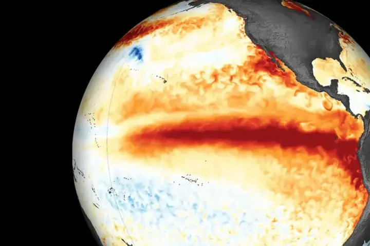
The larger climate context for this winter involves El Niño. NOAA's Climate Prediction Center puts the probability above 90% that a very strong El Niño continues through fall and winter 2026–27. Strong El Niño winters tend to produce warmer-than-average temperatures in the northern tier of the US and wetter-than-average conditions in the South — a pattern that historically has meant less severe winters in the Great Lakes and Northeast, though there is always year-to-year variation. This aligns with some model signals but is a general tendency, not a guarantee for any specific region or date.
The National Weather Service publishes its official winter outlook in October. That release, based on current sea surface temperatures and atmospheric conditions, will give the most reliable seasonal guidance available. Farmers’ Almanac predictions and long-range model signals are inputs worth noting; the NWS outlook is where to anchor your planning.
When does New York City typically get its first snow? Central Park’s historical average for its first measurable snowfall is December 7, according to NWS data. Years with earlier or later first snows are both common. This winter’s official seasonal outlook from NWS publishes in October.
Check back in October when NOAA’s winter 2026–27 seasonal outlook is released. For context on how El Niño is shaping this winter's forecast, see the explainer on Karmactive.