 Rahul Somvanshi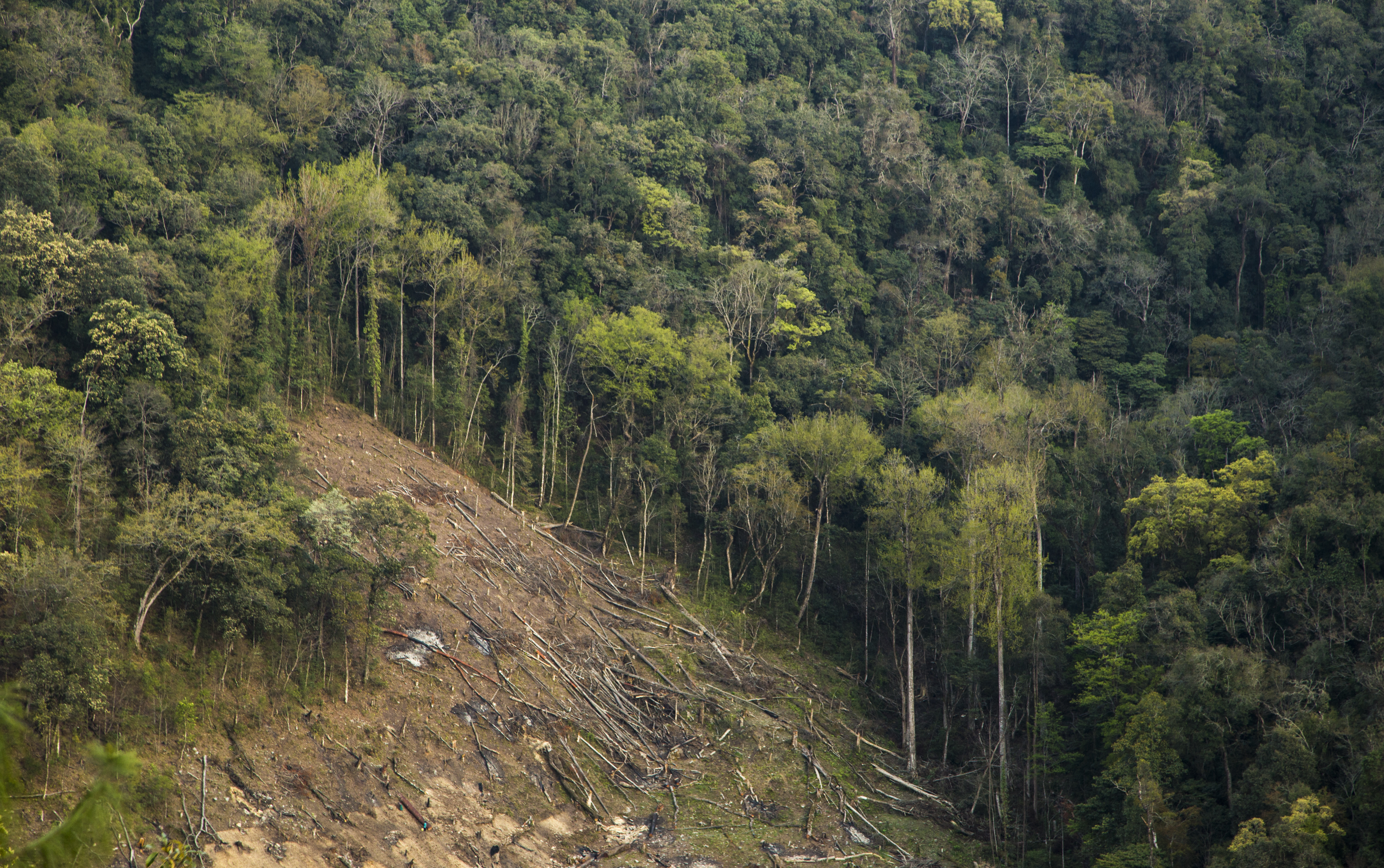

A tree falls during clearance work in Arunachal Pradesh — one slice of the 215,943 hectares India approved for diversion between 2014-15 and 2025-26, of which 62 percent was actually cleared. Approval and ground reality rarely match; the gap is where forests disappear. [Photo: Saurabh Sawant / Wikimedia Commons, CC BY-SA 4.0]
Alt text: Tree felling for forest clearance in Arunachal Pradesh, India.
Title: Forest clearing in Arunachal Pradesh, India
India Approves Clearing 215,000 Hectares of Forest—But 62% Gets Cleared
Approved Diversion vs. Actual Clearing: A Decade of Forest-Loss Slippage
India’s central government approved the conversion of 215,943 hectares of forestland to non-forest use between 2014-15 and 2025-26. On paper, the scale was staggering. In practice, the picture was murkier. Only 62% of that approved land was actually cleared—roughly 134,000 hectares. The gap between authorization and execution matters. It reveals both the volatility of state-level implementation and the possibility that even approved diversion orders do not guarantee forest loss.
The baseline for India is this: the country holds 44 million hectares of natural forest, representing about 15% of its total land area as of 2020. India ranks 10th globally in annual forest loss. The forest diversion approval process, governed by India’s Forest Conservation Act, requires federal sign-off before states can convert forest to agriculture, mining, infrastructure, or urban expansion. The approvals are supposed to be rare and scrutinized.
Yet 215,943 hectares approved for diversion in a single decade suggests either mounting pressure to develop forested land or a permitting apparatus inclined to grant requests. The fact that only 62% was actually cleared does not validate the permitting process. It raises questions: Why approve land that may not be developed? Are approvals issued speculatively, ahead of actual project execution? Do some approvals lapse before being acted upon?
Down to Earth's August 5, 2026 investigation provided the most recent aggregate accounting. The outlet analyzed ministry records and state-level forest department data to construct the decade-long picture. The 62% cleared rate means 82,000 hectares of approved forest land remains theoretically convertible but not yet logged or leveled. Whether it will be converted in future years is uncertain.
Within India, deforestation is not uniformly distributed. Northeast India, which comprises Assam, Meghalaya, Manipur, Mizoram, Nagaland, Tripura, Sikkim, and Arunachal Pradesh, accounts for a disproportionate share of the nation’s forest loss. The region’s geography—monsoon-dependent, biodiverse, steep terrain—makes forest conversion profitable for extractive industries. Tea, timber, and palm plantations compete with conservation. Mining companies have long sought access to northeastern forests for coal, bauxite, and other minerals.
The diversion approval data does not break down forest loss by cause. That matters for understanding trajectory. If the 134,000 hectares cleared since 2014-15 was split among agricultural conversion (state-driven), mining (federal and corporate-driven), and infrastructure (highways, dams, power lines), different actors bear different responsibility. Infrastructure projects often require forest clearance regardless of state opposition. Mining leases can be federal decisions. Agricultural pressure is typically state-level.
One additional metric adds context: the rate of approval is not stable. If the 215,943 hectare approvals were spread evenly across the decade, that would be roughly 21,594 hectares per year. In reality, the rate may have accelerated in recent years as development pressure increased. Data availability limits precision on year-by-year trends, but the aggregate figure suggests ongoing pressure to open forested land to commercial use. These trends align with broader forest loss challenges facing nations worldwide.