Karmactive Staff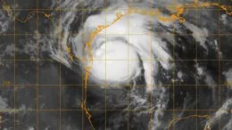
Hurricane Polo reached Category 5 strength early September 23, with maximum sustained winds of 165 mph, according to the National Hurricane Center, as it tracked slowly northwest off Mexico’s Pacific coast. The National Hurricane Center had a Tropical Storm Warning in effect from Tecpan de Galeana to Punta San Telmo. The storm’s center is not forecast to make direct landfall — but that does not mean residents from coastal Mexico to the US Southwest are in the clear.
As of NHC Advisory 14 at 9 p.m. CST on September 23, Polo’s center was positioned roughly 210 miles south of Zihuatanejo, Mexico, moving northwest near 6 mph. Minimum central pressure was dropping as sustained winds reached approximately 160 mph (260 km/h), with gusts higher. Hurricane-force winds extended 40 miles from the center; tropical-storm-force winds reached out 105 miles. NHC forecasters described Polo’s 24-hour intensification as “truly remarkable.”
Even without a direct eye strike on land, Polo’s slow crawl is generating real danger on two fronts. Coastal Mexico faces storm surge and 4 to 8 inches of rainfall, with isolated higher totals, driven into steep mountain terrain, where runoff concentrates rapidly regardless of where the center sits. Over the next 72 hours, residual tropical moisture may track north, pulled into a mid-latitude trough and steered toward Arizona, New Mexico, and parts of West Texas — desert basins that drain fast and produce flash flooding even from moderate totals.
Why Polo Intensified So Fast — and What That Means Inland
El Niño conditions pushed sea-surface temperatures in the eastern Pacific significantly above long-term averages. That warmer water is fuel: more heat energy available for the storm to convert into wind and rainfall. Low vertical wind shear — little variation in wind speed between low and high altitude — allowed Polo to organize without the disruption that normally limits intensification. Meteorologists confirmed both factors were present.
The element most breaking-news reports missed is what Polo’s slow forward speed means for rainfall. A storm traveling under 5 mph lingers over terrain far longer than a fast-moving system. In the steep coastal ranges of Guerrero and neighboring states, slow movement combined with orographic lift — air forced up mountain slopes, cooling and releasing rain — can prolong rainfall and enhance precipitation totals. Communities in those inland valleys face flood risk that does not require direct eye passage.
For the US, the threat is separate from the storm core. As Polo weakens in cooler water north of its current position, upper-level wind patterns are expected to capture the remnant moisture plume and redirect it northeast, potentially raising flood risk in Arizona, New Mexico, and West Texas. For the full 2026 Pacific hurricane season context, see our Pacific hurricane season tracker. For background on how El Niño raises sea surface temperatures and storm intensity, see our El Niño explainer.
Will Hurricane Polo hit the United States?
Polo’s center is not expected to reach the continental US. The storm will weaken as it moves into cooler waters off Baja California. Its remnant tropical moisture, however, may be captured by a mid-latitude trough and steered northeast into the US Southwest within four to six days, raising flash flood risk in Arizona, New Mexico, and West Texas. Desert terrain drains poorly; even moderate totals produce fast-moving conditions.
The NHC normally issues full tropical cyclone advisories every six hours, with intermediate advisories issued when watches or warnings are in effect. Check back here for updates as the storm’s track and remnant moisture path develop.