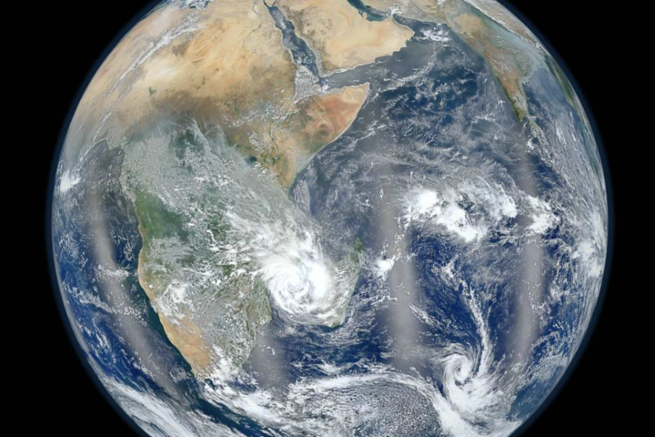
Oil residue floats along the water surface during the Refugio Oil Spill in California, illustrating how hydrocarbon slicks spread across coastal waters; such patterns often complicate early source identification—how quickly can response systems trace origin and limit spread when multiple sources are suspected? (Representative image; no direct connection to the Gulf of Mexico spill in Mexico) (Source: Zackmann08 / Wikimedia Commons, CC BY-SA 4.0)
Oil, Answers, and 785 Tons in Mexico’s Gulf Waters
Fishing halted, coastal communities affected, and conflicting official and civil-society accounts over three sources, one missing vessel, and satellite images that tell a different story.
Oil residue floating on the water surface — representative image showing how hydrocarbon slicks spread across coastal waters. (Zackmann08 / Wikimedia Commons, CC BY-SA 4.0)
In early March 2026, chapopote — oil residue — was reported washing up across at least 16 coastal sites between Pajapan, Veracruz, and Paraíso, Tabasco, along nearly 170 km of coastline. Fishing communities in the affected zone reported disruptions and losses. Wildlife impacts were documented and placed under monitoring. More than 2,400 personnel from the Mexican Navy, environment ministry, and state oil company were deployed. And then came the questions — about timing, about sources, and about who knew what, and when.
Mexico’s Secretariat of Environment (SEMARNAT) announced three identified sources: an unidentified anchored vessel off the coast of Coatzacoalcos, and two natural geological oil seeps — known in Mexico as chapopoteras — one near Coatzacoalcos and another in the Bay of Campeche. A coalition of 17 environmental organisations, including Greenpeace México and CEMDA, challenged that account using Copernicus satellite imagery — pointing to a Pemex pipeline and a timeline starting as early as February 6, weeks before the public announcement.
CEMDA stated that the absence of timely information was causing economic and environmental damage, and called for accountability, noting that no one had been held responsible.
— CEMDA (CENTRO MEXICANO DE DERECHO AMBIENTAL), MARCH 2026
The spill affected marine ecosystems along a coastline that includes protected natural areas. CONANP reported monitoring and cleanup activity in protected areas, while the government said it was still assessing the source and full extent of the impact. This piece tracks what is known, what is disputed, and what is still under investigation.
Interactive · Spill Origins
Where Did the Oil Come From?
TAP EACH SOURCE TO EXPLORE THE EVIDENCE · THREE ACCOUNTS, ONE UNRESOLVED INVESTIGATION
GOVERNMENT POSITION · SEMAR
Ships Under Scrutiny
13
vessels in area as of early March
Location
Coatzacoalcos
Port of Coatzacoalcos, Veracruz
What authorities say:Navy Admiral Raymundo Morales (SEMAR) stated that a vessel anchored off the coast of Coatzacoalcos was one of three identified spill sources. As of early March, 13 ships had been sailing in the area and had not yet been inspected, making it impossible to name a specific vessel. The investigation to identify the vessel remains ongoing. Environmental critics have pointed to the gap between the satellite detection date cited by NGOs (February 6) and the government’s public announcement (late March) as a transparency concern requiring further explanation.
GEOLOGICAL CONTEXT · NATURAL SEEPAGES
Distance from Port
8 km
Chapopotera near Coatzacoalcos
Second Location
Cantarell
Bay of Campeche seep zone
What a chapopotera is: A chapopotera is a natural geological site where crude oil seeps upward through the seafloor or coastal rock. These are common in the Gulf of Mexico basin and have been documented in Mexican geological surveys for decades. The Cantarell field area — once the world’s second-largest oil field — has known natural emission sites. President Claudia Sheinbaum said these seeps are “well-documented in scientific literature” and that natural causes were considered “more probable.” INEGI (Mexico’s national statistics institute) holds geological records documenting seep activity in the region. Cold Front 42 (Frente Frío 42) arrived in the Veracruz region in late March; local sources have referenced it in connection with oil reaching the shoreline, though a direct causal link has not been confirmed in official scientific releases.
NGO CLAIM · 17 ORGANISATIONS · DISPUTED BY PEMEX
Satellite First Detected
Feb 6
Per Copernicus imagery (ESA)
Vessel at Scene
Árbol Grande
Feb 7–15, pipeline repair speciality
What the NGO coalition says: A group of 17 organisations including Greenpeace México and CEMDA reviewed Copernicus (ESA) satellite imagery and identified a large oil slick appearing as early as February 6 — approximately six weeks before the government’s public announcement. The images showed the vessel Árbol Grande (operated by Diavaz, specialising in pipeline repair) stationed at the site of a suspected leak from the Ducto OLD AK C pipeline between Akal-C platform and the Dos Bocas Maritime Terminal.
Pemex’s response: Called the claims “inaccurate” and stated the Árbol Grande was performing “routine preventive inspections” and “specialised spill response operations.” No active pipeline leak was reported. The Fiscalía General de la República (FGR) has been requested to conduct an independent investigation into whether criminal negligence occurred.
Interactive · Timeline
How Events Unfolded
FROM FIRST SATELLITE DETECTION TO ONGOING INVESTIGATION — CLICK EACH EVENT FOR MORE DETAIL
February 6, 2026
First Satellite Detection (Disputed)
Environmental organisations say Copernicus satellite imagery shows a large oil slick in the Gulf of Mexico on this date — weeks before any official announcement. CEMDA’s March 4 post documents chapopote reported at at least 16 coastal sites between Pajapan, Veracruz, and Paraíso, Tabasco.
▸ EXPAND DETAIL
The repair vessel Árbol Grande, specialising in pipeline maintenance and operated by Diavaz, was reportedly present at the location from Feb 7 to Feb 15. Environmental groups argue this suggests Pemex was aware of a potential infrastructure issue at this point. Pemex denied any active leak was occurring and described the vessel’s presence as routine inspection and response work.
Early March 2026
Official Detection & Emergency Response Begins
Mexican authorities begin official detection and assessment of hydrocarbons along the Veracruz and Tabasco coasts. Fishing suspensions issued in affected communities.
▸ EXPAND DETAIL
Over 2,400 response personnel deployed from SEMAR (Navy), SEMARNAT, PROFEPA, Pemex, ASEA, and CONANP. This is the official start of the interdisciplinary response group.
~16 March 2026
Marine Containment Declared Complete
Offshore containment of the surface slick reported as complete by the government interdisciplinary group. Shoreline cleanup operations continue.
▸ EXPAND DETAIL
Cleanup progress reached approximately 88% by March 19 per SEMARNAT reports. However, environmental groups warned that submerged oil clinging to sargassum (floating seaweed) continued to pose a threat to the seafloor and marine species, as sargassum acts as a sponge trapping hydrocarbons.
Late March 2026
NGO Coalition Releases Satellite Evidence
17 organisations including Greenpeace México and CEMDA publicly release satellite imagery and challenge the official narrative about spill origins and timeline.
▸ EXPAND DETAIL
The coalition cited images obtained through the Copernicus Browser (ESA) showing what appeared to be an oil slick originating from a platform area in February. CEMDA stated that the absence of timely information was causing economic and environmental damage, and called for accountability. Health clinics in Pajapan also documented respiratory irritation and skin rashes among community volunteers who cleaned beaches without protective equipment, according to local human rights groups including the Bety Cariño Center.
31 March 2026
Environment Secretary Bárcena Leads Field Review
Environment Secretary Alicia Bárcena led the Interdisciplinary Group’s field review of the affected coastline. Government maintains the three-source narrative while acknowledging ongoing scientific investigation.
▸ EXPAND DETAIL
President Sheinbaum confirmed via morning briefings that an Interdisciplinary Group (GI) — which Bárcena leads — consisting of SEMAR, Pemex, SEMARNAT, and the CICESE (Center for Scientific Research and Higher Education of Ensenada) for ocean current analysis was actively investigating. A 31 March message placed the group in Barrillas, Veracruz. She acknowledged both the natural seep and infrastructure-leak possibilities were being assessed by scientists.
The Federal Prosecutor (Fiscalía General de la República) has been requested to conduct an independent investigation into possible criminal negligence. The unidentified vessel remains unidentified.
▸ EXPAND DETAIL
More than 700 tons of contaminated waste had been recovered from beaches by 30 March, with 785 tons accumulated per the SEMARNAT 30 March update. Environmentalists warn that submerged oil continues to threaten the seafloor. The nesting season for the critically endangered Kemp’s Ridley sea turtle (Lepidochelys kempii), documented by CONANP, coincided with the spill period, raising long-term biodiversity concerns.
The Gulf of Mexico has a documented history of both natural hydrocarbon seepages and industrial spills. The Cantarell basin — once ranked as the world’s second-largest oil field — has had naturally occurring oil seeps for centuries. What makes the 2026 spill unusual is the scale, the gap between satellite detection cited by NGOs and public disclosure, and the convergence of multiple possible sources in an area of heavy industrial and ecological significance.
Fishing communities across the affected zone reported disruptions and losses. These are communities with generations of dependence on the Gulf’s marine ecosystems. Oil residue on sargassum (seaweed) washing ashore complicated beach cleaning and trapped hydrocarbons in the water column where they could enter the food chain over months or years.
The spill also arrived as international context added a layer of concern. In the United States, the Trump administration exempted Gulf of Mexico oil and gas drilling from the Endangered Species Act, citing domestic energy security during the U.S.-Israeli conflict with Iran. Environmental groups on both sides of the border said this shift reduced transparency requirements for transboundary pollution events.
Key Numbers
The Scale of the Spill
VERIFIED DATA FROM SEMARNAT, SEMAR, PROFEPA AND CONANP OFFICIAL RELEASES
🛢️
785t
Hydrocarbons Accumulated (30 Mar)
SEMARNAT 30 March update
📏
630km
Coastline Affected (est.)
NGO estimates using Copernicus
👷
2,400+
Response Personnel Deployed
PROFEPA official release
🏛️
7–8
Protected Areas with Hydrocarbon Presence
CONANP monitoring reports
🧹
>700t
Waste Recovered by 30 March
SEMARNAT, 30 March 2026
🚢
13
Vessels Requiring Investigation
SEMAR, Admiral Morales
Geography · Affected Zone
Key Locations in the Spill Zone
GULF OF MEXICO · VERACRUZ & TABASCO · CLICK MARKERS FOR DETAILS
Spill Sources (Govt)
NGO-Identified Claim
Affected Communities
Protected Area Reference
A Transparency Gap in the Timeline
One of the most contested aspects of the 2026 Gulf spill is the gap between when environmental groups say satellite data shows the slick first appearing (February 6) and when the Mexican government made its first public announcement (late March). That is roughly a six-week period during which, according to the NGO coalition, communities and local authorities were not formally notified.
CEMDA stated that the absence of timely information was causing economic and environmental damage, and called for accountability, noting that no one had been held responsible. The Environment Ministry (SEMARNAT) and SEMAR have not provided a public explanation for why no earlier alert was issued if a seep was detected in February.
The Interdisciplinary Group investigation — involving SEMAR, Pemex, SEMARNAT, and the CICESE research centre for ocean current modelling — is ongoing. A separate independent investigation by the Federal Prosecutor has been requested. The accountability question around oil infrastructure is far from resolved.
Interactive · Two Accounts
Government Account vs. NGO Findings
SELECT A TOPIC TO COMPARE POSITIONS SIDE BY SIDE
🇲🇽 Government Position
Spill detection and response began in early March 2026. The government’s official releases by SEMAR and SEMARNAT describe a March-timeline for identification of sources.
🔭 NGO / Copernicus Data
Satellite imagery from the Copernicus Browser (ESA) shows an oil slick present as early as February 6, 2026 — approximately six weeks before the public announcement.
📌 Status
This discrepancy is a central point of the FGR independent investigation. Neither side has provided a mutually accepted explanation for the timing gap.
🇲🇽 Government Position
Three sources: one unidentified anchored vessel off Coatzacoalcos, one chapopotera (natural seep) 8 km from that port, and another natural seep in the Bay of Campeche. Source: SEMARNAT official communiqué.
🔭 NGO / Copernicus Data
The primary source is the Ducto OLD AK C pipeline between the Akal-C platform and the Dos Bocas Maritime Terminal, operated by Pemex. The pipeline failure is said to have preceded the official detection by weeks.
📌 Status
Pemex has denied any active leak in its infrastructure. The Interdisciplinary Group investigation is tasked with resolving this specific question using both satellite and field data.
🇲🇽 Government / CONANP
CONANP reported monitoring and cleanup operations in protected natural areas. Alicia Bárcena confirmed that five to six species including sea turtles and birds were affected. The government said it was still assessing the source and full impact, and that no infrastructure leak had been reported as of late March.
🐢 CONANP / NGO Observation
The spill coincided with the nesting season of the Kemp’s Ridley Sea Turtle (Lepidochelys kempii), critically endangered. Marine fauna impacts were documented and placed under monitoring. Sargassum trapping hydrocarbons poses long-term food chain risk. Community health impacts documented in Pajapan by local human rights groups.
📌 Status
CONANP continues to monitor protected areas. Long-term biodiversity impact assessments are pending. Submerged hydrocarbon contamination is not yet fully quantified.
🇲🇽 Pemex Response
The vessel Árbol Grande “permanently traverses the Gulf of Mexico, carrying out preventive inspections of platforms and specialised spill response operations.” Its presence at the location does not indicate an active leak.
🔭 NGO / Copernicus Data
The Árbol Grande specialises in pipeline repair. Its presence from Feb 7–15 at the exact location where the satellite-detected slick appeared on Feb 6 is cited as evidence that authorities were aware of the situation before official disclosure.
📌 Status
The FGR has been asked to investigate whether the vessel’s presence and the satellite-detected slick indicate prior knowledge of an infrastructure failure. No finding has been issued as of April 2026.
Wildlife · Species at Risk
Marine Life in the Affected Zone
DOCUMENTED SPECIES CONCERNS · CONANP MONITORING RECORDS
🐢
Critically Endangered
Kemp’s Ridley Sea Turtle
Lepidochelys kempii
Spill coincided with nesting season. Oil-coated turtles documented on shores. Primary nesting beaches exist along affected Veracruz and Tamaulipas coastline. Monitored by CONANP.
🐋
Endangered
Sperm Whale
Physeter macrocephalus
Deep-diving cetaceans that feed in the Gulf’s central basin. Hydrocarbon contamination in prey species and surface slicks pose ingestion risks during deep-water surfacing. Population uses Gulf of Mexico as feeding habitat.
🐟
Commercially Impacted
Gulf Coastal Fisheries
Multiple species
Fishing communities across the affected zone reported disruptions and losses. Sargassum acting as a hydrocarbon sponge complicates decontamination. Long-term food chain contamination poses multi-year risk to artisanal fishing communities. See also: marine mammal recovery.
Response Progress
Cleanup Response by the Numbers
BASED ON SEMARNAT AND PROFEPA OFFICIAL RELEASES AS OF LATE MARCH 2026
Marine Containment (Offshore)100%
Declared complete around March 16. Offshore surface slick contained. Source: SEMARNAT.
Offshore Containment Progress (as of 19 March)88%
88% refers specifically to offshore containment progress, not total elimination of oil. Shoreline operations and submerged contamination continued past this date. Source: SEMARNAT.
Waste Recovered vs. Accumulated Total (30 March)>700t
More than 700 tons recovered by 30 March; 785 tons accumulated per the 30 March SEMARNAT update. Submerged oil not included in recovery figures. Source: SEMARNAT / PROFEPA.
Source Investigation ProgressOngoing
Vessel unidentified. Pipeline claim unresolved. FGR investigation requested. Timeline discrepancy unaddressed. As of April 2026.
Summary
The 2026 Gulf of Mexico oil spill was covered here across its key dimensions: the three officially identified sources including a vessel and two natural seepages, the counter-evidence presented by environmental organisations using satellite data, the scale of cleanup operations involving more than 2,400 personnel, and the documented impacts on marine life and fishing communities between Pajapan, Veracruz, and Paraíso, Tabasco.
The competing accounts — from SEMARNAT and SEMAR on one side, and from CEMDA and Greenpeace México on the other — were also outlined, along with the discrepancy in the timeline between satellite detection and public disclosure. The 30 March SEMARNAT update recorded 785 tons of accumulated hydrocarbons, with more than 700 tons recovered by that date. The ongoing nature of both the Interdisciplinary Group investigation and the separately requested FGR probe were noted. The affected coastline, species, and communities were documented as the situation continued through April 2026. For broader context on ocean pollution patterns and oil industry accountability, see related KarmActive coverage.
Rahul, possessing a profound background in the creative industry, illuminates the unspoken, often confronting revelations and unpleasant subjects, navigating their complexities with a discerning eye. He perpetually questions, explores, and unveils the multifaceted impacts of change and transformation in our global landscape. As an experienced filmmaker and writer, he intricately delves into the realms of sustainability, design, flora and fauna, health, science and technology, mobility, and space, ceaselessly investigating the practical applications and transformative potentials of burgeoning developments.
Leave a Reply
Previous Story
Santee Brush Fire: 5-Acre Riverbed Blaze Forces Evacuations Near Town Center Parkway, “Early in the Season” Says Fire Chief
Next Story
Artemis II Launches: Four Astronauts Head to Moon for First Time in 53 Years, Breaking Distance Records
El Niño 2026: The Pacific Is Warming Again — KarmActive Climate · El Niño Watch 2026 The Pacific Is Warming Again — And This Time, the Whole Planet Feels It Ocean temperatures
Tropical Cyclone Maila | Category 3 Tracking Toward Far North Queensland – April 2026 Active System Another CycloneHeading for Far North Queensland Severe Tropical Cyclone Maila — Category 3 — is tracking southwest
Santee Brush Fire: 5-Acre Riverbed Blaze Near Town Center Parkway | KarmActive Breaking Fire in the Riverbed — Santee Brush Fire NearTown Center Pkwy Santee, California · Sunday, 6:42 p.m. · Santee
Australia Braces for Catastrophic Flooding: Tropical Lows Unleash Record Rainfall Across Queensland and NT Australia Braces for Catastrophic Flooding: Tropical Lows Unleash Record Rainfall Across Queensland and NT Two tropical low-pressure systems
Greater Cincinnati Flood Watch – Great & Little Miami Rivers Rising | March 2026 Flood Watch in effect – Greater Cincinnati & Miami River Valleys Little Miami at Milford: Flood Warning issued
AusAlert 2026: Australia’s National Emergency Warning System — Tested on 23 Million Phones Australia · Emergency Alert · 2026 AusAlertIs Coming Australia’s $132 million national emergency warning system launches in October 2026
Fire Crews Contain Thornton Grass Fire Near Pinnacle Charter High School Emergency Response Fire Crews Contain Thornton Grass Fire Near Pinnacle Charter High School 10-acre blaze forces evacuations, closes Interstate 25, and
Hurricane Melissa 190 MPH Record: Jamaica’s Worst Hurricane on Record National Hurricane Center key messages and forecast path graphic for Hurricane Melissa on October 28, 2025, as the storm approached Jamaica as
🚨 ACTIVE WARNINGS – Multiple bushfires across NSW and Tasmania – December 5, 2025 EMERGENCY UPDATES Australia Bushfire Emergency: Real-Time Tracking Active bushfires continue across eastern Australia as severe heatwave conditions drive
Japan Earthquake Iwate M6.9: Tsunami Advisory Lifted – November 9, 2025 ⚠️ Natural Disaster Alert Strong Earthquake Strikes Off Iwate, Japan A 6.9 magnitude earthquake hit off Japan’s northeastern coast on November
Cyclone Montha: Interactive Tracker & Impact Analysis 🌪️ SEVERE WEATHER ALERT Cyclone Montha Makes Landfall: Tracking the Severe Storm’s Path Across India’s Eastern Coast Real-time tracking of wind speeds up to 110
Hurricane Melissa: Jamaica’s Most Powerful Storm on Record ⚠️ Category 5 Hurricane – Catastrophic Hurricane Melissa Devastates Jamaica as Strongest Storm on Record Category 5 hurricane makes landfall with 185 mph winds
Weather & Safety Thousands without power in Queensland as Victoria experiences ‘terrifying’ winds after year’s wettest day About 26,000 households were without power in South-East Queensland on Monday morning after severe thunderstorms,
")