 Karmactive Team
 Shrinanda Kothari
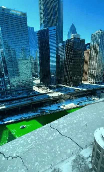
A Beautiful city in the USA, Chicago, is seen in the clip. An amazing time lapse of the Chicago
river is shown in the clip.
From Winters to summers, from snow to sun, from windy to breezy. A 5 seconds video said everything. Video is shot by Soroush.
Time-lapse photography reveals the dramatic seasonal transformation of urban waterways, where the Chicago River transitions from frozen surface to flowing current over just 90 days of spring thaw. This phenomenon reflects broader climate patterns documented by the National Oceanic and Atmospheric Administration (NOAA), which tracks seasonal timing shifts across the Great Lakes region.
According to the Metropolitan Water Reclamation District of Greater Chicago, the annual ice cover cycle affects local ecosystems, transportation, and recreational activities along the 286-mile waterway system. Environmental scientists note that earlier spring melts due to warming temperatures have altered the traditional freeze-thaw rhythm that shaped the city climate for over 150 years of recorded observations.
Urban planners reference these seasonal changes when designing flood management infrastructure and public space usage policies. The Chicago Department of Transportation adjusts its seasonal road closures and pedestrian pathway access based on historical freeze patterns tracked by the National Weather Service.
Climate scientists track these seasonal patterns using satellite imagery and sensor networks maintained by the National Weather Service. The freezing cycle typically begins in December when lake levels drop by up to 30 centimeters, creating ice formations that persist until March when rising temperatures initiate the annual thaw and renewal cycle that continues through summer months.
The Chicago River undergoes one of the most dramatic seasonal transformations in North America, shifting from completely frozen in winter to fully flowing by late March. According to the National Oceanic and Atmospheric Administration (NOAA), the river typically begins ice formation in December when water temperatures drop below 4 degrees Celsius, creating extensive ice cover that persists until March when warming temperatures initiate the spring thaw.
The Metropolitan Water Reclamation District of Greater Chicago manages the 286-mile waterway system using a network of locks and dams that regulate flow rates during seasonal transitions. Environmental scientists from the University of Chicago note that earlier spring melts due to climate change have altered the traditional freeze-thaw cycle that shaped local ecosystems for over 150 years of recorded observations, affecting urban wildlife migration patterns and recreational activities along the riverbank corridors.
Urban planners reference these seasonal patterns when designing flood management infrastructure and public space usage policies. The Chicago Department of Transportation adjusts its seasonal road closures and pedestrian pathway access based on historical weather data tracked by the National Weather Service, ensuring public safety during extreme temperature fluctuations that can reach 100 degrees Fahrenheit between January and August.
See: Watch.
See: Watch.