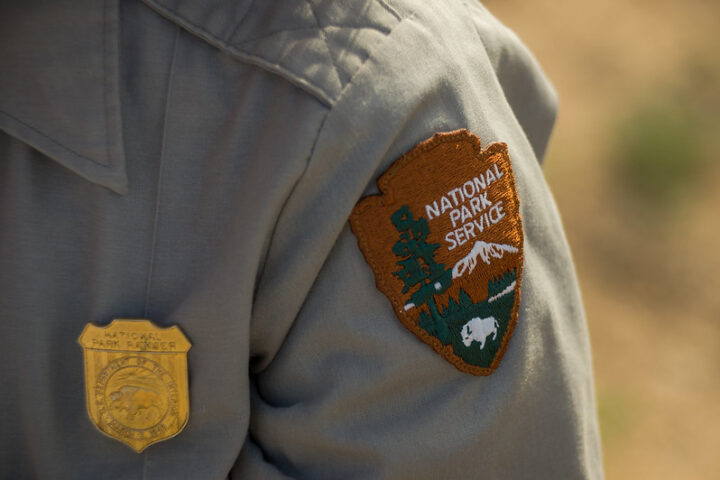
The US map that we are all familiar with is incorrect, at least inasmuch as it omits territories and other islands that have been recognised by the US Geological Survey. These intriguing isles, which are not in North America but have tropical rainforests, volcanoes, white sandy beaches, technicolour coral reefs, and some of the country’s oldest fortifications, are worth learning about.
US Virgin Islands
US citizens travelling to any of these three Virgin Islands islands do not need a passport. They are St Croix, St John, and St Thomas, and they are a part of the larger Leeward Islands. In the northeastern Caribbean Sea, the region is situated around 40 miles (64 km) east of Puerto Rico.
The picturesque islands, which are frequently referred to as “America’s Paradise,” provide guests with everything you’d anticipate from a normal Caribbean getaway: fantastic beaches, amazing snorkelling, and untouched natural beauty. The islands were devastated by Hurricanes Maria and Irma in 2017, killing people and destroying property, but since then, the region has made significant progress toward recovery. Hotels have reopened, and the wreckage has even been used to build a new artificial reef and dive destination.
The picturesque islands, which are frequently referred to as “America’s Paradise,” provide guests with everything you’d anticipate from a normal Caribbean getaway: fantastic beaches, amazing snorkelling, and untouched natural beauty. The islands were devastated by Hurricanes Maria and Irma in 2017, killing people and destroying property, but since then, the region has made significant progress toward recovery. Hotels have reopened, and the wreckage has even been used to build a new artificial reef and dive destination.
The island of St. Croix, considered the easternmost point of the US, is known for its tranquil atmosphere. One of the main draws can be found not on the island itself, but in its surrounding waters: protected coral reefs provide a kaleidoscope of color and there’s plenty for snorkelers and scuba divers to explore.
Northern Mariana Islands
22 islands and islets make up the Northern Mariana archipelago, which is situated in the western North Pacific Ocean. The Northern Marianas were fought over by the US and the Japanese during World War II, and the US took control of them in 1947.
With a surface area of 44.6 square miles (115.4 square kilometres), Saipan is the largest of the islands and is home to beaches with palm trees, rugged terrain, and fascinating historical monuments. Due to its remote location, however, few few Americans travel; instead, most visitors are from Asia, mainly Japan.
The little island of Tinian, which is three miles (5 km) wide and twelve miles (19 km) long, is another member of the Northern Mariana Islands. Despite appearing to be thousands of miles from the US mainland, it is actually connected to New York in a unique way. It served as a US aviation base during World War II, and streets including 42nd Street, Broadway, and Lenox Avenue were given Manhattan names. The picturesque Tachogna Beach is shown.
American Samoa
American Samoa is a charming combination of unspoiled volcanic scenery, lush rainforests, and shimmering turquoise oceans. It is situated roughly midway between Hawaii and New Zealand. The five-island archipelago became a US territory in 1900 after a US naval facility was built in Pago Pago Harbor in the late 1800s.
Despite signs of American influence, Samoan culture has been effectively preserved on the islands, and 90% of the native population speaks Samoan. Many traditions still exist today, such as cooking in conventional earth ovens called umu and performing siva, a Samoan dance, as well as donning Polynesian clothing like the lavalava (sarong) and puletasi (patterned skirt and tunic).
Five inhabited islands—Tutuila, Ta’, Olosega, Ofu, and Aunu’u—as well as two coral atolls make up the region. The main tourist attractions in this Polynesian paradise are whale viewing and snorkelling above vibrant coral reefs. The National Park of American Samoa, the only US National Park south of the equator, contains portions of three islands.
Palmyra Atoll and the Pacific Remote Islands Marine National Monument
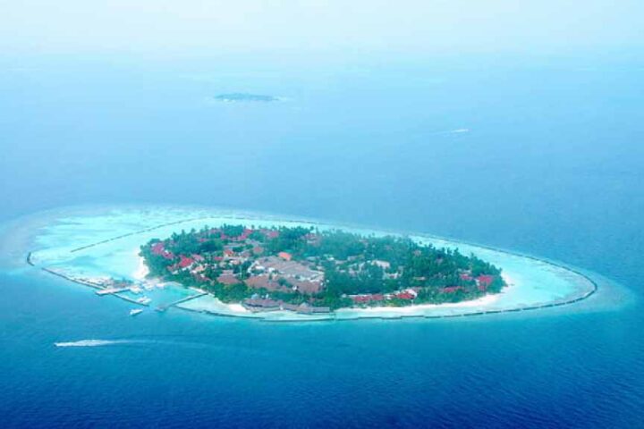
The Pacific Ocean’s Palmyra Atoll is a ring-shaped cluster of about 50 deserted islets with a total area of only four square miles (10sq km). Only those who have received authorization from the US Fish and Wildlife Service may travel to the archipelago (USFWS). The Pacific Remote Islands Marine National Monument, one of the largest marine conservation zones in the world, includes the nearby islands of Baker Island, Howland Island, Jarvis Island, Johnston Atoll, Midway Atoll, Wake Atoll, and Kingman Reef.
Several strange events have caused some people to think that Palmyra Atoll is cursed. A number of ships capsized nearby in the 1800s, including the Angel in 1870. Although its crew was believed to have made it to shore, a passing ship discovered their slain bodies on the island a few months later. The story of Malcolm and Eleanor Graham, an American couple who set out on a global journey with the purpose of visiting Palmyra Atoll but didn’t make it out alive, is even more horrific.
A few months after leaving the US in their boat Sea Wind in 1974, the couple was reported missing. No traces of them or their belongings were uncovered by investigators when they visited Palmyra Atoll. Six years later, a couple travelling to Palmyra Atoll unearthed a metal jar containing a woman’s watch, some bones, and a skull. They belonged to Eleanor Graham, who had been brutally killed on the island, it was discovered during investigations. Malcolm’s body was never discovered, but Duane Walker, who had previously been accused of stealing the Grahams’ boat Sea Wind, was convicted of the murder.
Baker island
Baker Island is so little that it can be missed in a blink of an eye. Atoll with a reef surrounding it, which is uninhabited and midway between Australia and Hawaii, is extraordinarily abundant in animals. More than a dozen different species of seabirds and shorebirds frequent this US National Wildlife Refuge, which also offers a refuge for sea turtles who are in risk of extinction. 2009 saw its inclusion as a component of the Pacific Remote Islands Marine National Monument.
Howland Island
Only a small number of individuals travel to Baker and the adjoining Howland Island, and those who do must first obtain permission from the US Fish and Wildlife Service (USFWS). What justifies America’s possession of these two islands? Seabird excrement. You did read that correctly. The Guano Act was formed in 1857 after American farmers learned that guano, or seabird droppings, was a potent fertiliser in the 1840s. The statute, which is still in effect today, grants the US the authority to “mine” unclaimed islands for resources.
Jervis Island
Due to the Guano Act, the US also took possession of Jarvis Island in 1856. It is estimated that 8,000 tonnes of guano were harvested during the next 20 years of guano mining here, but the mines and the island itself were abandoned in 1878. On Jarvis Island, the infrastructure of a long-gone town still stands as a sombre reminder of this forgotten era.
Kingman Reef
The remaining landmasses that are part of the Pacific Remote Islands Marine National Monument are Midway Atoll, Wake Atoll, and Kingman Reef. Some of the deep sea corals on Kingman Reef are among the oldest ever discovered; some gold coral colonies are thought to be 5,000 years old. A large variety of marine life, including blacktip sharks, more than 225 species of fish, and numerous rare and endangered species of giant clams, are supported by the reef.
Navassa Island
Navassa Island, which is three square miles (7.8 square kilometres) in size and situated between Haiti and Jamaica, is regarded to be a shelter for endangered coral. According to researchers on the Global Reef Expedition, the remarkably lush environment had escaped the harm that other coral reefs in the area had sustained from overfishing, climate change, and pollution. The Guano Act allowed the US to claim Navassa Island in 1857.
Guam
Guam may be far away, but it has everything you need for a perfect beach vacation: clear waters, pristine coral reefs, and white sand beaches. It is the largest island in Micronesia, covering a total area of 217 square miles, and is situated in the North Pacific Ocean approximately 5,800 miles (9,300 km) west of San Francisco (561sq km).
The population of the island, which numbers about 167,000 people, is made up of native Chamorro people as well as people of Filipino, Spanish, Mexican, and European ancestry. The wide diversity of traditions that collide here reflect its numerous cultural influences. Every four years, the Festival of Pacific Arts unites the 27 Pacific Island countries and territories and offers Guam the chance to celebrate its Chamorro history via music, food, dance, and art.
There are desolate beaches, quaint tiny villages, cascading waterfalls, and the impressive Mount Lamlam outside of developed Tumon Bay, where the majority of Guam’s large hotels are located. Lamlam, the highest point on the island at 1,332 feet (406 metres), provides breathtaking views of the surrounding area.