 Sonali Tiwary
A 20°F temperature plunge from Chicago to Atlanta anchors this Eastern US winter storm cold snap forecast. Nearly 200 million people east of the Mississippi will feel the coldest air in six months. Accumulating snow stays locked above 3,500 feet and in Great Lakes snowbelts. Along the I-95 corridor, expect cold rain instead.
The storm moves in two stages between Wednesday, Nov. 11, and Saturday, Nov. 14. An Ohio Valley low drives the first push Wednesday into Thursday. A coastal low off the Eastern Seaboard takes over from Thursday night through Saturday.
Daytime highs drop about 20°F from Wednesday to Friday, leaving Midwest highs in the 40s. Sub-freezing lows on Friday and Saturday bring the first freeze to Atlanta and Birmingham. Lows in the 30s and 40s stretch from the Florida Panhandle to Orlando.
Snow is most likely in the Adirondacks, the Green and White Mountains, the West Virginia and western Maryland Appalachians, and the Great Lakes snowbelts.
If you live in the Huron Mountains, northwest Indiana, or anywhere above 3,500 feet, prepare for snow now. Check tires, wipers and emergency kits. In the Ohio Valley, Atlanta and Birmingham, wrap exposed pipes and cover tender crops before Friday night. Travelers through JFK, LaGuardia, Newark or Boston should know airlines usually wait 48 to 72 hours before issuing formal waivers.
Why Warmer Great Lakes Are Supercharging November Snow Squalls
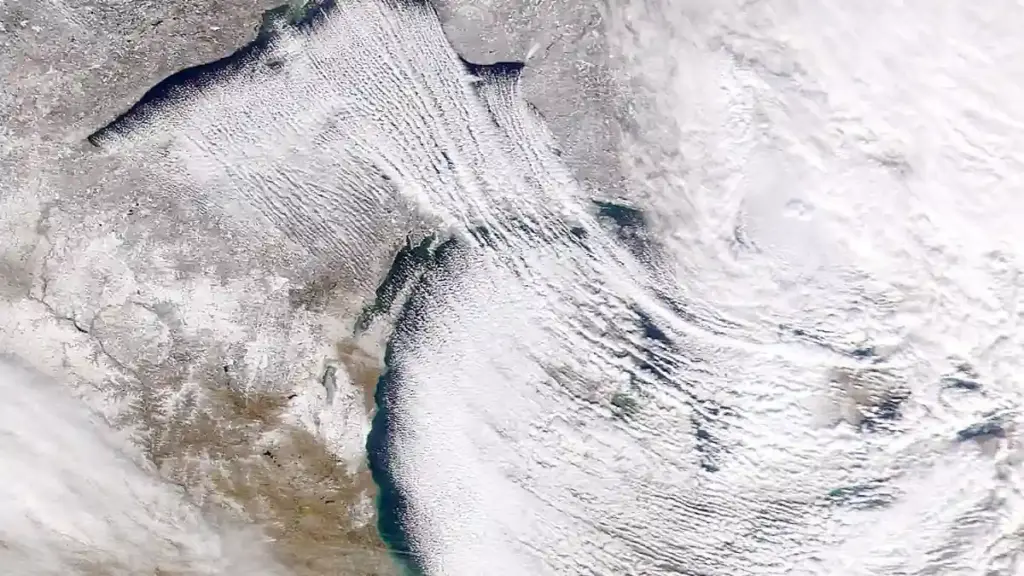
Lake-effect snow needs a big temperature gap between water and air. Right now the lakes are still holding autumn warmth. Cold air crossing them picks up moisture and heat, then dumps it as snow on the downwind shore.
The long-term trend adds fuel. NOAA Research finds Great Lakes water winters are shrinking by 14 days per decade since 1995. Climate Central reports basin-wide maximum ice cover fell 25% from 1973 to 2023, with 15 to 49 fewer frozen days. Less ice means more open water feeding snow bands.
The National Weather Service uses sudden visibility drops in lake-effect bands as Winter Weather Advisory criteria. Conditions can change within a mile. Drivers should expect whiteouts with little warning.
Cold also hits machines, not just roads. See how NMC batteries and thermal management protect electric vehicle range in arctic cold. For a reminder of how snow can shut down a major destination, read about Yosemite’s three-week closure after severe storms and snow. More on the warming backdrop is in our carbon and climate coverage.
NOAA’s Weather Prediction Center forecasters Kong, Hamrick and Fracasso are tracking the setup. Forecaster Fracasso’s mesoscale data shows Lake Superior at +8°C to +12°C and Lake Michigan at +10°C to +15°C. Air at 850 millibars sits at -5°C to -10°C above them. That is a 15°C to 20°C difference. The data shows a greater than 50% probability of at least 4 inches of snow in Michigan’s Huron Mountains. The same odds apply above 3,500 feet in the Adirondacks and the Green and White Mountains.
Will It Snow in NYC, Philadelphia, or Boston This Week?
Mostly no. Washington, Philadelphia, New York and Boston should see cold rain, not accumulating snow. Warm ground and above-freezing surface temperatures keep flakes from sticking. The coastal low’s track is the wild card. If it hugs the coast, inland areas get heavier snow and stronger gusts. Minor high-tide flooding is possible from the North Carolina Outer Banks to New England. If it tracks farther offshore, impacts ease.
Relief is coming. NOAA’s Climate Prediction Center expects temperatures to rebound early next week. A Super El Niño keeps the US on pace for a top-10 warmest November. This 20°F whiplash caught road crews, air travelers and southern growers while autumn foliage was still on the trees.