 Karmactive Staff
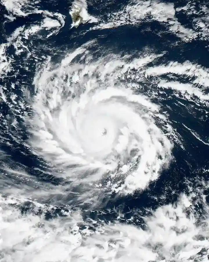
If you live on the US Atlantic or Gulf Coast and you have been watching a storm-free summer with growing confidence, the atmospheric science tells a more cautious story.
The 2026 Atlantic hurricane season passed its statistical peak — the climatological high point centered on September 10 to 11 — without a single hurricane forming. As of September 15, 2026, the National Hurricane Center recorded five named storms, zero hurricanes, and zero major hurricanes for the season. The Accumulated Cyclone Energy (ACE) index — a measure of total storm activity — stood at just 4.4, approximately 94% below the 1991–2020 normal. That is an unusually inactive showing for this point in the season. In a typical year, the basin would expect multiple hurricanes and significantly higher ACE totals by mid-September.
Coastal residents should not interpret the current quiet as a signal that hurricane risk has ended for the year. The Atlantic hurricane season runs through November 30. Late-season storms forming in October in the Caribbean and the Gulf of Mexico historically have less warning time before landfall because they develop closer to the coast. Extreme ocean surface temperatures remain stored in the tropical Atlantic, the Caribbean, and the Gulf. If the atmospheric conditions that have suppressed storm formation shift in the coming weeks, rapidly intensifying storms remain possible with less lead time for evacuation.
Why No Storms Have Formed
The absence of hurricanes is not because the Atlantic ocean has been cold. Ocean surface temperatures in the tropical Atlantic basin have been running at record or near-record levels — conditions that would, under typical circumstances, support rapid storm intensification.
What has prevented storm formation is a set of atmospheric factors sitting above that warm water:
Saharan dust outbreaks: The Saharan Air Layer is a mass of dry, dusty air that periodically moves off the West African coast and spreads across the tropical Atlantic. Dust absorbs solar radiation, dries out the mid-level atmosphere, and suppresses the thunderstorm activity that tropical systems need to organize.
Dry mid-level air: Even when Saharan dust is not the direct cause, widespread dry air at mid-levels of the atmosphere acts as a cap on convection — the upward movement of warm, moist air that powers tropical storm development.
Vertical wind shear: Wind shear refers to a change in wind speed or direction with altitude. High wind shear tears apart the organized thunderstorm structure of a developing tropical system. The 2026 season has seen persistent anomalous shear across the main development region.
The combination of all three — dust, dry air, and shear — has suppressed storm organization despite having the thermal energy in the water to support it. Thermal energy in the ocean and atmospheric conditions that allow storms to form are two separate requirements. The ocean provides the fuel; the atmosphere determines whether that fuel can ignite.
What the Numbers Mean
The Accumulated Cyclone Energy (ACE) index measures the total activity of a hurricane season by combining storm intensity and duration. A season with zero named storms has essentially zero ACE. By comparison, a typical Atlantic season produces around 15 named storms and the equivalent of roughly 100 units of ACE.
The 2026 season’s ACE of 4.4 is at an exceptionally low level for mid-September, running 94% below the 1991–2020 baseline. But ACE can still accumulate — a single major hurricane in October would shift the seasonal totals considerably.
Why October Matters More Than Most People Expect
The September 10–11 statistical peak is a climatological average across many decades. Individual storms do not follow the calendar. Some of the most destructive Atlantic hurricanes have formed after September 15, including systems that struck the US Gulf Coast and Caribbean in October and November.
October hurricanes that form in the western Caribbean or Gulf of Mexico pose a specific timing risk: by that point in the season, the steering winds have shifted, and storms may move more slowly, stall, or recurve toward the Southeast US in ways that reduce the warning time available to coastal populations.
Coastal homeowners and business operators in Florida, the Gulf Coast states, and the Eastern Seaboard should maintain their hurricane preparedness through the end of October at minimum.
—
FAQ
Why has the 2026 Atlantic hurricane season been so quiet? As of mid-September 2026, the Atlantic hurricane season had produced five named storms but zero hurricanes, with an ACE index of 4.4 — 94% below the 1991–2020 normal. The suppression is due to persistent Saharan dust outbreaks, widespread dry air at mid-levels of the atmosphere, and strong vertical wind shear across the main development region. These factors have prevented storm organization despite elevated ocean surface temperatures.
Can a hurricane still form in September and October? Yes. The Atlantic hurricane season runs through November 30. The statistical peak is September 10–11, but significant and destructive storms have formed in October and November historically. Late-season storms that develop in the Caribbean or Gulf of Mexico can move toward coastal areas with less warning time because of their proximity to land.
Does a quiet early season mean the rest of the season will be calm? No. Seasons with suppressed early activity can still produce catastrophic late-season storms. The NOAA National Hurricane Center notes that a quiet mid-September does not guarantee a quiet finish. The oceanic heat stored in the tropical Atlantic and Gulf remains available to fuel storm development if atmospheric suppression factors weaken.