 Rahul Somvanshi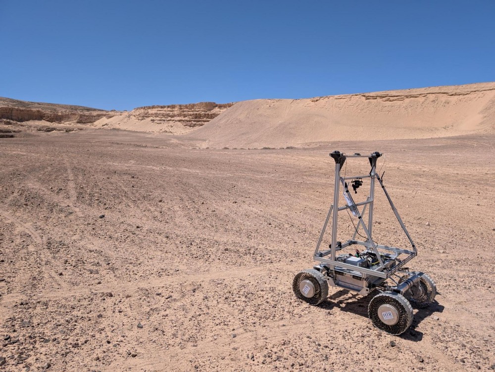
Getting lost on the Moon might soon be a problem of the past. Spanish technology company GMV has created LUPIN, a navigation system that brings Earth-style GPS convenience to lunar exploration.
Right now, moving around on the Moon is surprisingly difficult. Lunar rovers and astronauts must rely on delayed signals from Earth and complex mathematical calculations to know their location. These delays and communication lag times hinder immediate decision-making. Imagine trying to drive while waiting just to know where you are.
LUPIN (Enabling High-Performance PNT in the Lunar Environment) changes this completely. The system uses satellites orbiting the Moon to provide instant location information, similar to how our phones pick up GPS signals on Earth. This means future Moon explorers will know their exact position in real-time, without the constant back-and-forth with Earth.
“We were able to successfully compile data over the course of 7 kilometers of travel, and at various speeds,” explains Steven Kay, LUPIN’s project director. The testing pushed boundaries, moving from traditional slow speeds of 0.2 meters per second to faster rates of 1.0 meters per second, showing significant improvement in navigation capability.
These tests haven’t been done on the Moon yet. Instead, GMV chose Fuerteventura, Spain, where the volcanic landscape mirrors lunar conditions. The team didn’t just test during daylight. They conducted trials in total darkness, using only rover headlights – exactly like conditions in the Moon’s permanently shadowed craters where scientists believe water ice exists.
Similar Posts
Current lunar navigation faces serious challenges. When dust moves or meteors hit the Moon’s surface, maps become outdated. Communication blackouts occur when rovers can’t directly signal Earth. LUPIN tackles these problems by combining existing lunar maps with fresh satellite data, working even in challenging areas like the Moon’s far side, where Earth isn’t visible.
“We want these rovers to map the surface of the moon in a fast and safe way so that astronauts can return in a few years, work there and set up permanent bases,” says Mariella Graziano, GMV’s head of strategy. The system represents a significant step forward in lunar navigation technology.
The European Space Agency’s backing through its Navigation Innovation and Support Program shows the technology’s potential importance. As more countries and private companies plan Moon missions for research, mining, and even tourism, reliable navigation becomes crucial.
LUPIN’s development comes with practical benefits beyond just knowing where you are on the Moon. Faster, more confident navigation means rovers can explore more territory in less time. Reduced dependency on Earth communication allows missions to operate more independently. These improvements could make future lunar bases more practical and exploration more efficient.

The technology represents a significant shift in how we explore space. Just as GPS transformed life on Earth – from delivery services to emergency response – LUPIN could revolutionize lunar activities. Instead of carefully plotting every move, future astronauts and rovers could navigate the Moon’s surface with the same confidence we have driving in our own neighborhoods.
Testing continues, but GMV’s innovation might become as essential for Moon exploration as maps are for Earth travel. In the coming years, as lunar missions increase, having a reliable “Moon GPS” could mean the difference between successful exploration and costly delays.
The development marks an important contribution to lunar exploration technology. As part of ESA’s Navigation Innovation and Support Program, LUPIN demonstrates Europe’s commitment to advancing space exploration capabilities and supporting future lunar missions.