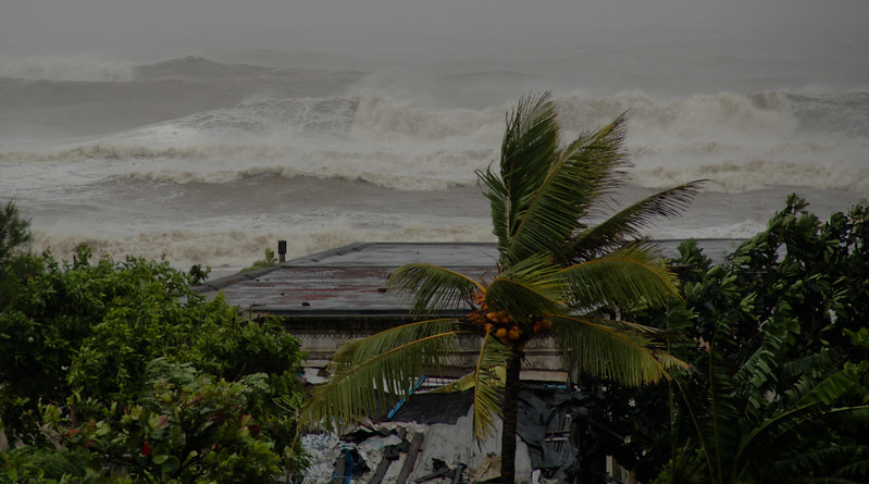
Representative Image: A powerful storm scene with rough ocean waves crashing in the background, indicating an intense cyclone or hurricane. EU Civil Protection and Humanitarian Aid (CC BY-ND 2.0)
Tropical Low 02U → Cyclone Fina | NT Cyclone Alert & PreparednessSkip to main content
⚠️ Critical Weather Alert📅 Tuesday, November 18, 2025 | 3:15 PM IST
Tropical Low 02U Forecast to Intensify Into Cyclone Fina by Thursday
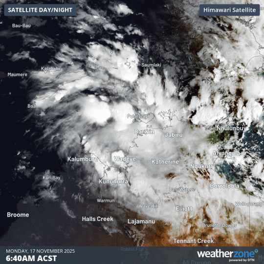
Wind patterns and dense cloud bands over the Timor Sea show Tropical Low 02U strengthening as it edges closer to the Northern Territory coast. A system developing this early often raises questions about how quickly conditions can shift for Top End communities. (Photo source: WEATHERZONE — licence not provided by the platform)
⚡
Live Update: Tropical Low 02U — High Risk of Cyclone Formation
Tropical Low 02U has a moderate (25%) chance through Wednesday and a high (55%) chance by Thursday morning of developing into tropical cyclone strength. The system is located approximately 255 km north-northwest of Darwin in the western Arafura Sea, with current sustained winds around 55 km/h gusting to 85 km/h. Sea surface temperatures remain very warm at 30–31°C, which is above the 26.5°C threshold required for cyclone formation, providing strong energy for rapid intensification.
If the low develops into a tropical cyclone, it will be named Tropical Cyclone Fina. Such an early-season landfall would be unusually early and among the earliest recorded Northern Territory crossings since routine records began in the 1980s.
📅 5-Day Development Timeline (Latest Forecast)
Tuesday, Nov 18
Current Status
Tropical Low 02U: 255 km NNW Darwin; winds 55 km/h gusts 85 km/h; moving ENE at 9 km/h
Expected to reach tropical cyclone strength (Category 1) by morning; current forecasts suggest potential Category 2 by evening (according to latest BoM forecast)
Friday–Weekend
Approach & Landfall Risk
System turns south–southwest, moving toward Northern Territory coast near Darwin, Tiwi Islands, or Kimberley by weekend
Current Position
255 km
North-Northwest of Darwin in the Arafura Sea
Current Winds
55 km/h
Sustained; Gusting to 85 km/h
Sea Temperature
30–31°C
Well above 26.5°C cyclone threshold
Movement
9 km/h
Slowly Moving East-Northeast (turning south by Thu)
📍 Current Position & Expected Movement
As of Tuesday, November 18, 2025 (3:15 PM IST), Tropical Low 02U is positioned approximately 255 kilometres north-northwest of Darwin within the central Timor and Arafura Seas. The system is moving slowly east-northeast at 9 km/h, which is temporarily taking it away from Australia’s northern coast. However, this eastward movement is forecast to cease by late Thursday, when the low is expected to turn south and then southwest—bringing it toward the Northern Territory’s northern coast, potentially impacting the Top End, Tiwi Islands, and Kimberley region over the weekend.
Warm Sea Surface Temperatures Supporting Intensification: Sea surface temperatures in the Arafura and Timor Seas remain unseasonably warm at 30–31°C, well above the 26.5°C threshold needed for tropical cyclone formation. This abundant warm water is the primary energy source driving the system’s expected intensification over the next 36–48 hours. The Bureau of Meteorology’s Tropical Climate Update confirms these unusually warm water conditions and their role in supporting rapid development.
📊 Cyclone Development Probability — 7-Day Outlook
Tuesday–Wednesday (Now through 48 hrs)
25%
Moderate chance of tropical cyclone formation; intensification expected to accelerate.
Thursday Onward (48–72 hrs ahead)
55%
High chance of tropical cyclone formation; most forecast models indicate cyclone status by Thursday morning.
⚠️ Expected Hazards & Impacts for Northern Territory
🌧️
Heavy Rainfall & Flooding
Heavy to very heavy rainfall expected, particularly in exposed coastal areas and the Tiwi Islands. Charles Point near Darwin received 228 mm in 24 hours (highest in a decade), indicating the system’s rainfall potential. Flash flooding likely in low-lying regions and near watercourses.
💨
Damaging Winds
If cyclone formation occurs, destructive winds expected. Even tropical lows produce sudden gusts of 85 km/h or stronger. Loose outdoor items at risk; minor structural damage possible from strong wind gusts.
🌊
Storm Surge & Rough Seas
Significantly increased wave heights will precede heavy rain and strong winds. Large storm surge possible once the system moves toward the coast. Coastal erosion risk in Darwin Harbour and exposed beaches; small craft should remain in port.
⚡
Severe Thunderstorms
Already occurring in the western Top End with showers and thunderstorms. Expect to increase around the outer edge of the low as it approaches the coast, with potential for lightning, hail, and waterspouts.
🚫
Transport Disruption
Air, sea, and road services may be suspended or significantly delayed. Power outages and communication disruptions likely in affected areas. Darwin Airport and maritime operations may close.
🏗️
Infrastructure Damage
Loose roofing, fencing, and outdoor structures at significant risk. Flying debris is a major hazard in strong wind conditions. Vegetation damage and tree fall possible; power lines vulnerable.
📈 Australian Tropical Cyclone Categories (BOM Official)
Tropical cyclones in Australia are classified by the Bureau of Meteorology using maximum wind gusts. Current forecasts suggest Cyclone Fina could reach Category 1–2 strength by Thursday evening.
Category 1
Gusts up to 125 km/h
Damaging winds. Negligible house damage. Damage to crops, trees, caravans. Craft may drag moorings.
Category 2
Gusts 125–164 km/h
Destructive winds. Minor house damage. Significant damage to signs, trees, caravans. Heavy crop damage. Risk of power failure.
Category 3
Gusts 165–224 km/h
Very destructive winds. Some roof and structural damage. Caravans destroyed. Significant crop/tree damage. Power failures likely.
Category 4
Gusts 225–279 km/h
Significant roofing loss and structural damage. Many caravans destroyed. Extensive vegetation damage. Dangerous airborne debris.
Category 5
Gusts over 279 km/h
Extremely dangerous. Widespread destruction. Buildings destroyed. Vegetation stripped. Catastrophic damage and risk to life.
If Tropical Low 02U does intensify into a tropical cyclone and make landfall, it would be unusually early and among the earliest recorded Northern Territory crossings since routine records began in the 1980s. BoM records show that Tropical Cyclone Alessia (November 28, 2013) was the last early-season November cyclone to impact the Top End. This means Tropical Low 02U, if it develops, could make a landfall nearly one month earlier than the historical norm.
The Warm Water Driver: The unusually warm sea surface temperatures (30–31°C) are the primary reason for this potential early intensification. These temperatures are well above the 26.5°C threshold required for tropical cyclone formation and are higher than typical for this time of year. This warm water mass, combined with favourable atmospheric conditions (low wind shear, poleward upper-level outflow, and strong convection), creates an optimal environment for rapid system development.
📹 Latest Forecast Video Update
Watch this latest forecast video from the Bureau of Meteorology for real-time analysis of Tropical Low 02U’s development, projected track, and potential impacts on the Northern Territory coast. Meteorologists explain the system’s current position, intensification factors, and expected timeline for cyclone formation.
Tropical Low 02U is currently moving slowly east-northeast at 9 km/h. The Bureau of Meteorology Tropical Cyclone Forecast Track Map shows the system’s projected path and the “uncertainty zone” (displayed as a shaded area) indicating potential track variations. Most forecast models agree that the system will turn south or southwest by late Thursday or early Friday, bringing it toward the Northern Territory’s northern coast over the weekend.
⏰ Timeline: When Will Official Warnings Be Issued?
The Bureau of Meteorology issues cyclone warnings in stages based on timing and forecast certainty:
Cyclone Watch
Issued when gale-force winds (≥63 km/h) are expected to reach coastal areas within the next 24–48 hours. Expected by Wednesday morning (November 19) if the system continues to strengthen on its current forecast track.
Cyclone Warning
Issued when gale-force winds are expected to reach land within 24 hours or are already occurring. Updated every 3 hours during the warning period. Expected by Thursday (November 20) or Friday morning if development progresses as forecasted.
📚 Historical Cyclone Context for Northern Territory
Darwin has a well-documented tropical cyclone history, making preparedness knowledge critical for residents. The most devastating was Tropical Cyclone Tracy (December 1974), which struck on Christmas Eve with minimal warning and killed 66 people, destroying or severely damaging approximately 90% of Darwin’s buildings. The rebuilding effort transformed Darwin’s building codes and became a benchmark for Australian cyclone preparedness standards.
More recently, Tropical Cyclone Marcus (2018) crossed Darwin as a Category 2 system, leaving nearly 29,000 properties without power and causing significant infrastructure damage across the Top End. The economic and social disruption from Marcus demonstrated that even moderate-category cyclones create widespread hardship for weeks or months as repairs and recovery proceed.
While Tropical Low 02U is currently forecast to reach Category 1–2 strength, the Bureau of Meteorology emphasises that hazards from even lower-category cyclones or persistent tropical lows can be severe. Heavy rainfall, storm surge, coastal erosion, and prolonged power disruptions occur regardless of wind category, and residents in all affected areas should treat the threat seriously and prepare accordingly.
📖 Related KARMACTIVE Coverage & Resources
Explore related articles and comprehensive cyclone coverage from KARMACTIVE:
Tropical Low 02U is not isolated to the Northern Territory. The system’s circulation is influencing weather patterns across broader Australia. Moisture patterns associated with the tropical low are influencing rainfall distribution across northern regions, while southern Australian states continue to experience different weather systems. The Bureau of Meteorology’s weekly Tropical Climate Update provides detailed regional forecasts showing how this system affects precipitation and temperature anomalies across all states and territories.
Residents in Queensland, Western Australia, and southern states should monitor BoM’s regional forecasts for relevant impacts, though the most significant effects will be concentrated in the Northern Territory’s Top End and Kimberley regions if the system develops and approaches the coast as currently forecast.
What This Report Covered
This report documented Tropical Low 02U’s current atmospheric position, system strength, and forecast development trajectory over the next 5 days. The moderate (25%) and high (55%) cyclone formation probabilities were presented alongside the expected timeline for cyclone watch and warning issuance. Hazards specific to each weather impact (rainfall, winds, storm surge, thunderstorms, transport disruption, infrastructure damage) were detailed with reference to Australian cyclone categories and official BoM classification standards.
The report outlined why this system’s potential early-season intensification and landfall would be historically significant (earliest NT crossing since 1980s records began), contextualised within warm sea surface temperatures and past cyclone impacts (Tracy 1974, Marcus 2018, Alessia 2013). Preparedness guidance aligned with NT Police, Fire & Emergency Services recommendations, with links to official BOM forecasts, track maps, and emergency service resources for residents and businesses in affected areas.
Cyclone categories, warning procedures, and a comprehensive preparedness checklist were provided to support decision-making by Northern Territory residents, emergency services, and critical infrastructure operators. Related KARMACTIVE coverage and external authority sources (BoM, PFES, NT Emergency Services, Darwin Port Authority) were integrated throughout to ensure factual accuracy and support public awareness.
Last Updated: Tuesday, November 18, 2025, 3:15 PM IST Recommend checking:Bureau of Meteorology & NT Emergency Services daily for the latest developments, as forecasts are updated at least twice daily as the system evolves.
Rahul, possessing a profound background in the creative industry, illuminates the unspoken, often confronting revelations and unpleasant subjects, navigating their complexities with a discerning eye. He perpetually questions, explores, and unveils the multifaceted impacts of change and transformation in our global landscape. As an experienced filmmaker and writer, he intricately delves into the realms of sustainability, design, flora and fauna, health, science and technology, mobility, and space, ceaselessly investigating the practical applications and transformative potentials of burgeoning developments.
Leave a Reply
Previous Story
Asbestos In Children’s Play Sand: ACCC Recall After TEM Finds Tremolite, “It Was Just By Chance”
Sydney Shark Incidents: Three Events in 26 Hours Temporary beach closure and shark sighting warning signs stand along Dee Why Beach after multiple shark incidents were reported across Sydney’s coastline within a
🚨 ACTIVE WARNINGS – Multiple bushfires across NSW and Tasmania – December 5, 2025 EMERGENCY UPDATES Australia Bushfire Emergency: Real-Time Tracking Active bushfires continue across eastern Australia as severe heatwave conditions drive
Fatal Shark Attack at Crowdy Bay NSW – Complete Report Kylies Beach in Crowdy Bay National Park, NSW Mid North Coast, where the fatal shark attack occurred. Photo: Representative image Breaking News
Asbestos in Children’s Sand Recall: Facts, Health Risks & Action Steps Health Alert November 2025 Asbestos Found in Children’s Play Sand: A National Recall Explained Schools across Australia and New Zealand closed
Bureau of Meteorology Website Cost: Hidden Expenses Revealed Bureau of Meteorology weather radar at Berrimah, Northern Territory — the critical infrastructure that powers Australia’s national weather forecasts. The radar network underpins the
Weather & Safety Thousands without power in Queensland as Victoria experiences ‘terrifying’ winds after year’s wettest day About 26,000 households were without power in South-East Queensland on Monday morning after severe thunderstorms,
Environment 📅 Oct 26, 2025 ⏱️ 3–4 min interactive Queensland’s Tropical Rainforests Now Release More Carbon Than They Absorb A long-term record from north‑eastern Australia reports a shift in above‑ground biomass balance:
Health & Safety New Zealand Teen Loses Part of Bowel After Swallowing Powerful Magnets A 13‑year‑old was admitted to Tauranga Hospital after four days of abdominal pain. An X‑ray showed four linear
EV Launch Tracker 2026 Mazda 6e Electric Sedan Confirmed for Australia Rear‑wheel‑drive electric sedan slated for Q2 2026 Australian launch with a sub-$55K target, a 78 kWh LFP battery, claimed 500 km WLTP range,
Weather Alert Stark storm warning for big city: Severe thunderstorms forecast for Brisbane; risks across Victoria, NSW and South Australia Heavy rainfall, large hail (≥5 cm) and damaging wind gusts are in
⚠️ Severe Weather Event NSW Thunderstorms: 400,000 Lightning Strikes Hit Sydney Region Massive storm system stretching over 800km brought large hail, damaging winds, and intense lightning to New South Wales on Friday,
RetailAustralia Costco confirms third WA warehouse at Alkimos Central Home X Trade Hub (opening 2027) WA government confirms the US membership retailer as anchor tenant in a $33 million precinct; another store is
Australian Bird of the Year 2025: Tawny Frogmouth Takes the Crown Final vote placed the tawny frogmouth ahead of Baudin’s black cockatoo and the gang-gang cockatoo after 313,000+ total votes. Final Round:
Wildlife Tawny Frogmouth wins Australia’s Bird of the Year 2025 Final votes, quick facts & how to join the Aussie Bird Count (20–26 October 2025). 📅 October 16, 2025 ⏱️ ~3 min