The NSW Mid-North Coast is experiencing unprecedented flooding. A slow-moving storm system between Newcastle and Grafton has dumped massive amounts of rain across the region, forcing thousands from their homes and breaking long-standing flood records.
In Taree, the Manning River rose higher than ever before, beating its previous record from 1929. The water level reached 6.37 meters on Wednesday morning. The town received 279 millimeters of rain in 24 hours to 9am Tuesday, which is nearly a third of its average annual rainfall.
The rainfall has been intense and widespread. Mount Seaview recorded 319mm in just 24 hours by 9 AM. Many areas across the Mid-North Coast have seen between 200mm to 400mm of rain in just two days. This heavy rainfall has turned into floodwater racing through communities.
“Soils are completely saturated, and any rainfall that falls will run off and go straight into the creeks and rivers,” warns Steve Bernasconi from the Bureau of Meteorology. This means even a small amount of extra rain could make things worse quickly.
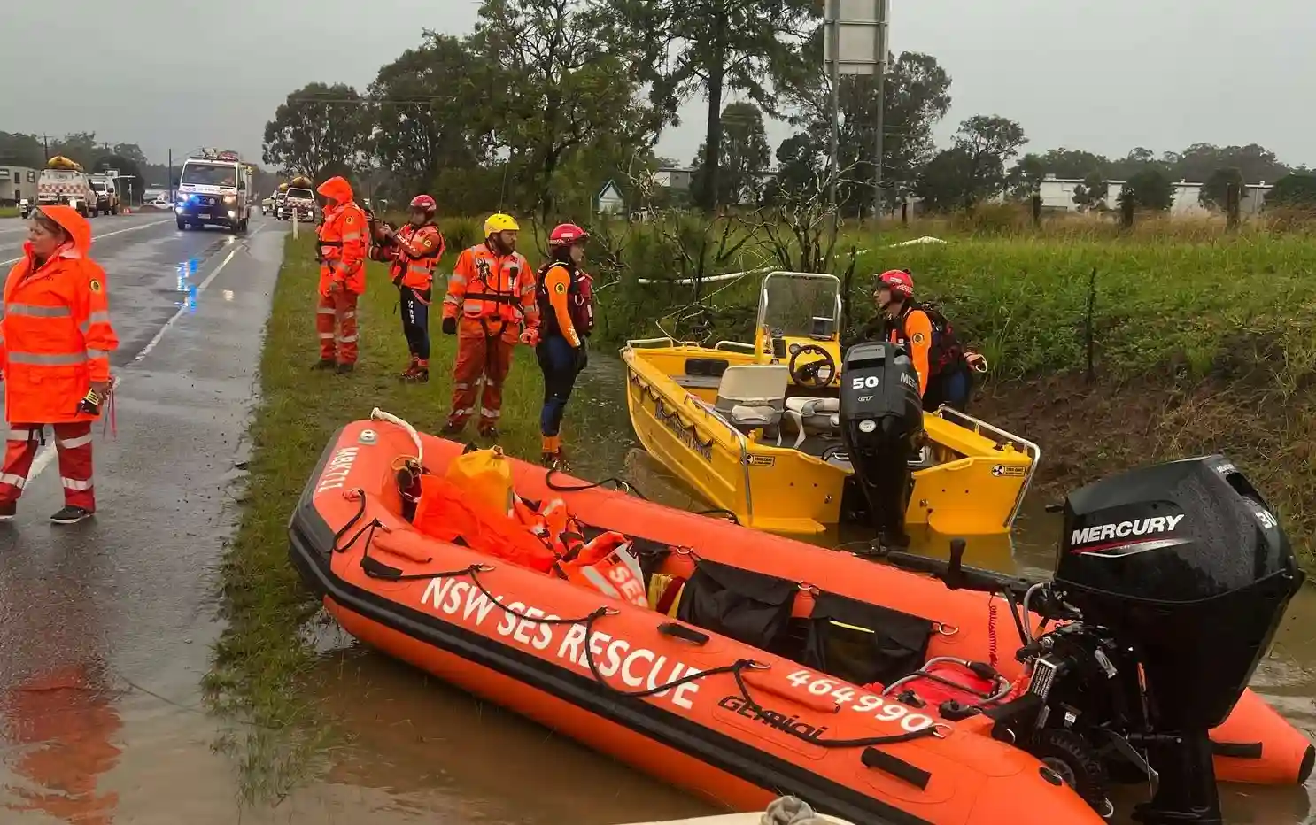
The numbers paint a stark picture: More than 48,800 people and 23,200 dwellings are cut off by floodwaters. Emergency services have conducted 284 rescues in the past 24 hours, mostly in Taree, Wingham, and Glenthorne. Nine helicopters are now working around the clock to help stranded residents.
Similar Posts
Local resident Jordan Halloran shared her family’s ordeal. “The main concern is our two-year-old son who is here with us and two dogs,” she said while waiting to be rescued from the top floor of her house. The family was later safely evacuated by police helicopter.
The impact spreads beyond immediate safety concerns. Over 3,700 homes have lost power across Taree, Wingham, Tinonee, Burrell Creek, and Hillville. The Pacific Highway, a major transport route, has also seen rescues – including 24 people saved at Ghini Ghini.
Major flooding is happening right now on multiple rivers – the Nambucca, Macleay, Hastings, Manning, Gloucester, and Paterson. Minor to moderate flooding stretches from inland of Sydney all the way up to the Grafton area.
More rain is coming. The Bureau of Meteorology forecasts another widespread 100mm to 200mm for flood-affected areas before the system finally moves away on Friday night. The storm will first hit inland areas on Thursday, then move south along the NSW coast while continuing to drench already flooded regions between Newcastle and Grafton.
The Insurance Council of Australia has declared this a “Significant Event,” which will speed up insurance claims for affected residents. But the broader economic impact is concerning – small businesses already dealing with challenges now face flood damage and cleanup costs.
For those in flood-prone areas, emergency services have a clear message: Listen to evacuation orders and don’t drive through floodwater.

These floods follow a pattern of increasingly severe weather events. A 2022 Climate Council report showed that by 2030, about 148,546 properties in NSW might become uninsurable due to flood risk. The state currently spends around $250 million yearly dealing with flood damage.
The NSW Government is responding with its Floodplain Management Program, matching every dollar spent by local communities with two dollars of state money. This helps build flood defenses and improve warning systems, though the current crisis shows there’s still much work to be done.
For now, the focus remains on immediate safety. Weather experts warn that intense falls could lead to dangerous and deadly flooding. Residents can stay informed through the Bureau of Meteorology’s website, app, and social media channels, along with Live Traffic NSW for road closures. Those wanting to help can donate or volunteer through official SES channels.