Sonali Tiwary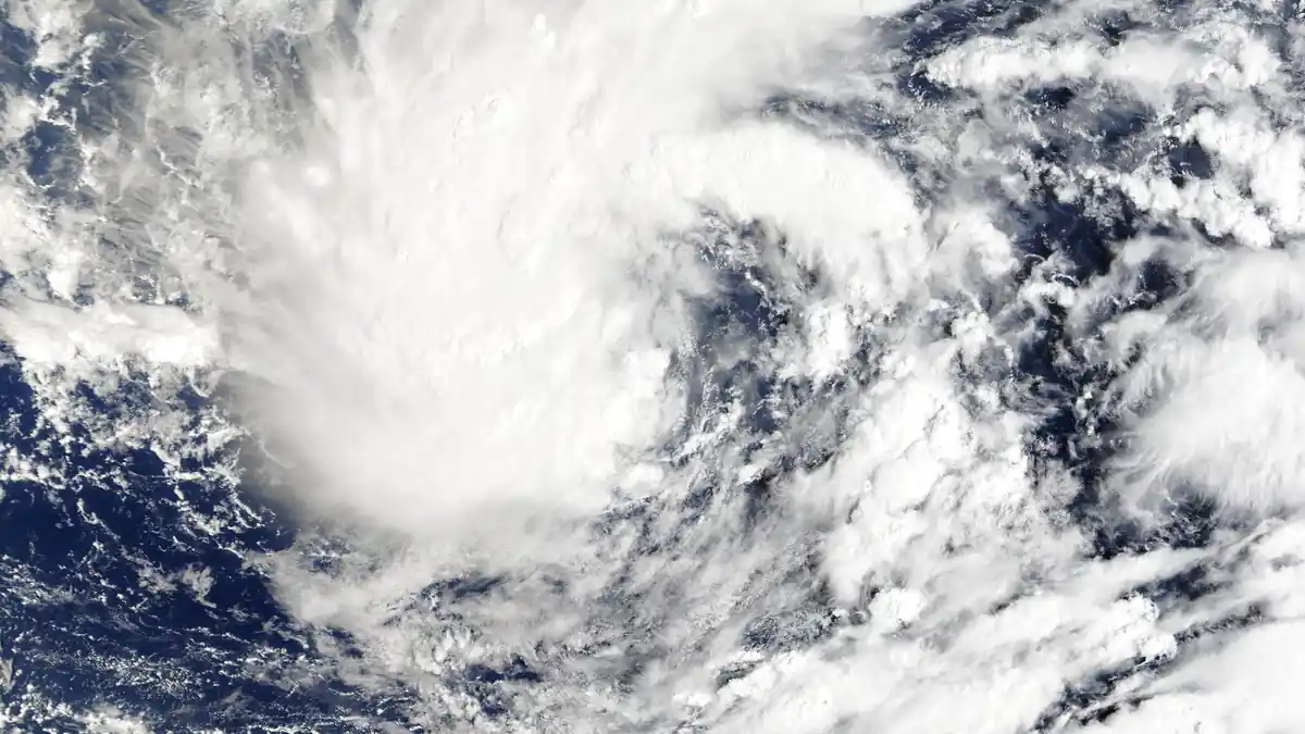
Hurricane Nolo is a Category 2 storm with maximum sustained winds of 105 mph, nearly stationary south of Hawaii Island. Official forecasts warn of catastrophic and life-threatening flash flooding across parts of the Big Island, with some areas potentially receiving up to 35 inches of rain. The storm is forecast to strengthen into a major hurricane tonight or early Sunday before beginning a westward turn away from the islands.
What the official forecast says
As of the latest National Hurricane Center advisory, Nolo is positioned approximately 145 miles south of South Point, Hawaii Island. Tropical storm conditions — winds between 39 and 73 mph — are already affecting the Big Island, and wind-prone areas of Maui County, Oahu, and Kauai are also experiencing gusts. The National Weather Service has active watches and warnings across Hawaii County and Maui County.
The NWS explicitly warns that serious impacts will extend well beyond the hurricane’s center track. This distinction matters for preparation decisions: the storm does not need to make landfall for life-threatening conditions to develop across the islands.
Why a stalled offshore storm is especially dangerous
One of the most important factors in Nolo’s current threat is its near-stationary movement. A slow-moving or stalled storm continuously trains heavy rainbands across the same terrain, multiplying rainfall totals dramatically compared with a faster-moving system that passes through.
Hawaii’s steep volcanic terrain amplifies this effect further. When tropical moisture interacts with the high ridges of the Big Island, orographic enhancement causes rainfall totals to spike on windward slopes — triggering flash floods and mudslides in areas far from the coast. The NWS warning of up to 35 inches of rain in parts of the Big Island reflects this combination of a stalled system and steep terrain. Karmactive’s previous Nolo Hawaii hurricane-watch update and earlier Tropical Storm Lala Hawaii coverage show why offshore systems can become inland flood threats.
The storm is also forecast to intensify further tonight, potentially reaching major hurricane strength before its westward track takes it away from the island chain.
What residents and visitors should do
Anyone in Hawaii County or Maui County should monitor National Weather Service Hawaii alerts. Flash flooding can develop suddenly, cut off roads, and trigger dangerous debris flows with little warning. Avoid shorelines, stream channels, and mountain trails. Secure loose outdoor items, confirm emergency water and food supplies, and have a battery-powered radio or charged phone available.
Visitors should check with airlines and hotels about flight disruptions — inter-island travel is affected. South-facing beaches and coastal areas carry elevated surf risk. Readers can also compare Nolo with Karmactive’s report on Hurricane Lala’s Big Island flooding impacts.
FAQ
Will Hurricane Nolo make landfall on Hawaii?
Current forecasts project Nolo to remain south of the Hawaiian Islands rather than making direct landfall. However, the storm is nearly stationary and catastrophic flash flooding, dangerous surf, and strong winds are actively threatening Hawaii County and Maui County regardless of the track.
How strong is Hurricane Nolo?
As of the most recent advisory, Nolo has maximum sustained winds of 105 mph, making it a Category 2 hurricane. It is forecast to strengthen to major hurricane intensity before turning west.
How much rain will Hurricane Nolo bring?
The National Weather Service warns of catastrophic and life-threatening flash flooding across parts of the Big Island, with some areas potentially receiving up to 35 inches of rain. Rainfall amounts are heavily influenced by terrain.
Track changes and updated warning areas will be reflected in this article as Nolo progresses.