A powerful storm system hit Southeast Queensland on Thursday, October 2, 2025, pelting the Wide Bay and Burnett region with massive hailstones, fierce lightning, and heavy rain.
The day started peacefully with clear skies and gentle sea breezes. Everything changed when an upper trough moved over southern Queensland that afternoon. Warm, moist air at ground level mixed with cold air high above—creating perfect storm conditions.
Near the town of Childers, between Bundaberg and Maryborough, something remarkable happened. Small clouds just 1,500 meters high suddenly shot upward, reaching almost 10,000 meters in only half an hour.
“As the hail started pounding down, I was frightened it might smash through my two year old daughter’s bedroom window while she was sleeping,” said Shane Epps from Oakhurst. “Holding them in my hand, you could feel just how solid and heavy they were.”
The storm crossing Childers then split into two separate storms. While one continued east normally, the southern storm turned southeast in what weather experts call a “right-moving supercell.” This type of spinning storm breaks away from the main wind flow and feeds entirely on warm, moist air, allowing it to grow much stronger.
The result was devastating—tennis ball-sized hailstones up to 8 centimeters across hammered the Maryborough area.
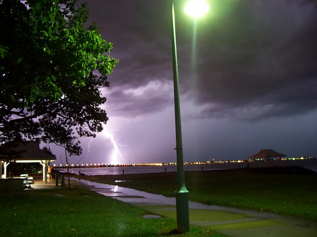
The lightning was just as extreme. Special tracking equipment recorded an incredible 204,734 lightning strikes within 200 kilometers of Hervey Bay during a nine-hour period. Of these, 25,050 were dangerous ground strikes that threatened people and property.
Similar Posts
For outdoor workers, the storm posed serious dangers with little warning time. Modern alert systems gave some businesses crucial advance notice—about 40 minutes before official severe weather warnings—allowing them to protect workers and equipment.
Insurance companies now face many claims for damaged cars, buildings, and property. Special weather tracking tools that map historical storm data to specific locations will help verify hail and wind damage claims.
This severe weather struck just seven months after Tropical Cyclone Alfred hit many of the same areas in March 2025. Alfred was the first tropical cyclone to hit near Brisbane since 1974, bringing destructive winds and heavy rain that caused widespread flooding.
Cyclone Alfred behaved unusually. After growing to a Category 4 system at sea, it weakened, changed form, and slowly approached the Queensland coast. Brisbane received about two months’ worth of rain in less than a day.

Climate scientists note that such intense storms, especially cyclones hitting areas outside the usual tropical zones, may become more common as the climate changes.
For now, Queensland residents can enjoy better weather. High pressure has moved in, bringing clear skies across the state. Forecasters expect fine, warm conditions for most of the weekend.
Residents should stay informed about future severe weather by monitoring official warnings and keeping emergency plans ready, particularly as the 2025-26 cyclone season approaches in November.