A strong cold front is charging toward southwest WA, bringing damaging wind gusts around 100 km/h, heavy rainfall and possible severe thunderstorms from early Tuesday morning, the Bureau of Meteorology warns in its warning issued at 11:21 am AWST Monday, 18 August 2025.
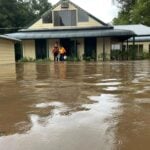
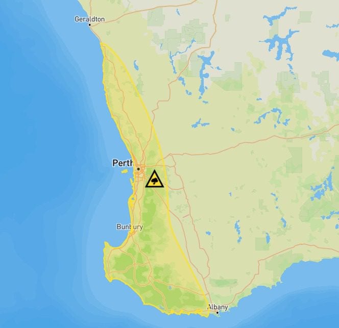
The severe weather warning covers a yellow-highlighted area on the BOM warning map from Jurien Bay southward through Lancelin, Perth, Bunbury and Busselton, extending to Margaret River and southwest of Albany. For Perth residents, the Tuesday morning commute could turn hazardous with heavy showers, local ponding on roads, and the risk of fallen branches and power lines.
“That means that if you live in this yellow highlighted area or know someone that does, tomorrow’s cold front in these areas could bring heavy rainfall that could lead to minor flooding and also damaging winds, enough to bring down trees and power lines,” the Bureau explained in their latest video update.
The timing of this weather event is critical. Shower and thunderstorm activity will reach the South West Capes around midnight tonight AWST, before gradually moving northeast toward Perth in the early hours of Tuesday. By lunchtime Tuesday AWST, the front will sweep through much of southwest WA including Perth, then continue pushing inland across the Wheatbelt Tuesday afternoon and evening.

A second follow-up front will arrive Wednesday, reinvigorating rain bands across southwestern WA with moderate to heavy falls and gusty winds.
According to the BOM, isolated six-hourly rainfall totals between 40 and 60 mm are likely in the South West and Lower West districts from early Tuesday morning. Higher totals are possible in slower-moving thunderstorms. Wednesday’s rainfall will spread more widely across western and southwestern WA, with heavier falls of 50 to 80mm possible just inland from Perth through the Perth Hills and areas south of Perth. Well inland, falls around 15 to 30mm are forecast for inland agricultural districts.
The severe thunderstorm risk is particularly concerning in the corridor between Jurien Bay and Bunbury, where the strongest cells could produce damaging winds and heavy rainfall. In severe cells, hail cannot be ruled out. This thunderstorm risk extends inland through much of the Wheatbelt.
Perth Metro (station 009225) has already recorded a wet start to August with 110.4mm falling in the first half of the month, according to BOM data. The long-term August average is 122.7mm, meaning this incoming system could push the monthly total well above average, continuing a pattern of generally above-average rainfall in recent months.
Following these fronts, a colder air mass will move across the region by Thursday, bringing daytime temperatures down below 20°C and overnight lows around 9°C as the showers begin to ease, according to the latest BOM forecast issued at 4:20 pm AWST on Monday 18 August 2025.
The Department of Fire and Emergency Services advises people to:
- Keep away from flooded drains, rivers, streams and waterways
- Store or weigh down loose items around your property
- Unplug electrical appliances and avoid using landline telephones during thunderstorms
- If driving through heavy rain, turn on headlights and drive to conditions
- Be alert for fallen trees and power lines
- For SES assistance call 132 500, and in life-threatening situations call 000
For the latest weather warnings, visit www.bom.gov.au/wa/warnings. Emergency information is available at www.emergency.wa.gov.au.