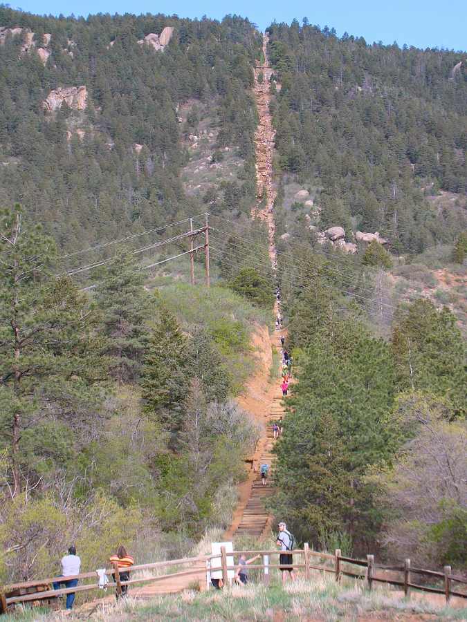
Climbing 2,768 railroad ties in less than a mile means every step fights gravity while testing the delicate balance between human recreation and mountain ecosystem protection. The Manitou Incline near Colorado Springs draws an estimated 250,000 annual visitors ranging across all age groups, making it one of Colorado’s most demanding outdoor challenges.
Table of Contents
- Introduction
- From Funicular to Fitness Challenge
- Engineering Solutions for Erosion Control
- Current Access and Reservation System
- Safety Considerations and Emergency Response
- Wildfire History and Forest Management
- Montane Ecosystem and Wildlife Habitat
- Ecosystem Protection Measures
- Community Impact and Cultural Significance
- Watershed and Water Quality
- Funding and Economic Considerations
- Climate Considerations
- Long-term Monitoring and Research
- FAQ
From Funicular to Fitness Challenge
The trail began in 1907 as a cable car system designed to haul materials for hydroelectric infrastructure on Pikes Peak. Originally constructed as a cable car track to transport materials for building pipelines on Pikes Peak – America’s Mountain, the Incline later became a scenic ride for visitors eager to take in the panoramic views of Colorado Springs and the eastern plains. The system operated until 1990, a rockslide damaged part of the track, leading to its closure.
What remained were 2,768 wooden railroad ties creating an impromptu staircase that climbs 2,000 feet in elevation over just 0.88 miles. Local adventurers began using the abandoned tracks unofficially until February 2013, when a unique public-private partnership finally made the Incline legally accessible to all.
Engineering Solutions for Erosion Control
The mountain’s granite soils pose constant challenges for trail stability. Between 2014 and 2017, comprehensive restoration projects addressed these concerns through advanced engineering techniques. The Incline was closed for four months in 2016 as it underwent Phase II renovation to improve loose railroad ties, erosion control and remove debris, following the approximately $1.5 million Phase I (2014-2015); Phase III proceeded in 2017 per the Management Plan.
Timberline Landscaping reports that it built dozens of retaining walls during Phase I. These measures will protect the trail from further erosion. The restoration work used helicopter transport to minimize ground disturbance while installing boulder retaining walls and stormwater diversion systems.
Timberline submitted Phase I for the National Association of Landscape Professionals’ Grand Award for Erosion Control and Ecological Restoration.
Quiz: What % of sediment reduction achieved?
After Phase I erosion control, roughly what % drop in sediment runoff was recorded?
Current Access and Reservation System
Since August 17, 2020, all hikers must secure free online reservations before attempting the trail. To help preserve the trail, support safety efforts, and enhance the experience for all visitors, a free online reservation and signed waiver are required before hiking the Manitou Incline. This system limits hikers to 45 people every half-hour, reducing previous overcrowding by an estimated 70%.
Reservations open on the 1st of each month for the following month. The 30-minute time slot you choose is simply your arrival window, giving you enough time to make final preparations for the difficult hike ahead. Parking costs $5 daily at the Dillon Mobility Hub, which includes ADA-accessible spaces.
Free shuttle service operates year-round with the FREE Route 33 Shuttle that runs between Hiawatha Gardens (Old Man’s Trail) and the Incline/Cog Depot. Route 36 circulates through downtown and connects to Route 33 at Old Man’s Trail.

Safety Considerations and Emergency Response
The trail’s extreme difficulty creates substantial safety concerns. After first responders were called to the Manitou Incline multiple times over the long weekend, the Manitou Springs Fire Department pleaded with hikers to prepare for the “strenuous” trek. El Paso County Search and Rescue responds to multiple rescues every year on the trail.
If you are planning to hike the Incline, keep in mind it could take up to 3-4 hours for first responders to reach you in the event of a medical emergency, depending on terrain and weather. The trail includes two bail-out connections: one at railroad tie 395 for a quick third-mile return, and another at tie 1300 (the halfway point) connecting to a 1.5-mile return route.
Trail hours vary seasonally. The trail is open from 6:00 a.m. – 3:00 p.m. during the winter season, which runs until April 30, 2025. During the summer season, the trail is open from 6 a.m. – 6:30 p.m.
Risk Readiness Calculator
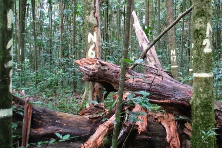
Wildfire History and Forest Management
The area has experienced several significant fire events that shaped current management approaches. What was initially reported as the “Barr Trail Fire” (3.5-5 acres) was later termed the “Incline Fire” (~1 acre) and was 100% contained as of Sunday afternoon, city officials said in October 2020. The fire started Thursday afternoon on private property about half a mile up Barr Trail. Authorities suspected arson in this incident, though no official ruling was confirmed.
The region’s fire management includes seasonal restrictions. Per Manitou Springs Ordinance No. 1022, Section 6.34.050 – Fire Danger Declarations, I am ordering that effective at noon on Friday, October 11th, 2024, the City of Manitou Springs is moving to Stage 1 Fire Restrictions.
Research at the nearby Manitou Experimental Forest provides ongoing data about post-fire vegetation recovery and soil stability that informs trail management decisions.
🔥 Fire Events on the Pikes Peak Corridor
2002: Hayman Fire
Largest wildfire in Colorado history, ~138,000 acres, prompted fuel‐reduction research.
Montane Ecosystem and Wildlife Habitat
The Incline corridor traverses multiple elevation zones within Colorado’s montane ecosystem, creating diverse habitat conditions that support numerous plant and animal species. Much of Manitou is covered by ponderosa pine and dry mixed conifer forests, with grasslands, moist mixed conifer forests, and lodgepole pine forests also prevalent in places.
-
Ponderosa Pine
Elevation: 5,000–9,000 ft
Fire Adaptation: Thick bark resists low-intensity fires. -
Engelmann Spruce
Elevation: 8,000–11,500 ft
Snow Shedding: Narrow crown prevents branch breakage. -
Common Juniper
Elevation: 6,000–10,000 ft
Drought Tolerance: Needle-like leaves reduce water loss. -
Colorado Columbine
Elevation: 6,000–10,000 ft
Bloom Time: Late spring to early summer pink flowers.
Flora and Vegetation Communities
The dominant tree species along the trail includes mature stands of ponderosa pine, limber pine, Douglas fir, Engelmann spruce and aspen. Understory vegetation consists of common juniper, kinnikinnick, white stem gooseberry, prickly currant, mountain mahogany, raspberry, pine dropseed mountain muhly, shrubby cinquefoil, Rocky mountain maple, red elderberry, baneberry, Colorado blue columbine, monkshood, bluebells, golden banner, yarrow and harebell.
Ponderosa pine woodlands are widespread throughout the western United States in warm, dry, exposed sites at certain elevations. In Colorado, ponderosa woodlands are primarily between about 6,000 and 9,000 feet, occurring at the lower treeline transition between grassland or shrubland and the more mesic coniferous forests above.
The area supports specialized plant communities including montane grasslands or meadows are common in the northern portion on dry clay soils; common grass species include Arizona fescue, needlegrass, blue grama, prairie Junegrass, squirreltail, milkvetch, locoweed, penstemon, pussytoes and stonecrop.
Rare plants inhabit subalpine and riparian areas of Pikes Peak region; specific occurrence of each listed species near Incline corridor is not publicly documented.
Wildlife and Fauna Diversity
The Incline’s location within the Pikes Peak region supports diverse wildlife populations across multiple elevation zones. Pikes Peak is full of wildlife—elk, deer, and yellow-bellied marmot sightings en route are common—and is home to a significant population of bighorn sheep.
Large mammals include species adapted to montane environments. The high species richness of the understory in this community makes it preferred by grazing animals such as elk (Cervus elaphus) and deer (Odocoileus hemionus). Mueller State Park sits at the base of Pikes Peak, where elk, black bear, eagles and hawks are able to roam amongst the 5,121 acres of natural land.
Specialized Wildlife Adaptations
The ponderosa pine forest, unlike the lodgepole pine and spruce/fir forests, supports numerous mammal species including Abert’s squirrel (Sciurus aberti), which only lives in ponderosa pine communities. Pygmy nuthatches (Sitta pygmaea) are also adapted to ponderosa pine woodlands.
Small mammals play important ecological roles, including the Colorado chipmunk (Tamias quadrivittatus). T. quadrivittatus helps spread the seeds of the ponderosa pine by spreading out and burying its caches.
Bird Communities
The area supports diverse avian species typical of montane habitats. Characteristic bird species include the pine siskin, mountain chickadee, pygmy nuthatch, and chipping sparrow. Higher elevation species include Williamson’s Sapsucker, Western and Mountain Bluebirds, Green-tailed Towhee, and Red Crossbill among the more likely species.
Specialized mountain birds occur at various elevations, with Clark’s Nutcracker, Gray Jay, Red-naped Sapsucker found in coniferous habitats, while Dusky Grouse can be found on the peak. White-tailed Ptarmigan and Rosy-Finches are found only at higher elevations near the summit of Pikes Peak proper, above 11,000 feet.
-
Abert’s Squirrel
Habitat: Ponderosa pine forests only
Diet: Pine seeds and bark. -
Pygmy Nuthatch
Range: 5,000–9,000 ft
Behavior: Communal roosting under bark in winter. -
Yellow-bellied Marmot
Habitat: Rocky talus slopes
Hibernation: Up to 8 months. -
Rocky Mountain Elk
Diet: Grasses & forbs
Behavior: Seasonal migrations.
Alpine Zone Wildlife
At the highest elevations, the ecosystem supports specialized alpine species. In the tundra of the Alpine Zone at 11,500 feet and above, tiny flowers, mosses and lichen eke out a cold existence in the short growing season in this unforgiving environment. This windy zone is home to the magnificent bighorn sheep, a significant population in Colorado.
The higher elevations are also an excellent place to find the cute little hampster-like animal called the pika, which is a relative of the rabbit.
Fire Ecology and Ecosystem Management
Fire is the most significant ecological process in maintaining this system; frequent, low-intensity ground fires are typical. Healthy ponderosa pine forests often consist of open and park-like stands of mature trees, with an understory of predominantly fire-tolerant grasses and forbs.
Ponderosa pine generally evolved with a natural cycle of frequent, low-intensity fire, which eliminated competing conifer seedlings but allowed mature pines to survive. The advent of aggressive fire suppression has resulted in increased encroachment of shade-tolerant Douglas-fir (Pseudotsuga menziesii) in the understory of ponderosa pine stands.
Species of Conservation Concern
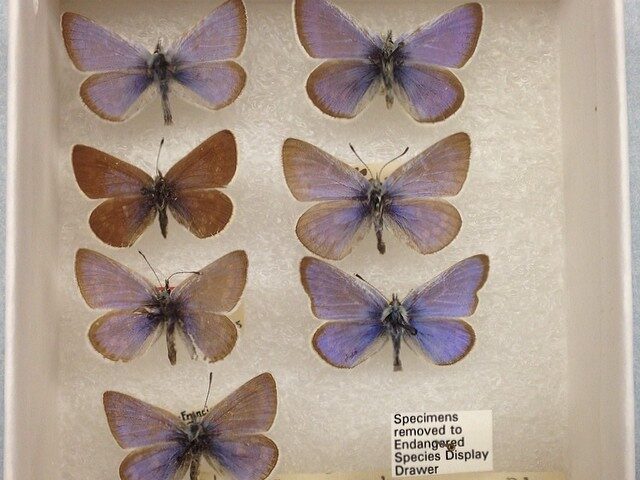
The most notable species of concern in Colorado’s ponderosa pine ecological system is the federally threatened Pawnee montane skipper butterfly (Hesperia leonardus montana). This species occurs only in ponderosa pine systems with an understory of blue grama grass (the skipper’s host plant).
Elevation Zones and Habitat Transitions
Thanks to the elevation change, on your trip up the mountain you’ll travel through Foothills (6,000-8,000 ft) and Montane (8,000-10,000 ft) life zones. These zones include the Eastern Plains Zone up to 6,000 feet, the Foothills Zone from 6,000 to 8,000 feet with scrub oak, juniper, sagebrush, and pinyon pine, and the Montane Zone from 8,000 to 10,000 feet featuring large forests of pines, Douglas fir, and colorful aspen trees.
Ecosystem Protection Measures
The trail exists within sensitive montane ponderosa pine habitat where soils derived from Pikes Peak granite remain highly susceptible to erosion when vegetation is disturbed. Native revegetation efforts focus on establishing bunchgrasses and forb species that naturally stabilize steep slopes.
Community volunteers through organizations like Incline Friends and Trail Ambassadors contribute to ongoing maintenance efforts, including quarterly invasive species removal and Leave No Trace education programs.
Community Impact and Cultural Significance
The Incline has become deeply embedded in regional fitness culture and community identity. The annual 9/11 firefighter climb typically leads to morning closure; exact 2025 schedule is yet to be determined.
Additional annual closures include the Pikes Peak Ascent and Marathon in mid-June, plus local festivals like the Emma Crawford Coffin Races in October. Record holders include Joseph Gray, who summited at 17:45 and Allie McLaughlin who finished at 20:07.
The memorandum of understanding between Colorado Springs and Manitou Springs established collaborative management protocols. Colorado Springs Parks, Recreation and Cultural Services manages daily operations while multiple agencies coordinate on environmental protection and emergency response.
Watershed and Water Quality
The trail’s location within the Fountain Creek watershed means erosion control directly impacts downstream water quality. Ongoing monitoring by the U.S. Geological Survey tracks sediment loads and flow patterns to assess the effectiveness of trail stabilization measures.
Restoration projects throughout the broader watershed focus on reducing sediment transport and protecting municipal water supplies for both Colorado Springs and downstream communities.
💧 Sediment‐Load Simulator
Funding and Economic Considerations
Trail maintenance relies primarily on parking fees and federal grants. The Colorado Springs parks department — identified as the “single entity to take on management responsibility” in a multijurisdictional agreement made in 2011 — has been paying attendants to station at the trail’s base every day, sunup to sundown, since August.
Revenue from the $5 daily parking fees and grants supports staffing, maintenance, and environmental monitoring programs. The city committed to sustained funding despite budget pressures, recognizing the trail’s importance to regional recreation and tourism.
Climate Considerations
Colorado has experienced significant temperature increases, with statewide averages rising 2.3°F from 1980 to 2022. These changes affect precipitation patterns, wildfire risk, and soil moisture levels that influence trail stability and vegetation recovery.
Future climate projections suggest continued warming and potential changes in storm intensity, requiring adaptive management approaches for erosion control infrastructure and emergency preparedness protocols.
Long-term Monitoring and Research
Scientific monitoring provides essential data for sustainable trail management. The U.S. Forest Service conducts regular soil moisture, precipitation, and temperature measurements that inform maintenance decisions and environmental protection strategies.
User count data helps managers balance recreational access with ecosystem protection. The reservation system generates detailed usage patterns that support capacity planning and resource allocation decisions.
The article covered the trail’s transformation from industrial infrastructure to recreational destination, engineering solutions for soil stabilization, current access protocols and safety measures, wildfire management history, ecosystem protection efforts, community engagement programs, watershed protection initiatives, funding mechanisms, climate adaptation needs, and scientific monitoring programs that support long-term sustainability.
FAQ
-
What is the Manitou Incline and where is it?
A steep hiking trail near Manitou Springs, Colorado. It climbs 2,768 steps—2,000 ft over 0.88 mi. -
How hard is the hike?
It’s rated “Extreme” for steep grade. Most hikers take 60–120 minutes to reach the top. -
Do I need a reservation and waiver?
Yes. Since August 17 2020, free reservations and a signed waiver are required. Slots are limited to 45 every 30 minutes. -
Is it free to hike? What about parking?
The trail is free to use. Parking at the Dillon Mobility Hub costs $5 per day. -
Can families with children hike it?
Not recommended for kids under about 10 years old. Check with a doctor if anyone has health issues. -
How should I prepare and what should I bring?
Carry at least 32 oz of water, wear sturdy shoes, and use sun protection. Check the weather and start early to avoid heat. -
What are the trail hours?
Winter (Nov 1–Apr 30): 6 a.m.–3 p.m. Summer (May 1–Oct 31): 6 a.m.–6 p.m. -
What safety issues should I know?
Risks include dehydration, heat exhaustion, and altitude sickness. Emergency help can take hours—follow all warning signs.