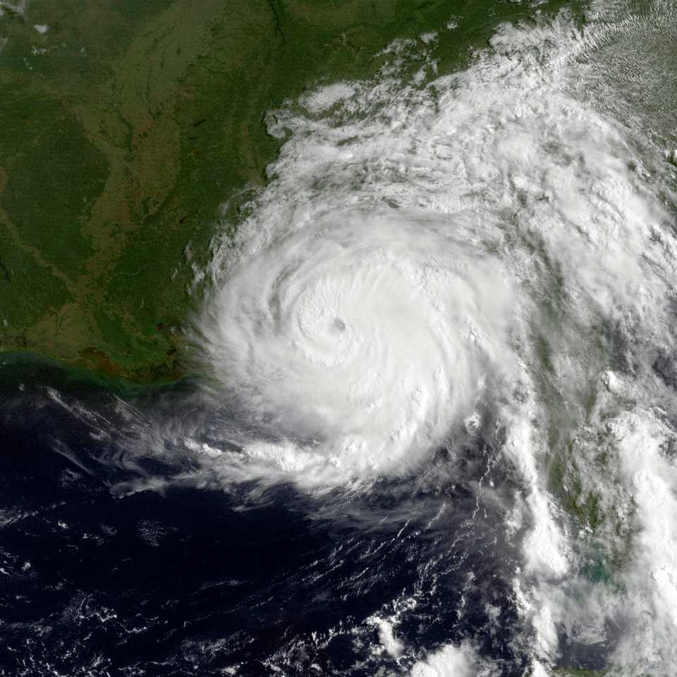
Hurricane Erin, which briefly reached a catastrophic Category 5 strength with 160 mph winds on Saturday, remains a dangerous major hurricane as it moves through the Atlantic. While the storm has weakened to a Category 3 with 125 mph winds, officials warn of significant coastal impacts along the U.S. East Coast, particularly for North Carolina’s Outer Banks.
Dare County has declared a state of emergency for all areas starting Sunday at 6 p.m., with a mandatory evacuation ordered for Hatteras Island. Visitors must leave starting Monday at 10 a.m., while residents are required to evacuate beginning Tuesday at 8 a.m.
“Portions of N.C. Highway 12 on Hatteras Island will likely be impassable for several days,” Dare County Emergency Management announced Sunday. Officials recommend evacuees heading north to travel westbound on Highway 64 to Interstate 95 to avoid traffic congestion.
A Coastal Flood Watch has been issued for Dare County, with flooding and ocean overwash expected to begin as early as Tuesday and continue through Thursday. The evacuation order covers all of Hatteras Island, including the villages of Rodanthe, Waves, Salvo, Avon, Buxton, Frisco, and Hatteras.
Hurricane Erin is currently located about 275 miles north-northwest of San Juan, Puerto Rico, and about 165 miles east of Grand Turk in the Turks and Caicos Islands. The storm is moving west-northwest at 13 mph but is expected to slow down before gradually turning north on Monday and Tuesday.
The storm has already caused significant disruption in the Caribbean. More than 150,000 power outages were reported across Puerto Rico as Hurricane Erin passed near the island. LUMA, Puerto Rico’s power company, stated: “The adverse weather has caused multiple interruptions across the island. Our teams continue to work to address each situation as quickly and safely as possible.”
Heavy rainfall of 3-6 inches, with isolated totals up to 8 inches, has fallen across parts of Puerto Rico and the Virgin Islands. At least 9 inches of rain was recorded in Tortola in the British Virgin Islands, while Caguas and Camuy in Puerto Rico and St. Thomas in the U.S. Virgin Islands received more than 2 inches.
The National Hurricane Center (NHC) notes that Hurricane Erin is growing in size, with hurricane-force winds extending about 25 miles from the storm’s center and tropical-storm-force winds reaching outward up to 205 miles.
Similar Posts
“The hurricane will also grow in size,” said FOX Weather Hurricane Specialist Bryan Norcross. “As the circulation diameter gets larger, the peak winds normally diminish because the energy in the system is spread out over a larger area.”
While Erin is not forecast to make landfall in the U.S., its effects will be widely felt. NHC Director Mike Brennan warned that the storm will generate “life-threatening surf swells and rip currents up almost the entire U.S. east coast,” with Florida and mid-Atlantic states experiencing the most dangerous conditions.
A Tropical Storm Warning is currently in effect for the Turks and Caicos Islands, with tropical storm conditions expected starting Sunday night. The southeastern Bahamas are also under a Tropical Storm Warning, with conditions deteriorating later Sunday night and Monday.
Ocean swells from Hurricane Erin will affect portions of the Virgin Islands, Puerto Rico, Hispaniola, and the Turks and Caicos Islands over the next few days. These swells will spread to the Bahamas, Bermuda, the entire U.S. East Coast, and Atlantic Canada during the early to middle part of this week.
The National Weather Service office in Newport/Morehead City has issued a High Surf Advisory and Coastal Flood Watch for parts of the Outer Banks, including west Carteret and coastal Onslow counties, with large breaking waves between 15 and 20 feet expected.

Hurricane Erin is the first hurricane of the 2025 Atlantic hurricane season, which runs from June 1 to November 30. This season is predicted to be unusually active, with forecasts calling for six to ten hurricanes, including three to five major hurricanes with winds exceeding 110 mph.
Meteorologists note that Erin is the 43rd Atlantic hurricane to reach Category 5 status on record, demonstrating the growing intensity of Atlantic hurricane seasons, which scientists link to warming ocean temperatures driven by climate change.