A tropical system brewing near the Bahamas could bring life-threatening flooding, coastal surge, and dangerous surf to the Southeast U.S. as early as Monday, leaving very little time for residents to prepare. The National Hurricane Center has designated the disturbance as Potential Tropical Cyclone Nine, a label used when a tropical storm hasn’t officially formed yet, but impacts are expected within three days.
This system, forecast to become Tropical Storm Imelda by early Sunday, is currently moving through the Bahamas and is expected to steadily strengthen as it approaches the U.S. mainland. Tropical storm warnings are already in effect across portions of the Bahamas.
The National Hurricane Center said the system could be near hurricane strength as it nears the Southeast U.S. The first effects could reach coastal areas as early as Monday, with the highest risk window centered on the Carolinas and coastal Georgia.
Meanwhile, Hurricane Humberto underwent remarkable rapid intensification Friday, jumping from tropical storm status to a Category 4 hurricane in less than 24 hours. With sustained winds of 145 mph, Humberto is expected to strengthen further, potentially becoming a rare Category 5 hurricane by late Saturday. Though not a direct threat to the U.S. mainland, Humberto could impact Bermuda by midweek and will generate dangerous swells along the East Coast.
South Carolina Governor Henry McMaster has already declared a state of emergency in anticipation of Imelda, activating statewide response plans and mobilizing agencies. Gov. Henry McMaster warned the storm could bring heavy rain, flooding, and strong winds across South Carolina, though its exact track and intensity remain uncertain.
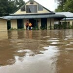
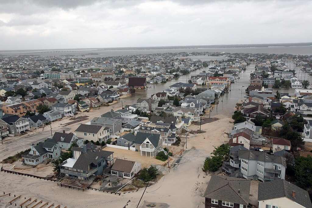
Flooding rain remains the top concern with future Imelda. Heavy, slow-moving rain bands could stall near the coast or drift into the southern Mid-Atlantic, quickly overwhelming already saturated ground, rivers and streams. Persistent onshore winds could drive storm surge into low-lying coastal areas, triggering flooding even without direct landfall.
Similar Posts
There is unusual uncertainty in this forecast because the system hasn’t fully formed yet. Weather models need a defined center of rotation to begin accurately forecasting a storm’s path. Adding to the complexity, Humberto’s position could influence how Imelda develops and where it tracks.
Three main scenarios remain possible:
Imelda could hook out to sea before reaching land, sparing the U.S. from its worst impacts.
The storm could stall just offshore, lingering close enough to bring days of heavy rain and push water onshore.
Most concerning would be a landfall somewhere along the Carolina or Georgia coast, potentially triggering widespread flooding in areas areas hard-hit by previous storms.
Even without direct landfall, the dual threat from both systems will create dangerous conditions. Large swells from Humberto combined with Imelda’s effects will generate life-threatening rip currents up and down the Eastern Seaboard next week.

Charleston officials are already preparing, deploying stormwater pumps, readying high-water vehicles, and developing sandbag distribution plans. Local officials in Charleston are preparing with stormwater pumps, high-water vehicles, and sandbag distribution plans.
Anyone from the Bahamas to the U.S. East Coast should closely monitor forecasts this weekend and prepare for potentially significant impacts as what will likely become Tropical Storm Imelda approaches.