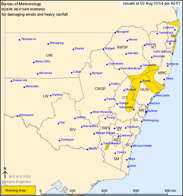
The skies above NSW are about to open up in a big way. A powerful low-pressure system developing offshore will drench coastal communities from Coffs Harbour to Newcastle this weekend, with conditions worsening significantly from late Friday.
Weather forecasters warn some areas could see up to 90mm in 24 hours, with isolated spots in elevated regions potentially copping 120mm. That’s a month’s worth of rain in a single day for many locations.
Rain will intensify Saturday afternoon when the coastal trough moves westward over land. Six-hour rainfall totals between 50-80mm are expected, with even heavier falls across higher ground. The downpour should ease by early Sunday, though a second low forming near the Queensland border could bring more wet weather to the state’s north.
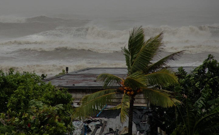
But it’s not just about getting wet. Forecasters expect damaging winds averaging 55-65 km/h with gusts reaching 90 km/h in elevated areas. These winds, combined with already saturated soil, could send trees crashing down and trigger flash flooding in vulnerable spots.
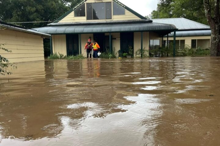
NSW’s river systems are primed to respond quickly. The Bureau has issued flood watches for more than a dozen catchments including the Orara, Bellinger, Kalang, Macleay, Hastings, Manning, Gloucester, Myall, Goulburn, Upper Hunter, Wollombi Brook, Lower Hunter, Paterson, Williams, Newcastle area, Gwydir, Peel and Namoi Rivers.
Many of these catchments are already wet or saturated from previous rainfall. With little capacity to absorb more water, any substantial rain will likely cause rapid runoff and river rises.
“Moderate to heavy rainfall is forecast in parts of the Mid North Coast and Hunter from Saturday into Sunday, extending to the North West Slopes,” the Bureau of Meteorology reports, adding that localized river level rises and flash flooding are likely in areas receiving the heaviest rain.
For Sydney’s water supply, Warragamba Dam sits at approximately 98% capacity and may spill in coming days. WaterNSW says the timing and rate of any spill depends on exactly when and where rain falls across the massive 9,000 square kilometer catchment. Smaller Sydney dams including Nepean, Cataract and Woronora are also expected to experience minor spills.
Similar Posts
The rain event follows May’s catastrophic flooding that hit the Mid North Coast and Hunter Valley regions, which claimed five lives and was described as a 1-in-500-year event. Taree, about 130 kilometers northeast of Newcastle, bore the brunt of those floods with record-breaking rainfall and the highest floodwaters in more than 90 years.
NSW Emergency Services Minister Jihad Dib has been actively monitoring the current situation. During the May floods, Dib signed a protection order for SES volunteers, ensuring their employment wouldn’t be affected while assisting in emergency response. “Although we can’t control the weather, we can prepare for it,” Dib noted at the time.
Transport disruptions have already begun, with Hunter Line train cancellations reported and the New England Highway experiencing closures around Armidale and Guyra due to snow and ice conditions. About 100 vehicles were stranded in the Northern Tablelands according to early reports.
The coastal hazards extend beyond rainfall, with large swells up to 5.5 meters creating dangerous surf conditions. A sandstone cliff collapse at Bronte Beach earlier this week narrowly missed beachgoers, underscoring the risks from waterlogged terrain.
Looking at the broader climate picture, the Bureau of Meteorology’s seasonal outlook suggests above-median rainfall is likely across most of NSW during the coming months. With a 45-80% chance of exceeding historical median rainfall for July through September depending on location, the wet pattern may continue.
The NSW State Emergency Service urges residents to prepare their properties by clearing gutters, securing loose items, and developing an emergency plan. Their long-standing safety message remains critical: never drive, walk or play in floodwater.
For those living in flood-prone areas, downloading the Hazards Near Me app provides real-time alerts about changing conditions. The SES recommends keeping emergency numbers handy: 132 500 for flood assistance and 000 for life-threatening situations.

Weather experts will continue monitoring the developing system over the weekend. Residents should stay tuned to official warnings from the Bureau of Meteorology and follow advice from emergency services.
While this weekend’s expected rainfall won’t match May’s record-breaking totals, already saturated catchments mean even moderate rain can cause significant impacts. The message from authorities is clear: stay alert, prepare now, and avoid unnecessary travel during the worst of the weather.
