Google DeepMind has released AlphaEarth Foundations, an AI model that works like a “virtual satellite” to create detailed maps of Earth’s surface. The system transforms satellite data into compact, information-rich summaries that help track environmental changes with greater accuracy and efficiency than ever before.
Satellites collect terabytes of images and measurements daily, but this flood of data has created new challenges. AlphaEarth Foundations solves this by integrating information from multiple sources into a unified digital representation covering the entire planet’s land and coastal waters.
“Today, we’re introducing AlphaEarth Foundations, an artificial intelligence model that functions like a virtual satellite,” states Google DeepMind in their announcement. “It accurately and efficiently characterizes the planet’s entire terrestrial land and coastal waters by integrating huge amounts of Earth observation data.”
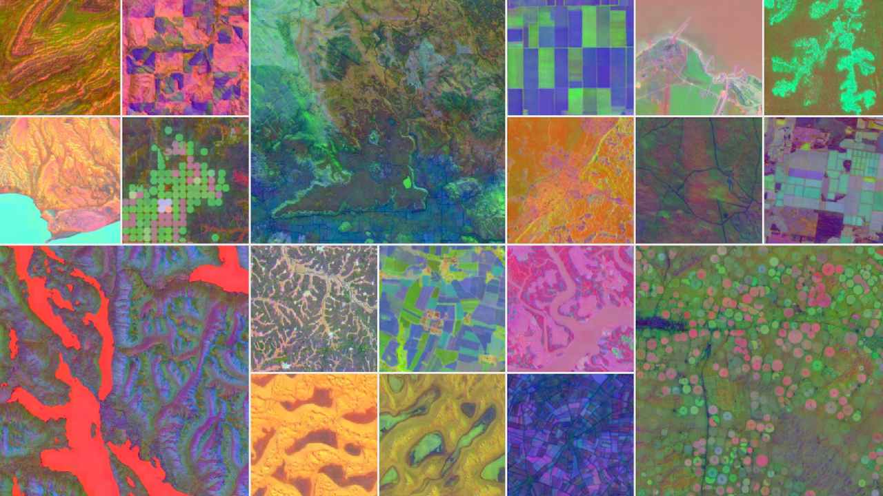
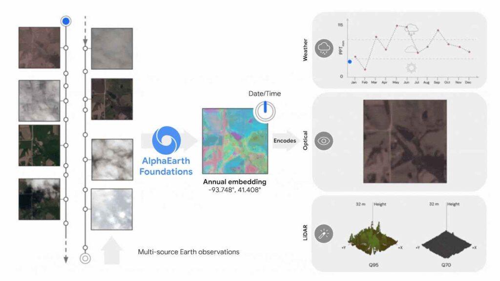
The system processes optical and thermal imagery from Sentinel-2 and Landsat satellites, cloud-penetrating radar data, 3D surface measurements, global elevation models, climate information, gravity fields, and descriptive text. This multimodal approach allows it to analyze Earth’s surface in 10×10 meter squares with remarkable precision.
AlphaEarth Foundations was trained on over 3 billion individual image frames sampled from over 5 million locations globally. By treating satellite images of locations over time like video frames, the model learns both spatial relationships and temporal patterns.
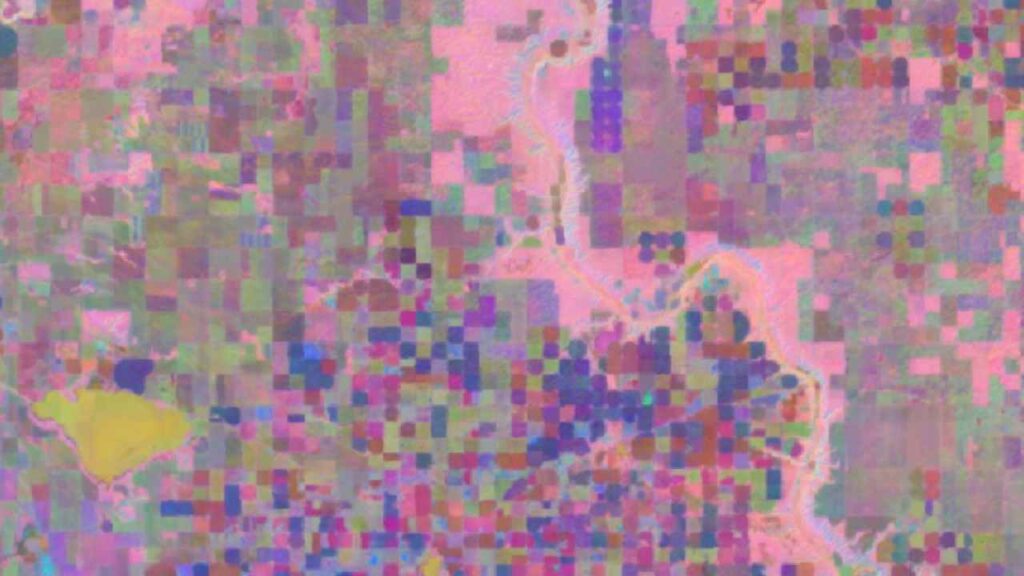
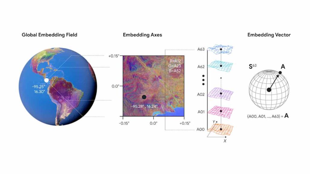
The technology creates 64-dimensional “embeddings” that compress a year’s worth of observations into a compact digital summary. These embeddings require 16 times less storage than comparable AI systems, dramatically reducing the cost of planetary-scale analysis.
When tested against traditional methods and other AI mapping systems, AlphaEarth Foundations showed 24% lower error rates on average, even with limited labeled data. This improved accuracy extends across diverse tasks including land cover classification, crop type identification, and environmental property estimation.
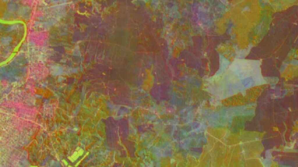
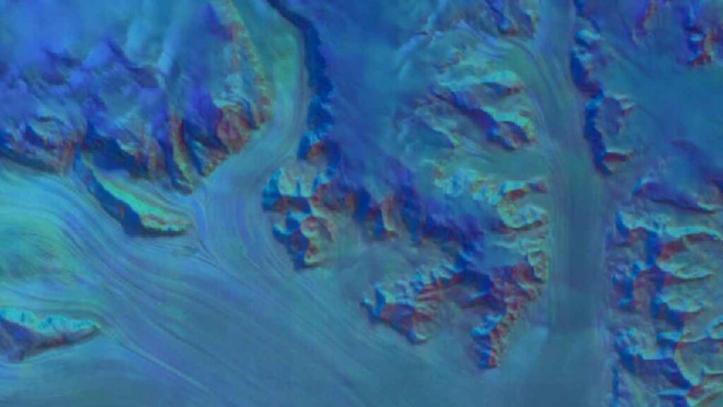
The system excels in challenging conditions where traditional satellites struggle. In Ecuador, it sees through persistent cloud cover to map agricultural plots in various stages of development. In Antarctica, an area difficult to image due to irregular satellite coverage, it renders surface features with unprecedented clarity. In Canada, it reveals subtle agricultural land-use variations invisible to conventional imaging.
To accelerate research, Google has released the Satellite Embedding dataset through Google Earth Engine. This collection contains over 1.4 trillion embedding footprints per year, covering 2017 through 2024, making it one of the largest datasets of its kind.
Similar Posts
More than 50 organizations are already using these embeddings in real-world applications. The Global Ecosystems Atlas uses the dataset to map previously uncharted ecosystems like hyper-arid deserts and coastal shrublands. In Brazil, MapBiomas leverages the data to monitor agricultural expansion and deforestation in the Amazon with greater speed and precision.
“The Satellite Embedding dataset is revolutionizing our work by helping countries map uncharted ecosystems—this is crucial for pinpointing where to focus their conservation efforts,” said Nick Murray, Director of the James Cook University Global Ecology Lab and Global Science Lead of Global Ecosystems Atlas.
AlphaEarth Foundations is part of Google Earth AI, a broader collection of geospatial models that includes systems for weather prediction, flood forecasting, and wildfire detection. These models already power features like flood and wildfire alerts in Google Search and Maps.

Looking forward, Google plans to integrate AlphaEarth with Gemini LLMs for more advanced geospatial reasoning, creating new possibilities for environmental monitoring and conservation planning.
The technology represents a fundamental shift in Earth observation—moving from limited satellite flybys to a comprehensive, AI-enhanced view that works across time and space, providing scientists and decision-makers with the tools they need to address our planet’s most pressing environmental challenges.