As Typhoon Wipha approached the Pearl River Delta on July 20, 2025, its powerful winds and torrential rain put Hong Kong’s early-warning systems and emergency protocols to the test, providing a real-time demonstration of how this densely populated metropolis handles increasingly intense tropical cyclones.
At 9:20 a.m. local time, the Hong Kong Observatory raised the Hurricane Signal No. 10—the highest level warning indicating winds exceeding 118 km/h. This marked the first such alert since Super Typhoon Saola in September 2023. As Wipha passed approximately 50 kilometers south of Hong Kong, maximum sustained winds reached 140 km/h at monitoring stations across the territory.
The Observatory urged residents to “stay indoors and away from exposed windows and doors,” ensuring they had a safe place to shelter as the city braced for the storm’s peak intensity.
City at a Standstill
The impact on transportation was immediate and comprehensive. Airport Authority Hong Kong activated its Emergency Centre, with approximately 500 flights canceled and another 400 rescheduled for later departures and arrivals. Cathay Pacific Airways suspended all flight operations between 5 a.m. and 6 p.m., offering flexible rebooking arrangements for affected passengers. Thai Airways International also announced the cancellation of flights to and from Hong Kong and Guangzhou on both July 20 and 21 due to the storm’s severity.
Ground transport faced similar disruptions. The Hong Kong–Zhuhai–Macao Bridge closed in the early morning, halting all cross-border traffic. MTR reduced train speeds on exposed sections and suspended operations in open areas, while high-speed rail services to Guangzhou paused completely. Ferry operators canceled all sailings across Victoria Harbour as wave heights grew dangerous.
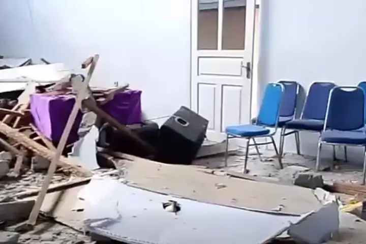
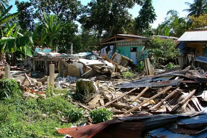
Public safety authorities moved quickly to protect residents. The Home Affairs Department opened 34 temporary shelters across various districts, with official figures showing that 253 people sought refuge by midday. Emergency services received 471 reports of fallen trees, with some crushing vehicles and blocking roadways. According to the Hospital Authority, 26 people required medical treatment at public hospital emergency departments for typhoon-related injuries.
Schools, Hong Kong Disneyland, Ocean Park, and the annual Hong Kong Book Fair all announced closures. The iconic “Symphony of Lights” harbor light show was also canceled as Victoria Harbour experienced phenomenal swells.
Similar Posts
By the Numbers: Measuring Wipha’s Impact
Weather stations across Hong Kong recorded significant rainfall as Wipha’s rainbands lashed the territory. The Hong Kong Observatory reported that more than 110 mm (4 inches) of rain fell within a three-hour period in some areas. Significant coastal flooding was observed in low-lying areas, with water levels rising dangerously. Maximum wind gusts exceeding 167 km/h were recorded at various locations, including Tate’s Cairn, as conditions intensified throughout the morning.
Offshore, high sea swells created dangerous conditions for marine vessels and prompted authorities to warn all ships to remain in typhoon shelters.
Beyond Hong Kong: A Regional Disaster
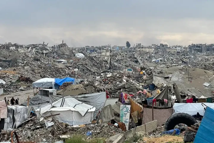
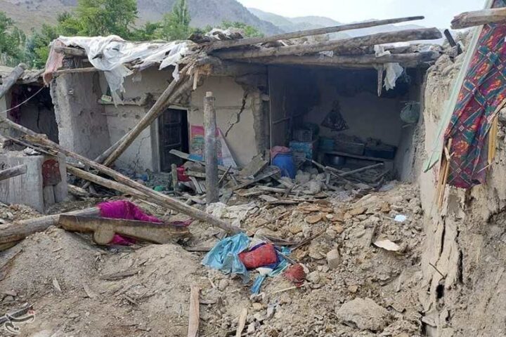
Wipha’s impact extended well beyond Hong Kong’s borders. Before reaching China, the storm affected the Philippines, where more than 370,000 people experienced flooding, landslides, and fierce winds. At least 43,000 people evacuated to emergency shelters, and the storm claimed at least one life in northern Cagayan province.
China’s Guangdong and Hainan provinces remained on high alert as Wipha approached. The system made landfall near Taishan city in Guangdong province at around 5:55 p.m. local time, at which point it began to weaken to a severe tropical storm with wind speeds of approximately 108 km/h. Cities including Shenzhen, Zhuhai, and Macao canceled daytime flights and suspended public transportation services.
Storm Timeline and Warning Signals
The Hong Kong Observatory began tracking Wipha when it was still designated as Tropical Storm Crising in Philippine waters. The system intensified rapidly as it moved northwest through the South China Sea, reflecting patterns observed with warming ocean temperatures.

The warning signal progression in Hong Kong was:
- July 19, 2:20 a.m.: No. 1 signal issued as Wipha entered within 800 km of Hong Kong
- July 19, 2:20 p.m.: No. 3 signal issued as outer rainbands approached
- July 20, 12:20 a.m.: No. 8 Northeast Gale or Storm Signal issued
- July 20, 7:20 a.m.: No. 9 signal issued
- July 20, 9:20 a.m.: No. 10 Hurricane Signal issued
- July 20, 4:10 p.m.: Downgraded to No. 8 as Wipha moved westward
- July 20, 7:40 p.m.: Further downgraded to No. 3 Strong Wind Signal
By evening, Wipha had tracked westward at about 22 km/h, moving along the coast of western Guangdong. The Observatory warned that despite the typhoon’s departure, seas would remain rough and strong winds would continue to affect parts of the territory.
Looking Ahead
After skirting Hong Kong, Wipha’s forecast track showed the system continuing westward along the coast of Guangdong province before entering the Gulf of Tonkin. Meteorologists predicted that after a brief period over water, Wipha would make a second landfall near Vietnam’s Red River Delta southeast of Hanoi.Throughout the event, Hong Kong’s weather monitoring systems and emergency response teams gathered valuable data on tropical cyclone behavior and community resilience, adding to the city’s preparedness knowledge base for future storms. This information becomes increasingly important as researchers continue to monitor changing weather patterns across the region, especially following earlier systems like Typhoon Danas and Storm Alvin.