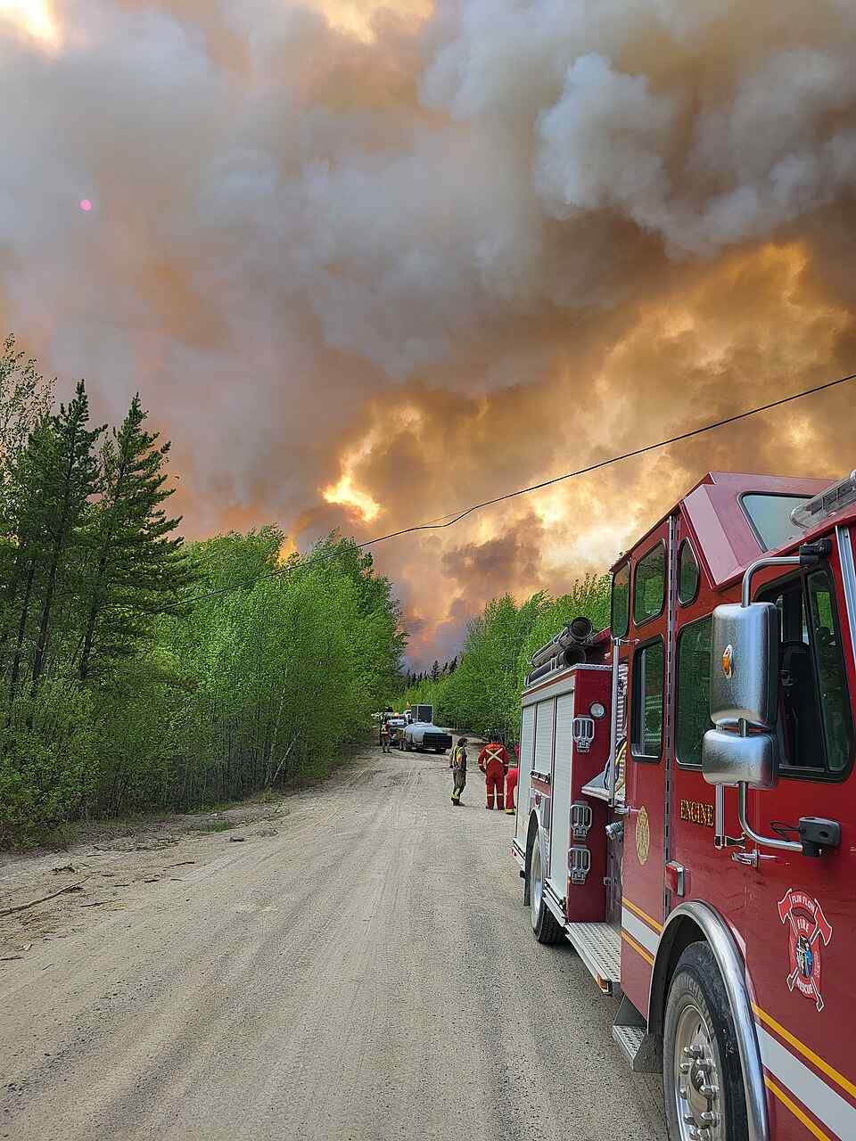
Caption: University of Ottawa research links Manitoba’s May 2025 fires to overlapping climate and vegetation anomalies that amplified early-season risk (PDM 1.0).
Photo Source: National Interagency Fire Center
Alt Text: Red fire engine on dirt road with firefighters as a large smoke plume from the Thunderhill Lake Complex wildfire rises near forest in Flin Flon, Manitoba, May 27, 2025
Manitoba’s devastating wildfires in May 2025 weren’t caused by a single extreme weather event but rather by several moderate climate and vegetation changes that overlapped at the worst possible time, according to new research from the University of Ottawa.
The study, led by Associate Professor Hossein Bonakdari, reveals how these “compound anomalies” created perfect conditions for the most severe fires Manitoba has seen in three decades.
“Multiple environmental anomalies converged to create a highly flammable landscape,” Bonakdari explains. “Moderate but simultaneous stresses set the stage for extreme fires.”
More Posts
The Perfect Storm of Conditions
The research identified several key factors that combined to create dangerous fire conditions:
April rainfall was about 8 mm below normal levels – not a dramatic shortage on its own, but problematic when combined with other factors.
Snow cover was approximately 40,000 km² less than usual, leaving more land exposed to drying earlier in the season.
Soil moisture was among the driest on record according to ERA5-Land data, creating parched ground conditions.
Satellite measurements showed reduced “greenness” in vegetation (measured by Leaf Area Index or LAI), indicating stressed plants more likely to burn.
This combination turned Manitoba’s landscape into a tinderbox waiting for a spark.
Early Warning Signs Detected by Satellites
Researchers used multiple satellite systems – including Sentinel-2 and Landsat 8 – alongside the Canadian Drought Monitor to identify warning signs before the fires began.
These tools detected early ignition zones on May 4 and May 14, particularly in eastern and northern Manitoba near Lac du Bonnet and Nopiming Provincial Park.
The fires spread rapidly under warm, windy conditions, eventually burning approximately 8,667 square kilometers of land by early May. Nearly 1,000 residents were evacuated, and two people lost their lives near Lac du Bonnet.
A Season for the Record Books
The 2025 wildfire season stands as Manitoba’s worst in thirty years, while Canada overall is experiencing its second-worst fire season on record.
Bonakdari describes this as a “synergistic interaction” where moderate anomalies working together created extreme danger. No single weather factor broke records, but their combined effect was devastating./

Improving Fire Prediction and Response
The study recommends integrating climate and biosphere anomalies into routine early-season risk monitoring. This means watching for combinations of rainfall deficits, snowpack changes, soil moisture levels, and vegetation health – not just individual indicators.
Canada currently relies on European and NASA satellites for wildfire monitoring, but plans are underway for WildFireSat, a domestic satellite system targeted for 2029. This system would deliver daily thermal imaging to help rank fire danger, forecast behavior, and optimize firefighter deployment.