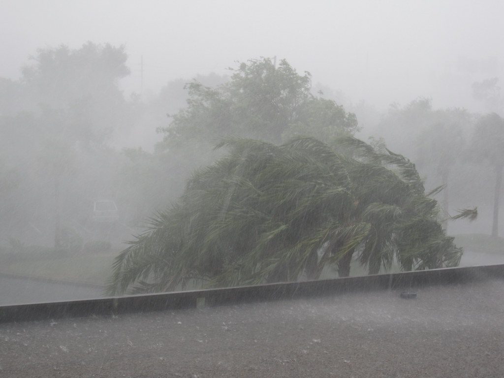
Strong storms will hit Central Florida this weekend, with dangerous beach conditions lingering from Hurricane Erin’s distant effects. A stalled front across the Southeast will keep rain chances high, especially Saturday when widespread storms are expected from midday through early evening.
Beach visitors face serious risks along Florida’s Atlantic coast. Coastal Flagler and Volusia counties remain under Rip Current Statements as Hurricane Erin continues generating dangerous swells despite moving away from the U.S. mainland.
“These rough ocean conditions are expected to cause life-threatening surf and rip currents,” warns the National Hurricane Center. Rip currents are “powerful, narrow channels of fast-moving water” that can endanger swimmers who try to rush back to shore.
Saturday’s forecast shows a 70% chance of rain. Morning showers will give way to a stronger round from midday through early evening. These storms will pack heavy downpours, frequent lightning, and possible gusty winds. Some rain may linger into the night, making it a soggy start to the weekend.
Sunday won’t offer much relief, with a 60% chance of afternoon storms, again favoring the afternoon and evening hours. The persistent cloud cover and rain will keep temperatures cooler than typical August heat, with highs only reaching the upper 80s to near 90 degrees both days.
Similar Posts
The timing couldn’t be worse for the Coke Zero Sugar 400 in Daytona Beach. Race fans should prepare for a 40% chance of early evening showers, though skies are expected to gradually clear with overnight lows in the upper 70s.
Looking ahead to next week, the unsettled pattern continues with daily storm chances into early week. Temperatures will gradually climb back to the low-to-mid 90s by midweek as the pattern shifts slightly.
Beachgoers should exercise extreme caution this weekend. The National Weather Service maintains a high risk of rip currents for Atlantic beaches through Saturday. If caught in a rip current, experts advise swimming parallel to the shoreline and at an angle back to shore rather than fighting directly against the current.

Drivers should also be alert for potential ponding on roadways during heavy downpours, which could reduce visibility and create hazardous conditions, especially during afternoon commutes.
This stormy pattern comes as the Atlantic hurricane season approaches its peak in September. While Hurricane Erin continues moving northeast in the Atlantic with winds of 90 mph, forecasters are also monitoring two additional systems in the Atlantic that could develop in the coming days.