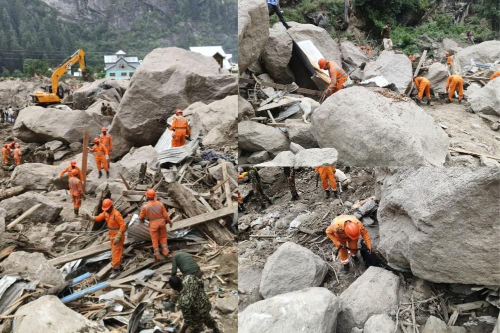
Heavy rains triggered a deadly landslide near Vaishno Devi shrine in August 2025, killing 34 pilgrims. Just weeks earlier, another disaster at Chasoti killed at least 60 people on the Machail Mata Yatra route. These aren’t isolated incidents but part of a worrying pattern across India’s hills.
Triple Threat to India’s Slopes
The Geological Survey of India (GSI) has mapped about 4.3 lakh square kilometers as landslide-prone – from the Himalayas to the Western Ghats and Nilgiris. What’s causing these slopes to fail?
“Geological factors, shifting climate patterns, and increasing human pressures together make our hilly regions particularly vulnerable,” explains GSI Director General Asit Saha.
Natural steep slopes and fragile rock have always existed, but climate change now causes more intense rainfall events. When Udhampur district recorded 629.4 mm in 24 hours – almost double the previous record of 342 mm set in 2019 – the severe storms triggered the Vaishno Devi landslide.
Human activities make things worse. Roads cut into hillsides, buildings on steep slopes, and disrupted drainage all weaken already vulnerable terrain.
Tracking Danger Spots
GSI’s National Landslide Susceptibility Mapping program has mapped 4.3 lakh square kilometers across 19 states since 2014. Maps show high, moderate, and low-risk zones, with the Nilgiris district having about 1,000 square kilometers classified as high-risk.
Detailed mapping focuses on 160 critical areas so far, helping authorities know where development should be restricted and where protective measures are needed.
Early Warnings Save Lives
Since 2020, GSI has developed a Regional Landslide Forecasting System using rainfall data and weather predictions. This system now sends warning bulletins to 21 districts across eight states.
The technology works by tracking rainfall intensity and duration – intense short bursts are far more hazardous than the same total rain spread over days.
Some universities have created even more precise systems. IIT Mandi’s team in Himachal Pradesh has developed a sensor network that, according to their reports, can predict landslides three hours in advance with up to 99% accuracy in test conditions, though this is based on local pilot studies rather than nationwide operational validation.
Protecting Communities
The government aims to expand warning systems nationwide by 2030, but covering all 91,000 historical landslide locations (of which 33,904 have been field-validated) would be extremely expensive.
For now, the Central Government provides aid through the National Landslide Risk Mitigation Programme and trains community volunteers through the Aapda Mitra scheme.

Simple safety steps can save lives:
- Follow weather alerts during monsoon
- Avoid slopes and retaining walls during heavy rain
- Report blocked drains that could trigger failures
- Know your evacuation routes
As GSI continues mapping danger zones and improving warnings, the race is on to keep people safe in India’s increasingly unstable hill regions – a challenge made harder by our changing climate.