Chattanooga faced one of its wettest days in history on Tuesday, August 12, 2025, when 6.42 inches of rain poured down in a single day. This marks the second-wettest day on record for the city since weather tracking began in 1879, according to the National Weather Service.
The heavy downpour led Hamilton County Mayor Weston Wamp to declare a state of emergency Tuesday evening. “We have been in communication with both TEMA and the Governor’s Office and will continue to assess damage overnight and into the morning. We ask the public to please exercise extreme caution,” Wamp said in his announcement.
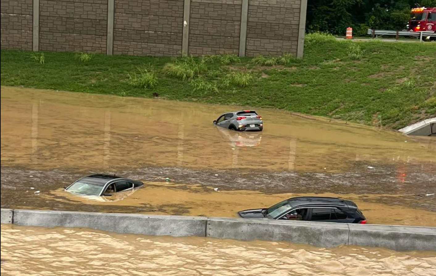
Interstate 24, a major highway through the city, was submerged under more than three feet of water near McBrien Road, forcing full closures in both directions. The Tennessee Department of Transportation (TDOT) closed I-24 between US 27 and I-75, with traffic being rerouted through I-27. Even the detour routes in East Ridge were flooded, making travel nearly impossible in many areas.
Sheriff Austin Garrett described the situation as unusually severe. “I’ve seen flooding throughout my career all over the county,” he said. “It’s typically concentrated in one area. This is extremely widespread. It made it difficult for us to even get here ourselves to try to help other people.”
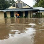
The flooding hit multiple neighborhoods hard, including Brainerd, East Brainerd, East Ridge, Collegedale, Ooltewah, and Lookout Mountain. Emergency crews conducted numerous water rescues throughout the evening, pulling people from submerged vehicles and homes. In East Ridge, residents on Maxwell Road needed boat evacuations by swift-water rescue teams.
For those displaced by flooding, officials opened the Chris Ramsey Brainerd Recreation Center at 1010 N. Moore Road as a shelter for evacuees.
Similar Posts
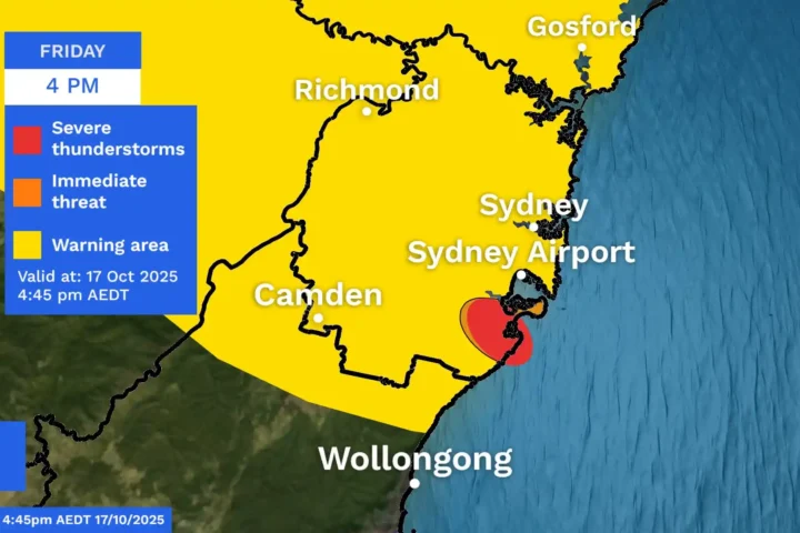
The National Weather Service in Morristown issued a Flash Flood Warning that remained in effect until 10:45 PM EDT for parts of Hamilton and Bradley counties. The warning noted that “flash flooding is already occurring” and described the threat as “considerable.”
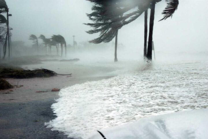
Weather experts attribute the heavy rainfall to abundant moisture from the Gulf of Mexico combined with the southern Appalachian terrain, which enhanced rainfall intensity. The storm system dumped nearly twice Chattanooga’s typical August rainfall in just one day.
Flash flooding is particularly dangerous – it’s the deadliest weather hazard in the United States, with almost half of all flood deaths involving vehicles. This prompted officials to repeatedly warn residents: “Turn around, don’t drown when encountering flooded roads.”
By late Tuesday night, some areas began seeing water recede. TDOT reported that I-24 East lanes reopened, while crews worked to clear disabled vehicles from I-24 West before reopening those lanes.

As of Tuesday evening, no injuries had been reported, according to local officials. Emergency management teams will continue assessing damage throughout the night and into Wednesday morning.
The public is urged to stay off roads when possible and avoid any water-covered areas. Additional rainfall was expected overnight and into Wednesday, potentially worsening conditions in some locations.