A rare Level 4 severe weather risk is in effect today across parts of South Dakota and Minnesota, as a dangerous derecho threatens to bring hurricane-force wind gusts exceeding 80 mph to the northern Plains. The Storm Prediction Center (SPC) has placed the I-29 corridor under a High-risk (Level 4 of 5) designation – something meteorologists don’t issue lightly.
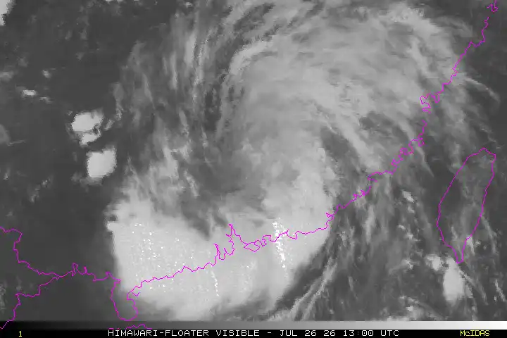
The derecho – a widespread, long-lived windstorm with a band of rapidly moving thunderstorms – is expected to develop this morning in eastern Montana and western North Dakota before intensifying dramatically through the afternoon and evening hours.
Morning observations already confirmed gusts of 75-76 mph in Billings and Dunn counties in North Dakota as the initial storm system began organizing. Meteorologists expect these storms to evolve from individual supercells into a more organized squall line capable of sustained destructive winds.
What’s Driving This Weather Beast?
The meteorological ingredients creating this derecho are textbook but extreme. A sprawling heat dome centered over the Mississippi Valley is generating intense instability as it collides with the jet stream racing across the northern tier of states. This coupling provides both the fuel and the mechanism for violent storm development.
Current atmospheric measurements show moderate to high CAPE (Convective Available Potential Energy) values combined with strong low-level wind shear – a perfect recipe for sustaining powerful thunderstorm complexes and potentially spawning embedded tornadoes.
Path, Timeline and Threats
The system is forecast to follow this timeline:
- Morning: Initial storm development in eastern Montana/western North Dakota
- Afternoon: Peak intensity across South Dakota, especially along and east of I-29
- Evening: Continued severe threat into Minnesota
- Overnight: Possible weakening but still dangerous progression into Iowa
Similar Posts
Beyond the primary threat of destructive straight-line winds, additional hazards include:
Flash flooding remains a serious concern, with the Weather Prediction Center highlighting a Level 2 (out of 4) risk. Recent weekend rainfall has left soils saturated across portions of the threatened region, making flash flooding more likely with any intense downpours.
Large hail may accompany the storms, particularly during the initial development stages when discrete supercells are more likely. Isolated tornadoes could form, especially along the leading edge of the squall line where rotation tends to develop.
The Past the Raises Concern
This potential derecho follows an already active severe weather season. The northern Plains experienced a significant derecho just last month (June 19-22, 2025) that produced gusts up to 120 mph in Beltrami County, Minnesota, with multiple embedded tornadoes and seven fatalities.
For a storm to qualify officially as a derecho, it must produce damage along a path at least 250 miles long (about 400 km), maintain a width of 60+ miles, and generate frequent wind gusts of 58+ mph.

The June 2020 Rocky Mountains-Northern Plains derecho serves as another sobering benchmark. That system traveled over 750 miles, produced 94 mph gusts in South Dakota, and left more than 200,000 customers without power.
Safety Critical During Fast-Moving Threat
For residents in the affected areas, the rapid forward motion of derecho systems – often 50-70 mph – means warning times may be shorter than typical severe thunderstorms.
Weather experts recommend:
- Having multiple ways to receive warnings: NOAA Weather Radio, smartphone alerts, local TV/radio
- Identifying the sturdiest interior room of your home, away from windows
- Mobile home residents should plan to relocate to sturdier shelter before storms arrive
- Securing outdoor items that could become projectiles in high winds
- Preparing for potential power outages that could last several days
The SPC noted in its discussion that “a derecho is likely across the northern Plains” with the greatest risk concentrated from Aberdeen through Sioux Falls and into southwestern Minnesota.
Advanced weather warning systems will continue monitoring the evolution of this dangerous system throughout the day. Updates will be provided as new data becomes available.
Frequently Asked Questions
What is a derecho and how is it different from a regular thunderstorm?
A derecho is a widespread, long-lived windstorm with a band of rapidly moving thunderstorms. Unlike regular thunderstorms that affect smaller areas, derechos can travel hundreds of miles, causing damage along a straight path. They produce sustained wind speeds of at least 58 mph with gusts that can exceed 80 mph – similar to a Category 1 hurricane. Derechos are rare, occurring only once or twice a year in the United States.
Why is this derecho considered so dangerous?
This derecho is especially dangerous because it’s rated as a Level 4 (out of 5) high-risk weather event by the Storm Prediction Center. It’s expected to bring hurricane-force winds exceeding 80 mph across multiple states. The system is also arriving when soils are already saturated from recent rainfall, increasing the risk of flash flooding. The combination of extreme winds, potential tornadoes, and flooding creates a serious threat to people, property, and infrastructure.
Which areas will be most affected by this derecho?
The areas at highest risk include eastern South Dakota, southern Minnesota, and northern Iowa, especially along the I-29 corridor. Cities like Aberdeen, Sioux Falls, and Brookings in South Dakota and parts of southwestern Minnesota are under the Level 4 risk area. The storm system is expected to develop in eastern Montana and western North Dakota before intensifying as it moves eastward.
When will the derecho hit my area?
The timeline for this derecho is:
– Morning: Initial development in eastern Montana/western North Dakota
– Afternoon: Peak intensity across South Dakota, especially along I-29
– Evening: Moving into Minnesota
– Overnight: Progressing into Iowa
Check your local weather service for more specific timing for your location.
What should I do to prepare for the derecho?
To prepare for a derecho:
– Have multiple ways to receive warnings (NOAA Weather Radio, smartphone alerts, local TV/radio)
– Identify the sturdiest interior room in your home to use as shelter
– If you live in a mobile home, plan to relocate to a sturdier shelter before the storm
– Secure or bring inside outdoor items that could become dangerous projectiles
– Prepare for potential power outages with flashlights, batteries, and charged devices
– Keep a supply of water and non-perishable food
– Have a first aid kit ready
How long will the derecho last in my area?
Derechos move quickly, typically at speeds of 50-70 mph. This means the most intense part of the storm will likely affect any single location for about 30 minutes to an hour. However, because derechos are fast-moving, warning times may be shorter than for typical severe thunderstorms. The entire system will progress from western North Dakota to Iowa over the course of about 12 hours.
Should I be worried about tornadoes during this derecho?
Yes, derechos can produce tornadoes, particularly along the leading edge of the squall line where rotation tends to develop. While the primary threat from this system is straight-line winds, isolated tornadoes could form. Have a plan for tornado safety, which is similar to derecho safety: move to an interior room on the lowest floor of a sturdy building, away from windows, and protect yourself from flying debris.
What’s the difference between a derecho watch and warning?
A watch means conditions are favorable for a derecho to develop in the next several hours. It’s time to prepare and stay alert. A warning means a derecho has been detected and is imminent for your area. When a warning is issued, take immediate action to protect yourself and your family by moving to your designated safe space. Warnings typically give you minutes, not hours, to react.