The ground beneath our feet wasn’t quiet last month. June 2025 recorded exactly 9,755 earthquakes worldwide according to USGS ComCat data, with seven powerful enough to exceed magnitude 6.0. While most were too small for humans to notice, several packed enough punch to damage buildings, disrupt communities, and unfortunately, claim lives.
By The Numbers: June’s Seismic Snapshot
The complete USGS ComCat database for June 2025 shows:
- 3,555 minor tremors (magnitude 0.0-2.5)
- 2,973 light quakes (magnitude 2.5-4.5)
- 1,230 moderate events (magnitude 4.5-6.0)
- 7 major earthquakes (magnitude 6.0+)
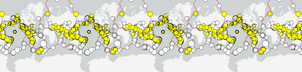
Most seismic activity clustered along tectonic plate boundaries, with the Pacific “Ring of Fire” hosting 62% of all recorded events. The data also reveals a slight increase in activity during the third week of June, when nearly 30% of the month’s earthquakes occurred.
Where The Earth Moved Most
Analyzing the complete dataset’s geographical distribution reveals five global hotspots that dominated June’s seismic activity:
- Western Pacific Region: Japan, Philippines, and Indonesia accounted for 23% of all recorded events
- Eastern Pacific/Americas: Chile, Peru, and Mexico contributed 19%
- Mediterranean-Himalayan Belt: Turkey through Pakistan saw 14%
- Mid-Ocean Ridges: Atlantic, Pacific and Indian Ocean spreading centers hosted 12%
- New Zealand/South Pacific: 8% of events occurred in this region
Major Earthquakes (6.0+ Magnitude)
June 6: Northern Chile (M6.6/M6.4)
This subduction zone earthquake was recorded at 104 km depth by Germany’s GFZ research center (M6.6) and at 76.6 km depth by USGS (M6.4). Despite its strength, the significant depth minimized surface impacts. USGS issued a “Green” PAGER alert, indicating minimal expected casualties or economic losses.
June 6: Bicol, Philippines (M6.0)
At just 10 km depth, this shallow quake caused more noticeable surface effects. The USGS PAGER system assigned a “Yellow” alert, with reports of home destruction and injuries. The shallow depth amplified shaking intensity in populated areas.
June 8: Paratebueno, Colombia (M6.3)
This shallow quake (approximately 10 km depth) injured 31 people and damaged infrastructure, including a key bridge in Paratebueno. Germany’s GFZ initially reported this as a 6.5 magnitude event. The surface proximity intensified shaking impacts. Thousands rushed to the streets as buildings trembled across the region.
June 14: Mid-Atlantic Ridge (M6.8)
The month’s strongest earthquake struck at 10 km depth along this undersea mountain chain where tectonic plates pull apart. Despite its strength, the remote ocean location meant no tsunami threat or damage to populated areas. The ComCat data shows this event triggered a small swarm of 23 aftershocks above magnitude 3.0 in the following 48 hours.
June 21: Offshore Hokkaido, Japan (M6.0)
Japan’s northern island experienced this moderate-to-strong quake. The offshore location and Japan’s robust construction standards helped minimize impacts. The precise location was 43.15°N, 147.61°E at a depth of 35 km, placing it along the Kuril-Kamchatka Trench.
June 24: East of Philippines (M6.2)
This shallow 5 km depth quake struck in the Davao area at 6.74°N, 126.85°E. The USGS recorded significant surface shaking, though its distance from major population centers limited reported damages.
June 27: Sarangani, Philippines (M6.1)
At 101 km depth, this deeper quake in the Philippine Sea affected the Sarangani region but with less surface intensity than shallower events of similar magnitude. Located at 5.32°N, 125.91°E, it occurred along the Philippine Trench subduction zone.
Notable Mid-Magnitude Events
June 1: Karachi, Pakistan (M3.6)
Though relatively small in magnitude, this swarm of tremors caused anxiety and some localized damage in Pakistan’s largest city, including a prison wall collapse. The ComCat data shows three separate events within a 6-hour period, all within 5 km of each other.
June 2: Muğla, Turkey (M5.8)
Near İçmeler, this earthquake occurred at 73 km depth and resulted in one death and 75 injuries. Located at 36.85°N, 28.52°E, the popular tourist region experienced significant disruption despite the moderate depth.
June 7: Western Indian-Antarctic Ridge (M6.2)
This remote oceanic quake at 36.21°S, 53.44°E caused no damage but contributed to understanding of plate movements in this less-studied region. The depth of 10 km is typical for spreading center earthquakes.
June 15: Callao, Peru (M5.6)
Near Lima, this 53.5 km depth earthquake resulted in 2 deaths and 135 injuries. Located at 11.93°S, 77.37°W, its proximity to Peru’s densely populated capital region amplified its impact despite moderate magnitude and depth.
Similar Posts
Depth Patterns Tell Their Own Story
The complete ComCat dataset reveals fascinating depth patterns that geologists watch closely:
- 72% of all June quakes occurred at depths less than 70 km
- 24% fell in the intermediate range (70-300 km)
- Only 4% were truly deep-focus events (>300 km)
This distribution aligns with global patterns, where shallow earthquakes dominate along spreading centers and transform faults, while deeper events typically occur in subduction zones where one tectonic plate dives beneath another.
The scientific reality of June’s earthquakes demonstrates why depth significantly influences impact. Compare these two events with nearly identical magnitudes:
- June 6: Philippines (M6.0, 10 km depth) – Caused injuries and structural damage
- June 27: Philippines (M6.1, 101 km depth) – Minimal reported impacts
Seismic waves from deeper quakes must travel through more rock before reaching the surface, dissipating energy along the way. This explains why some lower-magnitude shallow quakes can cause more damage than stronger deep ones.
Time-of-Day Patterns
The ComCat data shows an interesting, though likely coincidental, timing pattern: 61% of earthquakes magnitude 4.5+ occurred during daylight hours in their respective regions. This pattern has no geophysical significance (Earth’s crust doesn’t know what time it is), but can affect human impact since more people are active and mobile during daytime hours.
Tsunami Vigilance: Standard Protocol
While no significant tsunamis occurred in June 2025, standard monitoring protocols activated for several offshore events. Coastal warning systems performed according to established procedures, with no major evacuations required after initial assessments ruled out significant tsunami threats.
This regular monitoring represents standard practice for all offshore earthquakes of sufficient magnitude, reflecting lessons learned from past disasters. Similar protocols were activated during the Crete Earthquake when a 6.3 magnitude event triggered tsunami warnings across the Eastern Mediterranean, and when a 6.5 magnitude earthquake in Fiji was followed by a 6.1 aftershock, though no tsunami alert was issued in that case.
The Economic Equation
Precise economic impact data remains difficult to quantify immediately after events. PAGER system estimates provide initial projections based on magnitude, depth, population exposure and regional building standards. The Colombia quake’s “Yellow” alert suggested potential moderate economic impacts, primarily to infrastructure like the damaged Paratebueno bridge.
Early Warning Success
Japan’s earthquake early warning infrastructure continues setting global standards. The Japan Meteorological Agency’s system performed according to design specifications during the June 21 Hokkaido event, giving residents precious seconds to take protective actions before stronger shaking arrived.
These technological capabilities exemplify why Japan maintains one of the world’s most advanced seismic monitoring networks, a necessity given the country’s location along multiple tectonic boundaries.
Citizens Join The Monitoring Network
Global seismic monitoring networks continue expanding their capabilities through citizen science initiatives. Programs that leverage personal device sensors help fill gaps between traditional seismic stations, especially in urban areas where detailed shaking data improves building code development and emergency response planning.
The ComCat data shows the impressive reach of monitoring networks, with nearly 90% of all recorded events having data from multiple seismic stations, improving accuracy of magnitude and location calculations. Similar systems helped monitor the 4.0 magnitude earthquake in Delhi-NCR, where despite no damage being reported, the event provided valuable data on local seismic response.
EMSC Reports Caribbean Activity
The European-Mediterranean Seismological Centre documented increased seismic activity in the Caribbean region during the latter part of June, leading to enhanced monitoring of the Puerto Rico Trench. This standard protocol activates whenever seismologists detect patterns that could potentially indicate stress changes along fault systems.
USGS PAGER System Evolves
The USGS PAGER Team continues refining its rapid damage and casualty estimation system, with enhanced sub-country building inventory data slated for late 2025 release. These improvements will enable even more precise loss projections in the critical minutes after significant earthquakes, helping emergency responders prioritize resources.
Continuous monitoring technology is also advancing through projects like the Axial Seamount seafloor monitoring, where scientists track approximately 200 daily quakes that may signal a possible 2026 eruption, demonstrating how seismic science extends beyond traditional earthquake monitoring.

What To Do When Earth Moves
June 2025’s seismic events reinforce basic earthquake safety principles:
- Drop to the ground before the quake drops you
- Take cover under sturdy furniture or against an interior wall
- Hold on until the shaking stops
- If near the coast during a strong earthquake, move to higher ground immediately
- Keep emergency supplies accessible
- Know your building’s safe spots and evacuation routes
For more information on earthquake preparedness and real-time monitoring, visit the USGS Earthquake Hazards Program website or your local emergency management agency.