Widespread thunderstorms and heavy rainfall are battering the UK this weekend, following Friday’s record-breaking heat when temperatures soared to 29.4°C in Santon Downham, Suffolk – the hottest day of 2025 so far.
The Met Office has issued multiple weather warnings across the country, with some regions under amber alerts that warn of “danger to life” from fast-flowing or deep floodwater. Yellow thunderstorm warnings remain in place until 6pm today (Saturday, June 14) for large parts of the UK, including the South West, North East, North of England, Wales, much of Scotland, and eastern parts of Northern Ireland.
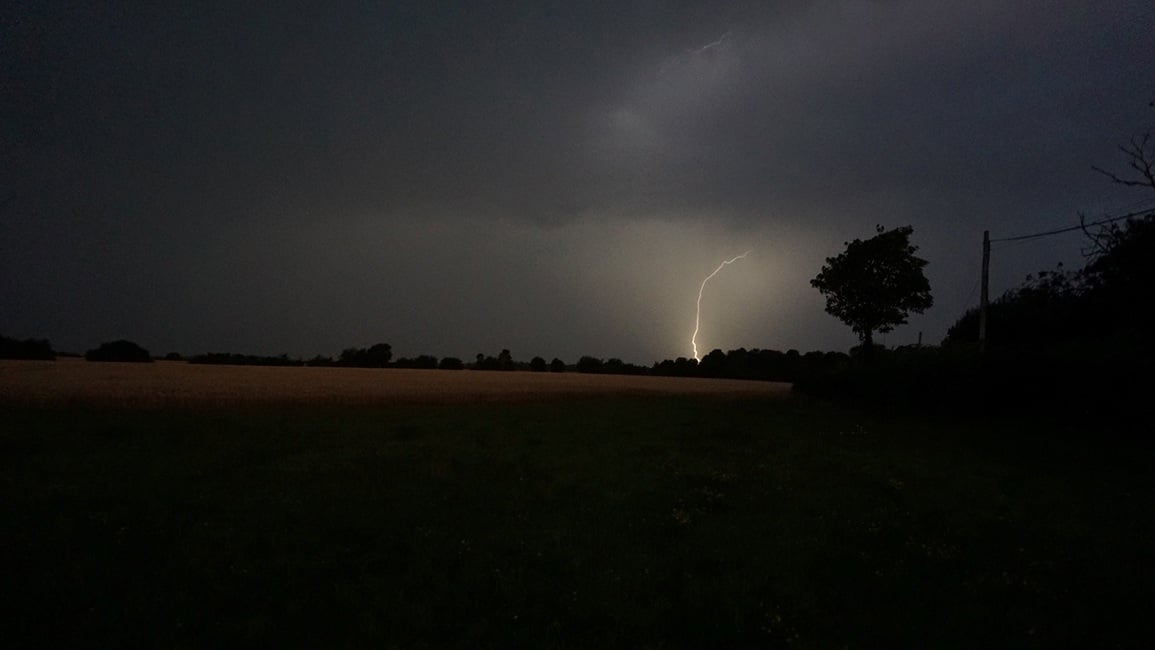
Over 30,000 lightning strikes have been recorded up to Saturday morning, though the Met Office notes that the “vast majority” occurred over the sea. This dramatic shift in weather comes as a weather system known as a “Spanish Plume” – hot, humid air from Spain and France drawn northward over the UK – collides with cooler air already present, creating perfect conditions for severe storms.
Met Office Chief Meteorologist Steve Ramsdale explained: “While warnings cover areas most at risk, not everyone within a warning area will experience a thunderstorm, and many parts will remain dry.”
What to Expect
The current thunderstorms pose several serious risks:
- Rainfall: Some areas could see 30-50mm of rain in just a few hours, with a few locations potentially reaching 80mm. This intense rainfall in short periods significantly increases the risk of flash flooding.
- Lightning: Frequent lightning strikes pose risks to people outdoors and can cause fires, as demonstrated by a reported fire in St Leonards-on-Sea.
- Strong winds: Gusts potentially exceeding 50mph accompany some of the most severe thunderstorms.
- Large hail: Hailstones 1-2cm in diameter are possible, causing damage to vehicles and property.
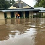
These conditions have already led to significant travel disruption. Roads have been flooded, particularly in Kent and Dover, while a landslip has disrupted train services between Exeter St Davids and Okehampton. Rail operators and Heathrow Airport have advised passengers to check for updates before traveling.
Similar Posts:
Safety Advice
Environment Agency Flood Duty Manager Katharine Smith emphasized: “We urge people not to drive through floodwater as just 30cm of flowing water is enough to move your car.”
The Met Office and emergency services recommend:
- Avoid travel if possible during the most severe weather
- Never drive, walk, or swim through floodwater
- Stay indoors during thunderstorms and avoid using landline phones
- Unplug non-essential electronics to protect from power surges
- Call 999 if affected by fast-flowing or deep water
RAC breakdown spokeswoman Alice Simpson added: “Anyone not confident driving in the conditions may wish to postpone their journeys until the stormy weather passes.”
Health Concerns
The UK Health Security Agency has issued its first yellow heat-health alert of the year for parts of England, active until Sunday morning. This warns of increased healthcare service demands and risks for vulnerable people, particularly important as the hot and humid conditions continue between storm systems.

Looking Ahead
According to Met Office forecasts, the UK can expect a northwest to southeast split developing in late June. The wettest and windiest conditions are expected in the northwest, while the southeast will see more settled conditions overall. However, the risk of isolated heavy showers and thunderstorms remains, with temperatures expected to be above normal, possibly with hot spells in southeastern regions.
While the current amber warning for the South East has expired, yellow warnings remain in effect until 6pm today. Residents across the UK are advised to stay updated with the latest Met Office warnings and Environment Agency flood alerts throughout the weekend.
This dramatic weather pattern, with record heat followed by severe thunderstorms, reflects the increasingly variable conditions the UK faces as our climate changes.