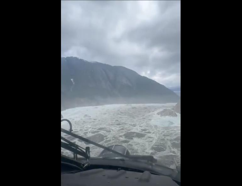
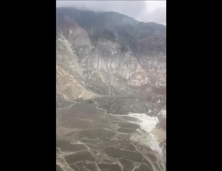
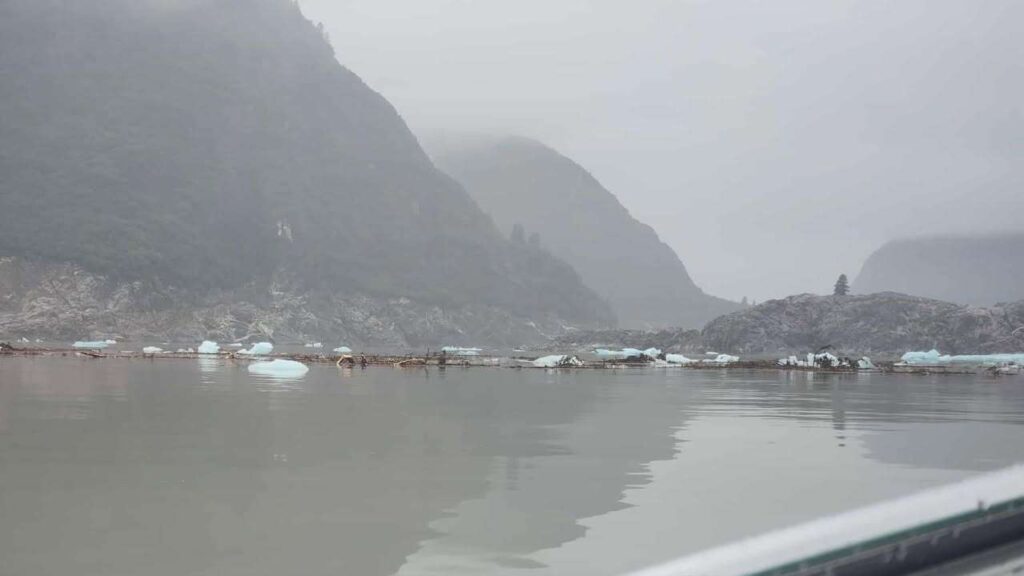
On August 10, a massive landslide in Southeast Alaska’s Tracy Arm triggered a tsunami with runup reaching approximately 100 feet near Sawyer Island. Occurring about 50 miles southeast of Juneau, this event coincided with a Mendenhall Glacier outburst flood threatening Juneau neighborhoods.
“This is larger than anything in the past decade in Alaska,” said Michael West, Alaska Earthquake Center Director at the University of Alaska Fairbanks.
Three kayakers—Sasha Calvey, Billy White, and Nick Heilgeist—barely escaped with their lives when 20-foot waves struck their Harbor Island campsite. “I look out of the tent, and then I see a massive wave coming, like, inches away,” said Calvey, who lost most of her gear but survived unharmed.
How Scientists Detected It
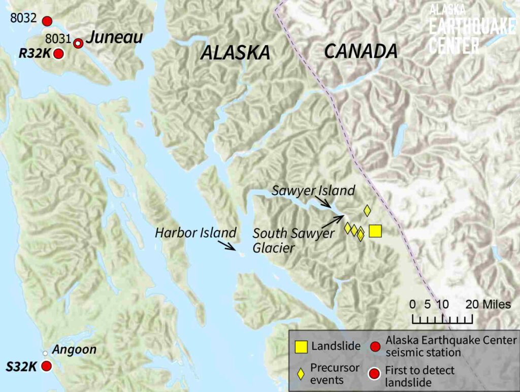
The Alaska Earthquake Center spotted the landslide using specialized algorithms that catch the distinctive seismic waves large slides create.
Their method separates long-period landslide signals from earthquake or glacier noise, explained Ezgi Karasözen, research seismologist who helped develop the detection system.
What makes this slide particularly interesting: scientists detected small tremors more than a day before the main failure – a rare warning sign that could someday help predict these events.

Juneau’s Double Threat: Mendenhall Glacier Flooding
While coastal communities monitor tsunami impacts, Juneau residents face a separate crisis as Mendenhall Glacier’s annual outburst flood begins.
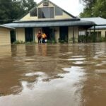
Governor Dunleavy issued a disaster declaration on Sunday, August 10; the basin overtopped Sunday night, and officials confirmed water release and downstream flooding on Tuesday.
Officials have urged evacuation in the 17-foot lake level inundation zone, which includes roughly 1,000 residents and businesses in the Mendenhall Valley.
The river is expected to crest Wednesday morning between 16.25 and 16.75 feet – breaking last year’s record that damaged nearly 300 Juneau homes.
“The basin is releasing and flooding is expected along Mendenhall Lake and River,” Juneau officials warned Tuesday. Temporary HESCO barriers now line vulnerable sections of the Mendenhall River to protect properties.
Understanding These Glacier Hazards
Both hazards are linked to glacier retreat: retreat exposes unstable fjord slopes (landslides) and forms/expands basins that can outburst.
As Mendenhall Glacier thins, the Suicide Basin side pocket fills with snowmelt and rainwater until pressure forces it underneath the glacier, flooding Juneau’s Mendenhall Valley.
Similarly, as glaciers retreat in fjords like Tracy Arm, they leave unstable slopes prone to massive failures.
“We were able to produce a rapid location and volume estimate using seismic data,” said Karasözen. Coast Guard flights confirmed the slide location; the National Park Service reported ~100-ft runup and vegetation stripping at Sawyer Island, with only one tree remaining.
What Happens Next
For Juneau residents near Mendenhall River, officials recommend:
- Evacuating if in the 17-foot lake level flood zone
- Using the emergency shelter at Floyd Dryden Gymnasium (3800 Mendenhall Loop Road)
- Monitoring official alerts for updates
Precise measurements of the Tracy Arm landslide will take weeks, but early estimates place it among Alaska’s largest in the past decade, with volume likely exceeding 100 million cubic meters – enough to fill 40,000 Olympic swimming pools.
Scientists from multiple agencies continue monitoring both situations, with the Mendenhall flooding expected to peak Wednesday and likely reach record levels.