From Sahara to British Skies — Desert Dust, Glowing Sunsets & Blood Rain Explained
A plume of fine mineral particles has crossed thousands of miles of ocean and air to paint the UK sky in gold and amber — and leave a rusty mark on your car.
If the sunsets lately have felt unusually vivid — deep golds bleeding into burnt oranges and rich ambers — there is a very real, very far-travelled reason. A vast plume of Saharan dust has swept northward from the deserts of North Africa, carried on warm southerly winds, and is now suspended high in the atmosphere above the UK. The same dust turning the sky spectacular is also the reason behind the so-called “blood rain” leaving reddish-brown stains on cars and garden furniture. Here is exactly what is happening, and why.
Interactive
The Dust’s Journey — Step by Step
Each step traces how fine Saharan sand travels from a desert haboob all the way to British skies. Click any step to read more.
1. The Haboob Lifts the Dust
A haboob — from the Arabic habūb, meaning “blasting wind” — is an intense desert dust storm. Dramatic walls of sand form across the Sahara and lift fine mineral particles high into the atmosphere. The coarser grains stay close to the desert; the ultra-fine particles are caught by upper-level winds and carried far beyond.
Particle size: PM10 fraction, with finer PM2.5 particles capable of long-distance transport2. Storm Regina Draws Warm Air North
Over the past few days, Storm Regina — a low-pressure system named by the Portuguese meteorological service IPMA and positioned off the southwest coast of Portugal — brought periods of rain and strong winds to the Iberian Peninsula. As warm southerly winds were drawn from North Africa around the system, Saharan dust was lifted high into the atmosphere above Spain and Portugal.
Named by: IPMA (Instituto Português do Mar e da Atmosfera)3. Satellite Data Confirms the Plume
Aerosol optical depth data from NASA Worldview and modelling from the Copernicus Atmosphere Monitoring Service (CAMS) indicated elevated dust concentrations over parts of Spain, consistent with a Saharan dust plume moving northward toward the UK.
Tracked by: NASA Worldview · Copernicus CAMS aerosol optical depth modelling4. High Pressure Steers Dust Into the UK
An area of high pressure over the UK has been delivering fine, mild, and settled spring conditions. This same high pressure is now directing the dusty southerly air straight toward England and Wales, where dust concentrations are expected to be highest due to the position of the pressure system and prevailing winds.
Most affected: England & Wales5. The Sky Turns Gold
As sunlight travels through an atmosphere laden with dust particles at sunrise and sunset — passing through a much greater depth of air — the shorter blue and violet wavelengths scatter away. The longer red, amber, and orange wavelengths dominate. The result: skies rich in gold and burnt orange that can feel almost surreal.
Peak: sunrise & sunset on Thursday–FridayWhat’s Happening
Why the Sky Glows — the Science of Scattered Light
Those tiny dust particles suspended kilometres up in the atmosphere interact with sunlight in a specific way. They scatter away the shorter, higher-energy blue and violet wavelengths of visible light while allowing the longer red, orange, and amber wavelengths to travel onward to our eyes. Dr. Claire Ryder, an atmospheric scientist at the University of Reading, notes that because Saharan dust contains iron oxides, it does not just scatter light — it also absorbs blue wavelengths, further intensifying the fiery glow on the horizon.
This effect involves a combination of Rayleigh scattering from atmospheric gases and Mie scattering from the larger mineral dust particles. While Rayleigh scattering explains why the sky appears blue on an ordinary clear day, the presence of coarser dust particles alters how sunlight is scattered and filtered through the atmosphere — producing the rich amber and orange tones visible at dusk and dawn. Similar dust events in other parts of the world produce the same optical effect.
Science Explainer
What the Dust Does to Sunlight
The visible light spectrum runs from violet (short wavelengths, ~380nm) to red (long wavelengths, ~700nm). Saharan dust and atmospheric gases together scatter the left side and allow the right side to dominate at dusk and dawn.
🔵 Blue & Violet — Scattered & Absorbed
Atmospheric gases scatter shorter blue wavelengths (Rayleigh scattering). Larger mineral dust particles further scatter them via Mie scattering. Iron oxides in the dust also absorb blue light directly — a combined effect that strips blue tones from the sky at low sun angles.
🟠 Red, Amber & Orange — Pass Through
The longer red and orange wavelengths are not scattered or absorbed as strongly. At sunrise and sunset, when sunlight travels through the greatest thickness of the atmosphere, they dominate entirely — producing those vivid deep-gold and burnt-orange skies.
Interactive Sky Simulator
What Does the Sky Look Like?
Select a condition to see how Saharan dust changes the appearance of British skies.
“The combination of warm air and Saharan dust may lead to some dusty deposits on cars or outdoor surfaces as the frontal rain washes the dust out of the atmosphere overnight into Friday.” — Met Office official statement on the Saharan dust event
Phenomenon
What Is “Blood Rain” — and Should You Be Concerned?
When Saharan dust mixes with rain it creates what is widely known as blood rain. This process — known as wet deposition — sees tiny dust particles suspended in the atmosphere captured by raindrops as they fall, and deposited onto surfaces, leaving a thin, gritty, reddish-brown residue.
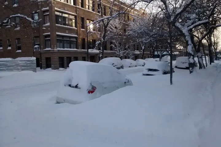
Cars, windows, garden furniture, and outdoor items can become visibly coated — sometimes requiring a wash to remove the marks. The UK Air Quality monitoring network (DEFRA) tracks particulate concentrations during these events. The dust itself is composed of mineral particles including silicates, quartz, and iron oxides — entirely natural, carried by atmospheric transport.
Parts of England and Wales are expected to experience the most pronounced effects, as dust concentrations are forecast highest there due to the position of the high-pressure system and the prevailing southerly winds.
Even areas with lighter dust concentrations may notice a faint film on surfaces after rainfall. Copernicus CAMS aerosol forecasts provide real-time maps of where the heaviest dust concentrations are moving across Europe.
For most people, Saharan dust events cause limited impacts. However, temporary increases in airborne particulate matter — both PM10 and PM2.5 — can affect air quality, and people with asthma, respiratory conditions, or allergies may experience symptoms during periods of higher dust concentrations.
Monitoring DEFRA’s Daily Air Quality Index (DAQI) gives a reliable, real-time guide. The Asthma + Lung UK website provides tailored advice during elevated particulate episodes. Official health guidance during dust events is issued by the UK Health Security Agency (UKHSA) and NHS. The wider health effects of sustained particulate air pollution are extensively documented — though natural dust events of this scale are short-lived.
Saharan dust reaching the UK is a natural and fairly frequent atmospheric phenomenon. These events occur several times each year, most often in late winter and spring when southerly airflow carries air masses north from the North African deserts.
In Burgos, Spain in 2022, residents woke to find cars, floors and rooftops coated in Saharan sand — a well-documented example of how significant these deposits can be further south. The World Meteorological Organization (WMO) documents the long-term frequency and transport pathways of global sand and dust storm events.
Forecast
When Will Skies Look Their Best?
The most vivid colours are expected on Thursday 5 March and into Friday 6 March, particularly at sunrise and sunset when skies are clear and the sun sits at a shallow angle. Met Office meteorologist Honor Criswick noted that there should be “lots of long sunny periods until that rain starts pushing into the east.”
The most noticeable displays are likely across England and Wales. Northern Ireland and Scotland are forecast to see more cloud but also more sunshine by the end of the week. The weekend brings a combination of patchy cloud and sunshine, with temperatures expected around 12–14°C. Up-to-date forecasts are available from the Met Office, whose weather blog also tracks the dust plume in detail.
Temperatures around 18–19°C were forecast in parts of southern England during the warm spell accompanying the dust plume, following the previous 2026 high of 18.7°C recorded at Kew Gardens on 25 February 2026. The dust’s arrival coincides with a stretch of genuine spring warmth that followed what was described as a chilly and exceptionally wet start to the year.
🩺 Health & Air Quality — Who Should Take Care
- People with asthma or respiratory conditions should monitor DEFRA’s DAQI air quality index and limit prolonged outdoor activity on high-dust days.
- Those with allergies or lung conditions can check guidance from Asthma + Lung UK.
- Particulate matter includes both PM10 and PM2.5 fractions during Saharan dust events — both are tracked by DEFRA’s UK-AIR network.
- Real-time UK air quality data is published by DEFRA’s UK-AIR network. Official health advice is issued by the UKHSA.
Bigger Picture
A Global System at Work
Saharan dust transport is one of the most visible examples of how connected the Earth’s atmospheric systems are. Atmospheric pollution monitoring satellites and tools developed through programmes like NASA’s TEMPO have made it easier than ever to track these plumes in near real-time. The European Centre for Medium-Range Weather Forecasts (ECMWF) and Copernicus CAMS run the aerosol modelling that underpins these forecasts.
Scientists at the University of Reading and NOAA have extensively researched dust transport pathways and their downstream effects, including the health implications of elevated particulate matter. On a shorter timescale, the current event is a reminder that a storm over the Sahara can, within days, colour a sky above London or Manchester. The interconnectedness of global climate systems plays out in remarkable and sometimes striking ways.
Spain’s national meteorological agency AEMET tracks the dust — known in Spain as calima — as it passes over the Iberian Peninsula before reaching the UK, providing a useful upstream data source. NASA’s TEMPO instrument and ESA’s Sentinel satellites further add granularity to the global picture.
Also on KarmActive
Related Stories You May Find Useful
In Summary
What Was Covered
This piece covered the current Saharan dust event affecting the UK — how a haboob lifts fine mineral particles from North Africa, how Storm Regina (named by IPMA) drew those particles northward on warm southerly winds while positioned off the southwest coast of Portugal, and how they are now carried into British skies by a settled area of high pressure.
The science of why sunsets turn vivid gold and amber was discussed — involving a combination of Rayleigh scattering from atmospheric gases and Mie scattering from larger mineral dust particles, alongside blue-light absorption by iron oxides in the dust. The “blood rain” phenomenon was covered alongside the areas of England and Wales most likely to be affected. Health guidance noting that particulate matter including both PM10 and PM2.5 fractions can affect sensitive groups was referenced from DEFRA, UKHSA, and NHS sources.
Atmospheric monitoring from Copernicus CAMS, aerosol optical depth data from NASA Worldview, and forecasting from the Met Office provided the scientific data underpinning this coverage.