Hurricane Melissa Devastates Jamaica as Strongest Storm on Record
Category 5 hurricane makes landfall with 185 mph winds – the most powerful direct hit to the island since record-keeping began in 1851
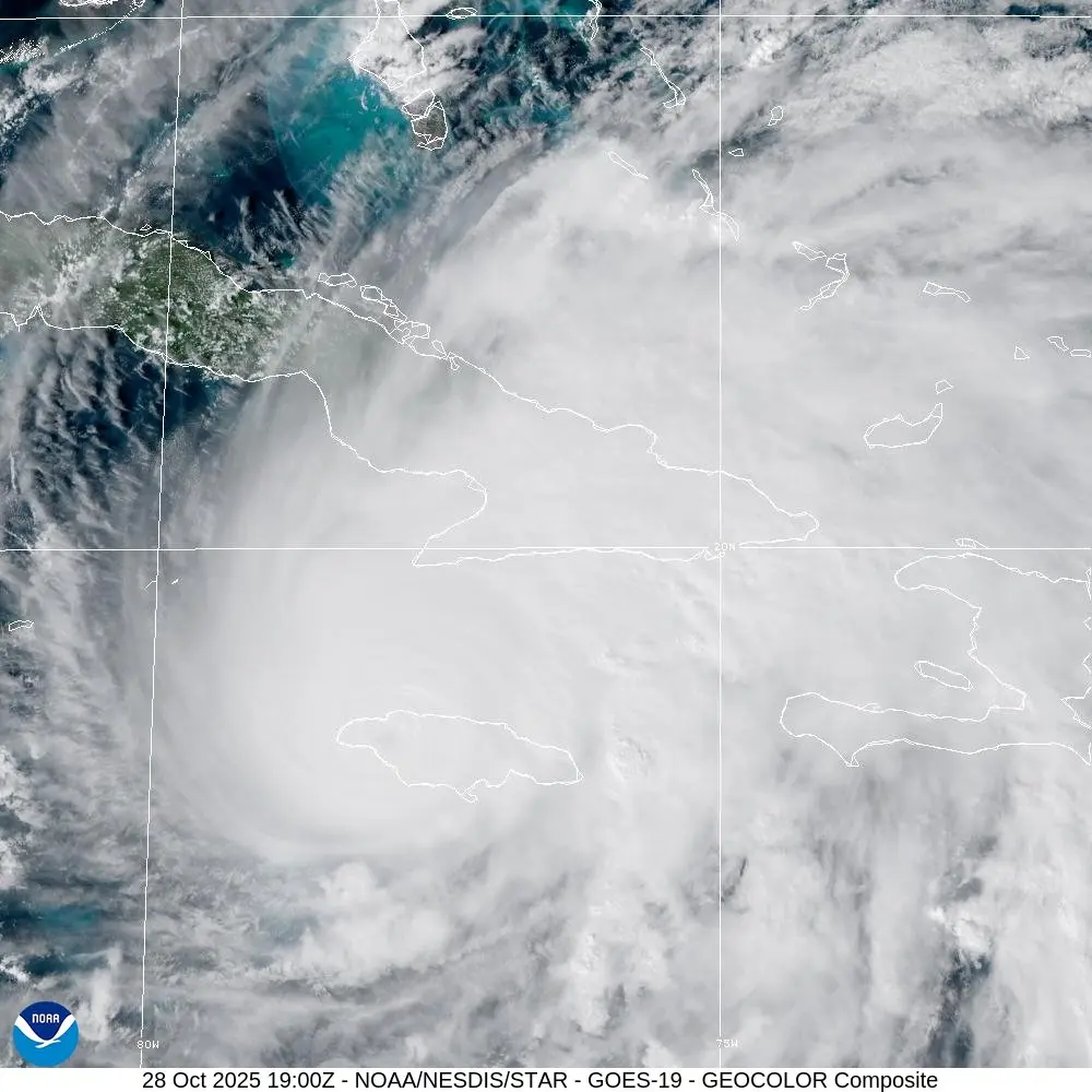
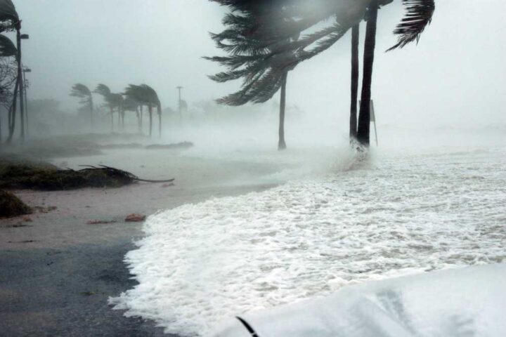
Hurricane Melissa made landfall in southwestern Jamaica near New Hope at approximately 1:00 PM EDT on Tuesday, October 28, 2025, as a catastrophic Category 5 hurricane with maximum sustained winds of 185 mph. According to the National Hurricane Center, the storm’s minimum central pressure dropped to 892 millibars, making it one of the most intense Atlantic hurricanes ever recorded.
The World Meteorological Organization has declared Melissa “the storm of the century” for Jamaica. Anne-Claire Fontan, the organization’s tropical cyclone specialist, stated at a press briefing that “for Jamaica, it will be the storm of the century for sure.” This assessment reflects the unprecedented nature of the threat facing the island nation of 2.8 million people.
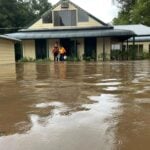
Jamaica’s Office of the Prime Minister issued mandatory evacuation orders for vulnerable communities as the storm approached. Prime Minister Andrew Holness warned residents that where the hurricane makes direct impact, “there will be catastrophic damage.” The government opened 850 shelters across the island with capacity for more than 20,000 evacuees, though many residents chose to shelter in their homes.
The storm’s rapid intensification shocked meteorologists worldwide. According to Climate Central, Melissa’s winds escalated from 70 mph to 140 mph in just 24 hours – one of the fastest intensification rates on record in the Atlantic Ocean. The research organization found that ocean temperatures in Melissa’s path were 2-3°C above normal, and these abnormally warm conditions were 500 to 800 times more likely due to climate change.
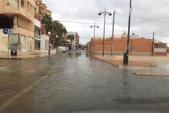
Evan Thompson, principal director of Jamaica’s Meteorological Service, warned that central parts of Jamaica could receive as much as 30 inches of rain over two days. This amount exceeds the annual rainfall total for some parts of the island. The slow forward motion of the storm – crawling north-northeast at just 8-9 mph – compounds the flooding threat as heavy rain continues to accumulate over the same areas for hours.
Hurricane Melissa’s Destructive Path
Track the storm’s journey from rapid intensification through Jamaica, with projected impacts on Cuba and the Bahamas
The storm’s unprecedented power resulted from exceptional conditions in the Caribbean Sea. According to NOAA satellite data, sea surface temperatures were running 2-3 degrees Celsius above the seasonal average. These warmer waters provided the energy that fueled Melissa’s explosive strengthening from a tropical storm on Saturday morning to a Category 5 monster by Monday afternoon.
Helen Willetts, a meteorologist analyzing the storm, explained that the 2024 Atlantic hurricane season had been relatively quiet before Melissa formed. This meant that warm ocean energy had not been depleted by previous storms, leaving abundant fuel available. The rapid intensification pattern mirrors what was observed with Hurricane Milton earlier in the season, though Melissa achieved even greater intensity.
24 Hours From Tropical Storm to Catastrophe
Melissa’s rapid transformation from tropical disturbance to one of the strongest Atlantic hurricanes ever recorded
How Melissa Compares to the Most Intense Hurricanes
Melissa ranks among the strongest tropical cyclones ever recorded in the Atlantic basin, and is by far the most powerful to ever strike Jamaica
Mark Poynting, climate reporter covering Melissa, notes that the storm ranks as one of the strongest on Earth this year. Globally, only Mexico’s Hurricane Patricia in 2015 and Typhoon Tip of 1979 have exceeded Melissa’s power. The 892 millibar pressure reading places Melissa third on the list of lowest pressure Atlantic hurricanes, behind only Wilma (2005) at 882 mb and Gilbert (1988) at 888 mb.
Catastrophic Impacts Across Jamaica
Multiple simultaneous threats create a dire humanitarian crisis affecting over half of Jamaica’s 2.8 million population
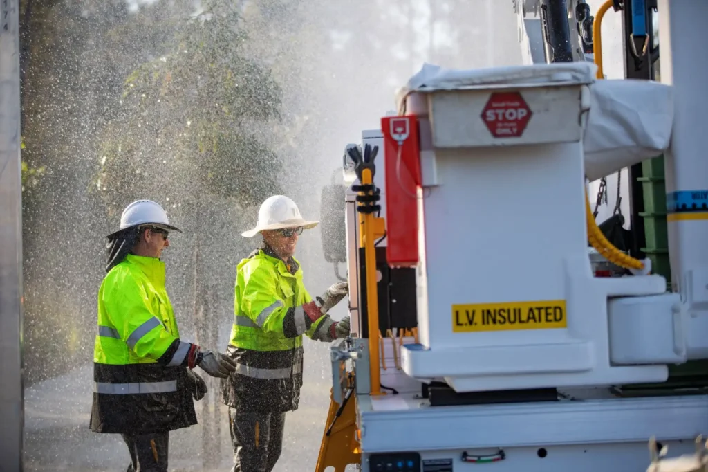
Richard Thompson, acting director general of Jamaica’s Office of Disaster Preparedness and Emergency Management, provided critical safety guidance as the storm approached. He emphasized staying away from outer walls, remaining downstairs in two-story homes, and securing loose items that could become dangerous projectiles in the extreme winds.
DO NOT leave your shelter as the eye of the hurricane passes. The National Hurricane Center issued explicit warnings that the calm conditions in the storm’s center are deceptive. Evan Thompson, principal director of Jamaica’s Meteorological Service, explained that the eye extends only a few miles in diameter with very little wind, but the eye wall surrounding it contains “the most intense wind speeds and the most torrential downpours.”
Winds will rapidly increase from the opposite direction once the back side of the eye wall arrives. Eye wall winds reached 185 mph at landfall, and residents must remain in their safest location throughout the entire passage of the storm.
Safest location: Interior, windowless room on the lowest floor of your building. Cover yourself with a mattress if possible and wear a helmet for protection from flying debris. Stay away from windows and exterior walls.
Additional hazards: Thompson warned that tornadoes can spawn during hurricanes, creating additional sudden threats. After the storm passes, it may take several days before weather clears completely over the island.
The Climate Factor Behind Melissa’s Intensity
Abnormally warm ocean temperatures fueled the hurricane’s explosive strengthening
Melissa’s extraordinary intensification occurred over Caribbean Sea waters that were 2-3°C (3.6-5.4°F) warmer than normal for late October. According to analysis by Climate Central, an organization that analyzes climate science, these exceptionally warm conditions were 500 to 800 times more likely because of human-caused climate change.
Helen Willetts, analyzing the storm for meteorological services, noted that the 2024 Atlantic hurricane season had been relatively calm before Melissa developed. This meant that warm ocean energy had not been depleted by previous major storms, leaving abundant fuel available when Melissa formed. The combination of record-warm waters and untapped energy reserves created ideal conditions for rapid intensification.
Studies consistently show that climate change is causing hurricanes to produce heavier rainfall because warmer air holds more moisture. The atmosphere can hold approximately 7% more water vapor for every 1°C of warming. With global temperatures having risen about 1.1-1.2°C since pre-industrial times, tropical cyclones now occur in an atmosphere capable of dumping significantly more rain.
The pattern observed with Melissa mirrors other rapidly intensifying hurricanes in recent seasons. Similar rapid strengthening was documented with Hurricane Milton earlier in 2024, though Melissa achieved even greater peak intensity.
Response Efforts and Recovery Challenges
Multiple nations and organizations mobilize to assist Jamaica in the aftermath
Several organizations and authorities sprang into action as Hurricane Melissa made landfall. According to posts from the Jamaica Information Service, Daryl Vaz announced that emergency relief flights could be accommodated at Norman Manley International Airport as early as October 30, 2025, provided the facility sustained no extensive damage.
The United Kingdom positioned rapid deployment teams in the region to support British nationals and prepare humanitarian assistance. British Foreign Secretary Yvette Cooper stated that the government is “closely tracking” the impact of Melissa and stands “ready to mobilise resources to support British nationals and Jamaica, at its request.”
World Central Kitchen reported that its partner organization Mystic Thai prepared meals ahead of Melissa’s arrival, with curry chicken, rice, and salad ready for distribution to those affected. The International Federation of the Red Cross has warned that assessment of damage could take an extended period given the scale of the disaster.
Melissa’s Continued Threat
The storm remains a major hurricane as it moves toward Cuba and the Bahamas
After devastating Jamaica, Melissa is forecast to strike southeastern Cuba Tuesday night into Wednesday morning as a Category 3 or 4 hurricane. A hurricane warning is in effect for the Cuban provinces of Granma, Santiago de Cuba, Guantanamo, Holguin, and Las Tunas. Cuban officials reported evacuating more than 600,000 people from the region, including from Santiago, the island’s second-largest city.
Cuba faces the storm while already struggling with an ongoing economic crisis and food shortages, compounded by tightened U.S. sanctions. The country expects up to 20 inches (51 centimeters) of rain along with significant storm surge along its southern coast. The Turks and Caicos Islands and southeastern Bahamas remain under tropical storm and hurricane warnings as Melissa continues its northward track.
By Wednesday evening, the National Hurricane Center forecasts Melissa will weaken to Category 2 strength as it impacts the southeastern and central Bahamas. However, even at reduced intensity, the storm will bring hurricane-force winds, dangerous storm surge, and heavy rainfall to these island nations still recovering from previous hurricanes including devastating strikes in recent years.
Coverage Summary
This coverage has documented Hurricane Melissa’s landfall in Jamaica as a Category 5 hurricane with 185 mph winds on October 28, 2025. The information presented includes data from the National Hurricane Center, World Meteorological Organization, Jamaica’s government agencies, and climate research organizations. The storm’s rapid intensification from tropical storm to Category 5 in 24 hours, its 892 millibar pressure reading, and its status as Jamaica’s strongest hurricane since 1851 were detailed.
The article covered Melissa’s impacts including catastrophic winds, life-threatening storm surge of 9-13 feet, extreme rainfall totals of 20-40 inches, widespread power outages affecting 240,000+ customers, and humanitarian effects on 1.5 million people. Response efforts by Jamaican authorities, international organizations, and neighboring countries were documented.
Information about ocean temperature anomalies, climate factors, historical comparisons with other Atlantic hurricanes, and the storm’s forecast track toward Cuba and the Bahamas was included. The National Hurricane Center and other authoritative sources continue to provide updates as the situation develops.
Related Coverage: For more information on extreme weather and tropical cyclone impacts, see additional coverage of recent rapidly intensifying hurricanes and coastal flooding threats.