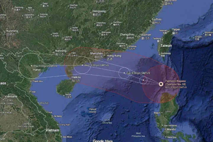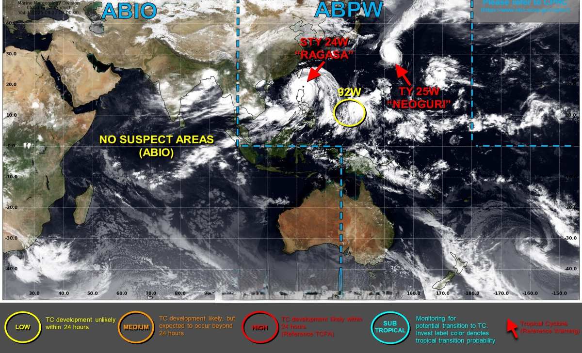
Thousands are rushing to safety as Super Typhoon Ragasa—2025’s most powerful storm—barrels through the Philippines with 215 km/h sustained winds and gusts up to 295 km/h, triggering major flight disruptions in Hong Kong and mass evacuations across the region.
The typhoon’s eye is passing dangerously close to the Babuyan Islands, where PAGASA has issued Signal No. 5 warnings. Weather instruments have recorded sustained winds of 215 km/h near the center with gusts reaching 295 km/h.
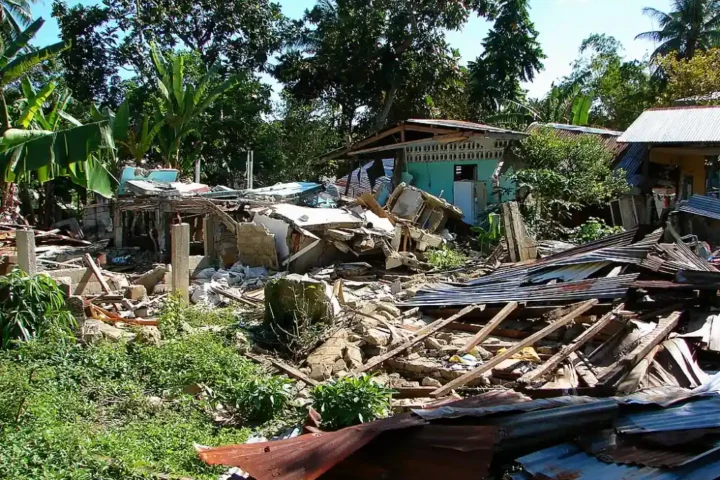
PAGASA warns of “a high risk of life-threatening storm surge with peak heights exceeding 3.0 m” in low-lying coastal areas. Power outages are affecting multiple provinces, with transmission lines down in northern Luzon. Authorities have reported approximately 10,000 people evacuated across affected regions, with official counts indicating over 8,200 people in Cagayan and 1,220 residents in Apayao have sought shelter.
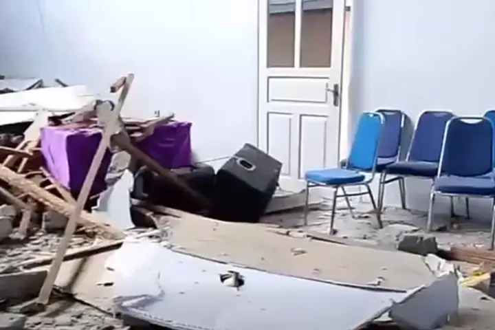
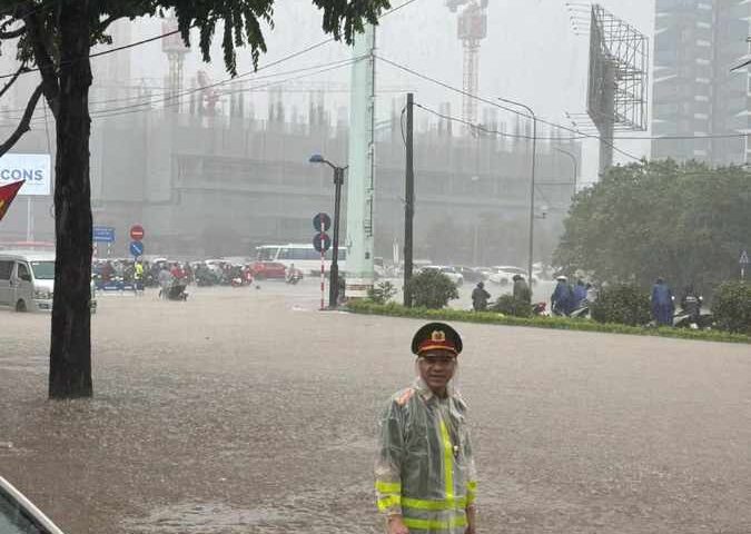
Manila has suspended work and classes as flood advisories go into effect. Government agencies and schools in affected northern regions and parts of Metro Manila were closed as precautionary measures.
Similar Posts
Hong Kong’s Observatory has issued Standby Signal No. 1 and plans to raise Strong Wind Signal No. 3 at 9:40 pm Monday, with officials considering Signal No. 8 between 1:00 pm and 4:00 pm Tuesday as conditions worsen.
The Hong Kong Observatory warned sea levels could rise about 2 meters over coastal areas, with maximum water levels generally reaching 3.5-4.0 meters above chart datum and Tolo Harbour possibly reaching 4-5 meters above chart datum during Wednesday’s high tide.
Several airlines, including Cathay Pacific, have announced flight suspensions, with passenger services ceasing from 6:00 pm Tuesday until 6:00 am Thursday. While runways will remain operational, flight operations will be significantly reduced. The Airport Authority recommends passengers verify flight status before traveling to the airport.
Taiwan’s Central Weather Administration has issued both land and sea warnings, suspending 88 ferry services across 13 routes. Domestic flights to offshore islands face cancellations, and authorities have closed nature trails throughout threatened areas.

China’s National Meteorological Center forecasts Ragasa will make landfall in the corridor between Huizhou and Wenchang. Guangdong Province has ordered citywide closures in the storm’s expected path, while Shenzhen emergency management officials plan to relocate 400,000 residents from vulnerable areas.
PAGASA and regional meteorological agencies stress:
- Avoid coastal areas completely during storm surge hours
- Stay away from downed power lines and report outages through official channels
- Follow evacuation orders immediately when issued
- Keep emergency supplies accessible
For those with travel plans, airlines recommend checking their websites for rebooking options, as cancellation policies vary by carrier. The Joint Typhoon Warning Center continues tracking Ragasa’s progression, with updated forecasts showing the storm will pass south of Hong Kong before making landfall in southern China.