NSW Thunderstorms: 400,000 Lightning Strikes Hit Sydney Region
Massive storm system stretching over 800km brought large hail, damaging winds, and intense lightning to New South Wales on Friday, October 17, 2025.
Warm and humid air interacting with an unstable atmosphere and a broad low pressure trough produced widespread and intense thunderstorm activity over NSW on Friday. While a few storms were rumbling across NSW in the morning, the day’s heat was the key ingredient that caused the storms to spread out and intensify in the afternoon.
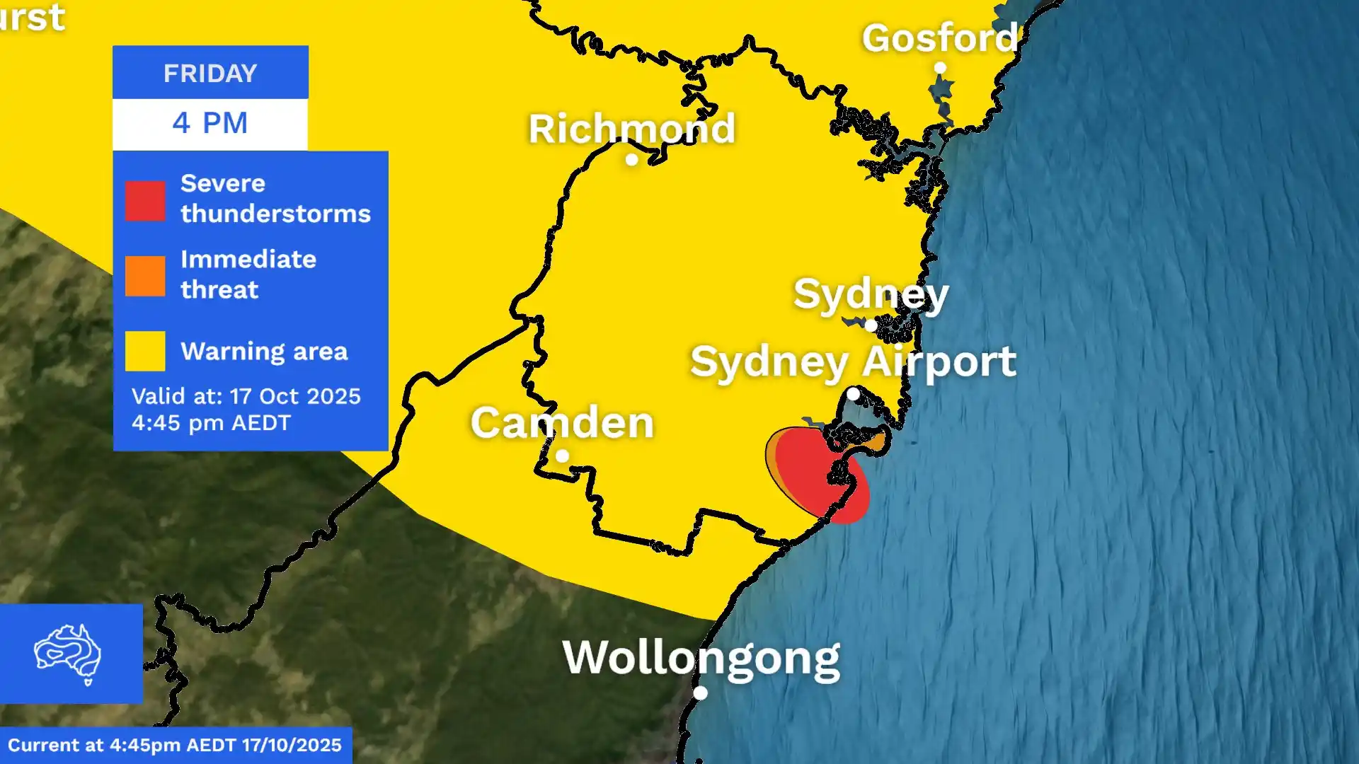
At 3pm there were multiple storm cells building over central and northern NSW and by 6pm, storms were stretching more than 800 km from Sydney to the state’s northern inland. Storms also spread north of Sydney up through the Mid North Coast throughout Friday afternoon.
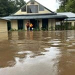
Parts of Sydney were hit with brief but intense bouts of rain on Friday afternoon as a storm front moved rapidly across the NSW coastline, threatening heavy gusts, hail and power outages for large parts of the state. The Bureau of Meteorology issued a severe thunderstorm warning for Sydney and the Blue Mountains, the Mid North Coast and Hunter, as well as the Central Tablelands and the state’s Central West.
⚡ Lightning Strike Detection Data
Around 400,000 lightning strikes were detected within a 500 km radius of Dubbo between 2pm and 7pm on Friday. Of these, around 70,000 were cloud-to-ground strikes and the rest were cloud-to-cloud strikes.
Temperatures dropped from a high of 31 degrees to the mid-20s by the early afternoon, after the Bureau forecast it could drop by as much as 10 degrees in half an hour. Bureau meteorologist Angus Hines said “quite a powerful storm” was developing around the airport in the city’s south, and three or four other storms could cause wild conditions as they moved quickly across the city.
“It’s hard to pinpoint which suburbs will get wet and which won’t but … a lot of places will get it and then 10 minutes later it’ll be gone,” he said. “It’ll be over the ocean before you know it.” The city’s highest rainfall was recorded at Cronulla South Bowling Club, which received 9 millimetres in the hour before 5.15pm.
🗺️ Affected Regions Across NSW
The storm system affected multiple regions across New South Wales, from Sydney’s metropolitan area to the Central West and up through the Mid North Coast. Interact with the map to see affected locations and warning details.
Hines said the risk of severe storms is likely to disappear after 7pm, but the stormy weather could continue further north “well into the night and possibly into tomorrow morning.” Power outages and damage to trees, roofs and fences were possible “as those winds really race through,” he said.
“The main hazards of these thunderstorms are set to be large hailstones bigger than two centimetres across, which can damage crops, cars and roofs,” Hines said earlier on Friday. “The risk of damaging wind gusts of over 90km/h can lead to property damage, power outages, or just take your rubbish bin on a trip over to the neighbours.”
The Bureau also issued a marine wind warning for strong winds around Sydney Harbour and along the coast from Eden all the way north to the Port Macquarie area.
⏰ Storm Timeline
Track the progression of Friday’s storm activity from morning through peak evening intensity. Slide to see how conditions evolved throughout the day.
🧊 Large Hail Reports
Friday’s storms caused large hail at multiple locations, including 4cm hail at Stuart Town in the state’s Central West and 3 cm hail at Engadine in southern Sydney.
Golf ball-sized hail capable of damaging crops, vehicles, and roofs.
Walnut-sized hail with potential to cause property damage and vehicle dents.
⚠️ Key Hazards & Impacts
The severe thunderstorms brought multiple hazards across NSW, from damaging winds to large hailstones and heavy rainfall.
Sydney woke to warm conditions on Friday morning, and temperatures were forecast to reach 32 degrees in the Sydney CBD and 34 degrees in the western suburbs before the dramatic change.
Hines said Friday would be the “peak day” for Sydney’s severe weather, noting there would be “some storminess” for the state’s coastline on Saturday, but the most extreme conditions would transfer to northern NSW and South East Queensland over the weekend.
“Storms in these areas could tend severe once again on Saturday, with damaging winds and large hail remaining at risk. By Sunday, that risk of storms and severe storms has pretty much completely cleared off the east coast,” Hines said. “A few showers will still remain, especially around southern Queensland.”
Event Summary: The severe thunderstorm event of October 17, 2025 was discussed, covering the 400,000 lightning strikes detected within a 500km radius of Dubbo, the widespread storm activity stretching over 800km across NSW, and the large hail reported at Stuart Town and Engadine. Temperature drops, heavy rainfall at Cronulla South Bowling Club, and the Bureau of Meteorology warnings for the Greater Sydney area, Blue Mountains, Mid North Coast, Hunter, Central Tablelands and Central West regions were outlined.
Stay updated with the latest warnings and weather information